Curated OER
Africa
Second graders explore Africa. They label the popular places in Africa on a map. Students label the different cities and monuments that are popular in Africa. They discuss the similarities and differences between cities in Africa and...
Curated OER
New Perspectives
Students examine maps that are designed to give different perspectives. They create mental maps that illustrate their own perspectives and those of people from other parts of the world.
Curated OER
ESOL Government and Commmunity Resources
Students study vocabulary words associated with community services. They label each community service on an index card and match a phrase with the service. They identify community service buildings in the area on a local map.
Curated OER
Draw A Coastline
Students identify, locate and draw at least ten different geographical features on a map. Using the map, they must make it to scale and include their own legend and compass rose. They share their map with the class and answer questions.
Curated OER
Rivers Run Through It
In this mapping practice worksheet, 5th graders read an informational paragraph and answer 7 questions about the parts of a map along with places shown on a given map.
Curated OER
Sum it Up!!
Students work to develop comprehension strategies. Through modeling they discover how to summarize a written passage by deleting unnecessary information and using clustering or concept mapping for the most important items or events. In...
Curated OER
Locating Patterns of Volcano Distribution
Students examine patterns of volcanic distribution worldwide, use tables to plot and label location of each volcano on map, lightly shade areas where volcanoes are found, and complete open-ended worksheet based on their findings.
Curated OER
Getting to Know the Seven Continents
Learners are introduced to basic map and globe skills. Using the internet, they identify and locate the seven continents and complete a blank map to reinforce the names of the continents. They also distinguish between land masses and...
Curated OER
A Place Called Fairfax
Students use maps to locate Virginia, its surrounding states and Fairfax County. Individually, they describe the absolute and relative location of the county and why it is important to know both. As a class, they brainstorm the...
Curated OER
Food Detectives
Students investigate the regions in which particular grains are grown. Using the packaging from a variety of foods, grains are identified and the general locations where they are grown are plotted on a map.
Curated OER
Zones of Conflict
Students read maps and identify specific countries involved in conflict. They classify countries in cultural realms. They relate maps to what they know about world conflict.
Curated OER
The Bozeman Trail
Eighth graders are introduced to the Bozeman Trail. Using the internet, they research the trail to discover the forts located on its path. They must also locate and label landmarks on a map using symbols they create. They answer...
Curated OER
A Place Called Fairfax
Students are introduced to the various types of maps of Fairfax County, Virginia. Using the maps, they explain the relative and absolute locations of the county and discuss the importance of both. They also discover how the county is...
Curated OER
Knowing Where You Are
Learners work together to research the names of places in their state. They divide up their state so that each group can research a different section and complete a chart of the different names. They create a key for the map to explain...
Curated OER
Park Problems
Students calculate park acreage and map the distribution of parks in Austin, TX using GIS. Students use a specific website to find the information.
Curated OER
U.S. Commonwealths and Territories
In this Puerto Rico worksheet, students follow directions to create icons and label cities on a map of Puerto Rico. Students follow 5 sets of directions.
Curated OER
Texas: U. S. Geography for Children
In this Texas map instructional activity, students locate and label key features of Texas on the map and create icons to symbolize the economy and culture of Texas.
Curated OER
Florida: U.S. Geography for Kids
In this Florida geography worksheet, students locate and label the important features of Florida and create icons for the economy and culture of Florida.
Curated OER
Coordinate Seating: Using a Coordinate System
Fourth graders discover coordinate systems. In this mapping lesson, 4th graders create a coordinate system for theater seating. Students observe a video based on a theater's seating map.
Curated OER
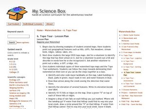
Watershed
Students study watersheds and use topo maps to help explore where they are located. In this watershed lesson students delineate their watershed on their own.
Curated OER
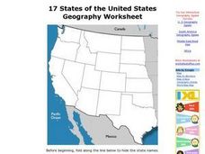
17 states
In this states worksheet, students label states in the United States that are on the west side of the country. Students label 17 states.
Curated OER
Natural History of Costa Rica
Students use outline maps to become acquainted with Costa Rica. They see how it was formed and how its origin has created very diverse environments. Students then use atlases and compare their physical maps with maps of climate and the...
Curated OER
The United Kingdom
In this United Kingdom activity, students label the capitals and color the countries of the United Kingdom. Students complete 8 tasks.
Curated OER
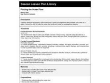
Plotting the Ocean Floor
Fourth graders plot points on a graph, connect the dots to make the ocean floor profile and label the topographical features. They utilize a worksheet and a website imbedded in this plan to plot the ocean floor.
Other popular searches
- Map Labeling
- Africa Map Labeling
- Midwest Map Labeling
- Geography Map Labeling
- Labeling a Map Continents
- Blank Labeling Maps
- Labeling Maps Pangaea
- Labeling Map Parts


