Curated OER
The Sahara Desert
The children will create a watercolor picture of the Sahara Desert and label it.
Curated OER
The Silly States: Where Is Your State and City?
First graders read The Scrambled States of America and discuss whether it is real or fantasy as compared to the United States. For this geography lesson, 1st graders identify their city or state on a map and work in groups to color the...
Curated OER
What a Relief Map
Students create a map using cookie dough. In this geography instructional activity, students research the physical features of a country, draw a diagram and design and create a map out of cookie dough.
Curated OER
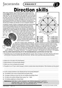
Direction Skills
In this geography worksheet, students read an excerpt on what directions tell someone. They respond to 6 short answer questions related to the neighborhood illustration found on the second page of the worksheet.
Curated OER
Mesopotamia
Middle schoolers map Mesopotamia. For this Geography lesson, students are introduced to Ancient Mesopotamia. Middle schoolers use an atlas to label the defining features and areas of Mesopotamia on a map.
Curated OER
The Olympics
Young scholars will research the geography and designa route form Columbia SC to an olympic competition, then follow local news and current events to track team perfomance.
Curated OER
Tourism in Northern Ireland
In this tourism worksheet, learners label pictures of tourist destinations with the name of the country they are located in, write sentences about pictures showing damage caused by tourists, identify locations on a map, and fill in...
Curated OER
Watersheds: The San Francisco Bay Watershed
Sixth graders make a model of a watershed. In this geography lesson, 6th graders view a shaded relief map of California and locate landmarks. Students examine the San Francisco Bay Watershed by following the journey of water through the...
Curated OER
Ancient Civilizations
Sixth graders complete map-work in order to understand the progression of hunter-gatherer societies. In this hunter-gatherer lesson, 6th graders label maps with the Equator, the Tropics, and the vegetation. They complete associated...
Curated OER
Using the Four Main Directions in the Classroom
Students utilize a compass to determine where North is in the classroom. In this direction lesson, students label the four main directions. Students locate features in the classroom and describe the directions to get to them. Students...
Curated OER
Where's the Sand?
Students identify the characteristics of deserts. In this geography lesson plan, students discuss the characteristics of a desert and label a map with the names of deserts.
Curated OER
Symbols of Culture
Young scholars discover artistic symbols from cultures around the world. In this cultural murals lesson, students observe different murals on-line, and select two to write about on their student blog. The young scholars investigate the...
Curated OER
Africa's Geographic Features
Fourth graders work in pairs and use atlases to locate specific geographic features in Africa. They use the Internet to view these geographic features.
Curated OER
Geography: Lesson One
Students pretend they have been chosen to receive an elephant for a pet. Individually, they use the internet to research where elephants come from, their diet and sleeping behaviors. They identify their habitat and their characteristics...
Curated OER
Social Studies:
Students identify various types of breads fromother countries and locate them on maps. In small groups, they make story maps of books that mention bread and make books resembling sandwiches. Students have a bread tasting party and...
Curated OER
Sand, Sand, Everywhere Sand
Students study the physical characteristics of four types of desert regions. In this desert regions lesson, students watch a video about deserts and discuss the deserts. Students compare the deserts and research the ways humans have...
Curated OER
Spanish-Speaking Countries
Students explore geographic areas. They list as many countries as possible, divide the countries into groups, and label the groups with logical names. As an introduction into Spanish, students memorize all the Spanish-speaking...
Curated OER
Put Me in My Place: Using Alphanumeric Grids to Locate Places
Students practice locating points on a large wall grid and create and label a neighborhood map. In this geography lesson, students spell and discuss places as the teacher places them on the map. They discuss the concept of an...
Curated OER
Through the Forest and Home Again: Maps Help Us Find Our Ways
Students read Little Red Riding Hood, focusing on her path home to Grandma's house. In this language arts and geography lesson, students perform a reader's theater, re-creating the walk home and possible routes that could have been...
Curated OER
Hemispheres & Continents
Students learn in cooperative learning groups to determine how the equator and the Prime Meridian divide the earth into hemispheres and use Venn diagrams. Students will locate and label the hemispheres, continents, and oceans.
Curated OER
The Water Around Us
Students discuss importance of reading maps and knowing about the geography of the United States, and locate bodies of water on different types of maps and examine how they are used in the state or local community.
Curated OER
European Union Map Quest
Sixth graders identify countries of the European Union. They locate countries of Europe on a map and pair with a student to complete a blank map of Europe. They label each country and complete worksheets for the European Union. They...
Curated OER
Colonization: Africa
Students analyze maps of Africa. They label physical features, tribal kingdoms, and European settlements, among other topics on the maps. They write reflective paragraphs on their work.
Curated OER
Three Mapping Activities
Students label three maps of China after being introduced to background information about the country. For this geography lesson, students color two maps and label various points of interest in China. Finally, students draw their own...


