Curated OER
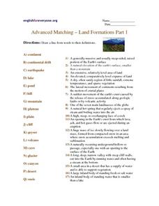
Advanced Matching--Land Formations Part 1
Using this activity, learners could review information they have covered about land forms, such as hills, mountains and plateaus. This 17 question activity could be used with upper elementary or ESL students to test or review information...
Curated OER
Hurricane Impact: Storm Surges and Elevation Transitions
For this hurricane worksheet, student answer 6 multiple choice questions and 8 short answer questions about hurricanes. They color the map to show flooded areas.
Curated OER
Land and People: Cape Cod Activity 1
Students make a model aquifer to study the uniqueness of Cape Cod's ground-water system. Using the model., they determine how easily contamination spreads in the aquifer system by completing and recording three activities. Using the...
Curated OER
Historical Geography Scavenger Hunt
Young scholars are told that Geography is the science that deals with the differentiation of the surface of the earth due to the influence of things like population, vegetation, geology, and land use. They explore the Geography Basics...
Curated OER
Tracing Highs and Lows in San Francisco
On a topographic map, pupils identify the scale bar, north arrow, and contour interval. They then locate a hill on the map and make note of the contour lines. Students then locate other places with similar contour line patterns....
Curated OER
Jeopardy - Earth Sciences
Questions about water, weather, geology, astronomy, and the scientific process make up this Jeopardy game. It is a pretty well-rounded set of slides, although you may want to be aware that a few of the questions are specific to the state...
Curated OER
Forest Communities
Students identify tree specimens. In this tree specimens lesson, students collect different parts of a tree from the areas around the school or their home. They then work in groups to create booklet that identifies tree specimens.
Curated OER
Crash landing
Students invent a device to prevent a raw egg from breaking when dropped from a high elevation. In this crash landing lesson, students compete in a challenge to create the safest device to prevent an egg from crashing.
Curated OER
Common Themes
Tenth graders test usefulness of a model Earth by comparing its predictions to observations in the real world. In this landforms lesson students construct an island from a contour map using model clay then analyze the landscape features...
Curated OER
Exploring Wyoming Species Habitats
Students are introduced to the concept of species habitats and ranges. They introduced to ArcView GIS as a tool for mapping. Pupils use query data for species withina county, elevation, range, rivers and streams, land cover, and etc....
Curated OER
Volcano Contour Models Activity and Tracing the Highs and Lows in San Francisco
Learners investigate how to draw topographic contours and read topographic maps.They examine the topography of San Francisco and contrast the elevation of different points within San Francisco.
Curated OER
Agriculture in Canada
Learners examine various elements in the physical environment and their relationship to agriculture in Canada. Using the ArcCanada CD-ROM, they analyze maps, and interpret relationships between the physical environment and land use.
Curated OER
Pilots, Airplanes, and the Tangent of Three Degrees
High schoolers explore how to use trigonometry in the aviation field. In this aviation instructional activity students complete trigonometry equations that show what planes should do to land their airplanes.
Curated OER
No Magic Borders: Haleakala Style
Students discuss borders and boundaries. They discuss pollution and the fact that boundaries cannot stop pollution and that pollution affects even protected wildlife and plants. They participate in an activity in which they must place...
Curated OER
Oregon Rainshadows
Students brainstorm list of possible highest locations in Oregon, identify and label places from list on map using color code, and discuss and identify causes of a rain shadow.
Curated OER
Geography Terms
Students identify different landforms and fill out a worksheet where they explain what each landform is. In this geography lesson plan, students fill in a landform map and then use landform words as they describe the landforms.
Michigan Sea Grant
Exploring Watersheds
Collaboratively, students partake in a hands-on activity in which they build models of a watershed. Each group member draws an elevation map—a bird's eye view—of their model and predicts how water will flow from the high to low points....
Curated OER
Soil Conservation
Learners examine soil conservation. In this agricultural management lesson plan, students study how to use good practices for soil conservation. They discuss the Dust Bowl and poor land management from the 1940's to infer how we can be...
Curated OER
Production of the Lunar Relief Map Project
Students replicate the lunar surface. In this mapping skills lesson, students study the topography of the moon. Students then use craft materials to create topographic maps of the lunar surface where the Eagle landed.
Curated OER
Build the Taiga: Hands on Biome-Building
Students explore environmental awareness by completing a construction project. For this biomes lesson, students identify the different elements for life to thrive in an ecosystem. Students utilize a cardboard or wood box to create a...
Curated OER
Hands On Biome-Building
Learners create a desert biome to understand the abiotic and biotic factors of that biome. In this desert biome lesson plan, students include elevation, precipitation, temperature, plants, and more.
Curated OER
What is a Watershed?
Students create a classroom size model of a landscape to define the concept of a river watersheds. They spread crumbled newspapers around the floor to simulate different elevations then cover the whole landscape with a sheet. They pour...
Curated OER
Carving Mountains
Students explore geography by participating in an illustration activity. In this land-form instructional activity, students define vocabulary terms associated with glaciers and forests. Students utilize pens, cardboard and pottery clay...
Curated OER
Rain Drops Keep Falin' On My Drainage Basin
Students compile information about rainfall, lake elevations and releases of water from Tuttle Creek reservoir into maps, graphs and charts.


