Curated OER
Water Works Wonders
Students examine where water is found in the world, how we use it, and the various forms it takes. They observe the refraction of light through a prism, record the day and night sky over a week's time, and create a topographic model of...
Curated OER
How to Use Technology to Teach Landforms
Students create a landform table on the computer. In this geography lesson, students use Microsoft Word to design a 3 column table. They list different landforms, examples, and attach a picture of each.
Curated OER
Wet Water, Dry Land
Students observe and examine relationship between landforms and bodies of water, recognizing differences between them. Students then define island, peninsula, isthmus, archipelago, lake, bay, straight, system of lakes, and identify land...
Curated OER
Sanctuary: Quail Island Banks Peninsula
Students explore world geography by creating a 3D diorama. In this New Zealand land form activity, students examine color images of New Zealand's wildlife and discuss the different elements inside them. Students utilize these images to...
Ocean Explorer
Easy as Pi
Seamounts are large, extinct volcanoes that rise up from the bottom of the ocean floor. They are a relatively new landform in the scientific community, and this activity invites students to learn about the amazing diversity of life found...
Curated OER
Forces of Change
Second graders discuss various ways in which landforms change over time. They, in groups, research and create a reference book about landform change including tsunamis, earthquakes, weathering, erosion and volcanic eruptions.
Messenger Education
Look But Don’t Touch—Exploration with Remote Sensing
Mars is home to the tallest mountain in our solar system, Olympus Mons. In this set of two activities, learners review geologic land formations through the analysis of aerial maps. They then apply this knowledge to aerial maps of objects...
Curated OER
Creating a 3d Model and Corresponding Topographic Map
Students create a landform model and topographic map. In this topography lesson, students use a real landform to create a model and topographic map to scale.
Curated OER
Landforms Slideshow
Students identify twelve different types of landforms, and create a slideshow about each landform that includes a title, pictures, definitions, conclusions and a reference page.
Curated OER
The Earth's Layers: Day 6: Landforms II
Students closely examine the earth's crust and various landforms. In this Earth's layers lesson students work in cooperative groups and analyze their roles and responsibilities therein. Each group is assigned a specific landform to...
Curated OER
Coasts and Reefs: Shallow Marine Processes
A more thorough presentation on coastal systems would be difficult to find! Detailed diagrams illuminate the offshore, shoreface, foreshore, and backshore zones of beach. The sources and movement of sediments along the coastline are...
Curated OER
Deserts and Winds
Although the wind blows frequently in deserts and may even contribute to their existence, you may teach these two topics separately. Regardless, there are demonstrative photos and diagrams that support the explanations. Explore the...
PBS
Regional Patterns of Climate: Pacific Northwest
Climate systems involve sunlight, ocean, atmosphere, ice, land forms, and many other factors. Scholars explore each of these variables related to the Pacific Northwest rain forest. They use an online interactive to investigate the polar...
Curated OER
Natural Disaster
Describe how plate tectonics account for various land formations. Learners discuss different marine sanctuaries and create a poster about tectonic activity in these areas. They share their posters with the class.
Curated OER
Erupting Volcanoes!
Learners examine the causes of earthquakes, volcanoes, and floods, and explore how these events shape the surface of the earth. In this erupting volcanoes lesson, students create a volcano model of their own, make observations about how...
PBS
Breaking it Down
After challenging themselves to correctly choose the form of erosion and length of time required for a given landform to develop, earth science class members model mechanical and chemical weathering with various lab demonstrations over...
Montana State University
Meet Mount Everest
Learning about one landform might seem boring to some, but using the resource provided practically guarantees scholar interest. The second in a sequential series of eight covering the topic of Mount Everest includes activities such as a...
Curated OER
Erosion
In this earth science activity, students describe the course of the river from its source to the mouth, including shapes of the valleys and erosion processes in each course. Then they identify possible types of erosion that would have...
Curated OER
What Land Works Best?
Fourth graders explore different types of land. In this land lesson, 4th graders investigate how water, climate, and soil type determine what types of crops may be grown. Students discover these elements while playing an interactive game.
Curated OER
Mud in the Water
Students build a soil erosion model to study the importance of soil conservation. They investigate how land forms from both constructive and destructive forces.
Curated OER
How Volcanoes Grow
Students study volcanoes including rock fragments, ash, aerosols and gases. In this volcano lesson students divide into groups and build models of the three major types of volcanoes.
Curated OER
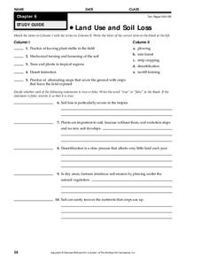
Land Use and Soil Loss
In this land use and soil loss worksheet, students match 5 types of land use with their description and write true or false to 5 statements about the effects of land use and soil loss. The correct false statements to make them true.
Curated OER
First Land Plants Found on Earth
In this first land plants worksheet, students read about the major events that allowed plants to evolve on Earth. Students read about the primary and secondary atmospheres, the formation of the ozone layer to protect from UV light and...
Curated OER
Understanding Topographic Maps
Underclassmen create a cone-shaped landform and then draw a contour map for it. Then they examine a quadrangle (which was easily located with an online search), and relate it to what they experienced. The accompanying worksheet is...


