Curated OER
Get Out in the Field
Pupils visit a shoreline--of an ocean, a lake, a pond, a riverbank, etc., survey it and record what they find there. They map the shoreline and surrounding area and conclude where potential waterfront projects could occur.
Curated OER
Green Space in the City
Students identify the different kinds and uses of green space that exist in an urban area. They create maps of local parks and research the history of each park. They conduct a survey of residents near the park and interview a park...
Curated OER
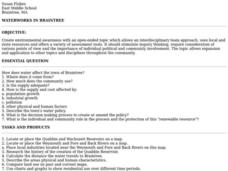
Waterworks In Braintree
Learners examine how water affects the community of Braintree. Using a map, they locate main resevoirs and rivers in the area and research the history of one of the resevoirs. They use charts and graphs to show how land use has changed...
Curated OER
What Can Be Done to Improve Ha'iku Town Shopping Areas?
Second graders examine different areas to determine how they can be improved. They observe and collect data concerning different problems and use a map to record their information. After analyzing the data, they develop possible...
Curated OER
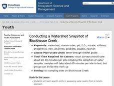
"Conducting a Watershed Snapshot of Blockhouse Creek"
Students examine specific skills in assessing water quality from a holistic approach. They assess the health of a local watershed and identify problems in the local watershed and suggest remediation.
Curated OER
Comparison of Protein Sequences From Two Samples of Crabmeat Using Gel Electrophoresis As an Introduction To the Biotechnology Lab
Students discover that proteins that are the product of DNA translation are different for different species. They determine that by analyzing their mass and charge they can differentiate between two different species. They use some of...
Curated OER
Victory in Europe, 1944-1945
Students examine the overall strategy pursued by the Allies in the final moths of World War II in Europe by examining military documents and consulting an interactive map of the European theater.
Curated OER
Volcanoes and People
Young scholars discover that volcanic eruptions are geologic events that take place within the upper part and on the surface of the Earth's lithosphere. They explain how volcanoes are related to the Earth's lithosphere. They focus on the...
Curated OER
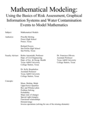
Mathematical Modeling
Study various types of mathematical models in this math lesson. Learners calculate the slope to determine the risk in a situation described. They respond to a number of questions and analyze their statistical data. Then, they determine...
University of Wisconsin
Follow the Drop
Young surveyors look for patterns in water flow around campus. Using a map of the school (that you will need to create), they mark the direction of the path of water. They also perform calculations for the volume that becomes runoff. The...
Teach Engineering
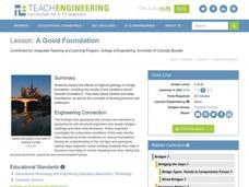
A Good Foundation
It takes a strong foundation to build a house and a stronger one for a bridge. This resource presents the effects of geology and soil on bridge foundations. Working in groups, the class investigates the interaction of shallow and deep...
California Academy of Science
Exploring Our Growing Need for Water
Pupils explore the amount of water people use in agriculture and for personal use. They compare water usage for various crops to that of raising animals before considering solutions for increased access to safe drinking water worldwide....
Curated OER
How Does Your Soil Stack Up?
Students examine the soil in their local area and create a soil profile. They record observations in the field and the classroom. They create their own display of the soil profile as well.
Curated OER
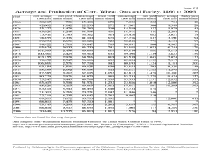
Making Sense of the Census
Learners problem solve the mean and median of agricultural data by completing a worksheet. They discuss the results of the statistical data.
Curated OER
Does Hawaiian Agriculture Feed Hawaii's People?
Students research background information about Hawaiian agriculture in a variety of resources, then read and collect newspaper ads marketing local produce. They suggest food preparation ideas using local produce.
Curated OER
Aerial Photography
Eleventh graders compare the artistic values of Terry Evans' photography with LandSAT images and other images made for purely scientific, government and commercial purposes. They consider the artistic choices made in aerial photography.
Curated OER
Basics of Environmental Science
Ninth graders explore environmental concerns of the community and identify the basic needs of people, wildlife and domestic animals. Working both individually and in groups, they also define natural resources and compare and contrast...
Curated OER
Location
Students explore the tools used by Columbus to chart his latitude. They study the change of a location over time.
Curated OER
Seeking a Fortune in 18th Century Maritime Boston
Study the Revolutionary War era practice of recruiting seamen to prey upon the British shipping industry, and discuss the impact this practice had on the Colonial war efforts. Learners read and interpret recruiting advertisements for...
Curated OER
A Good Foundation
Young scholars examine how regional geology affects bridge foundations. In this physical science instructional activity, students explore how bridge types are constructed for different purposes.
Curated OER
Organizing A Persuasive Speech
Have the class listen to a lecture on persuasive speeches. They practice outlining and detailing the components of a persuasive speech. The lecture outline also includes suggestions for researching a topic or thesis, organizing the...
Curated OER
The Fact Finders
Students analyze agricultural data and make predictions about events in history. In this history lesson, students correlate the relationship between historic events and issues in agriculture to see if there is a correlation. They analyze...
Curated OER
George Washington and the First Census of Agriculture
Sixth graders compare modern agricultural statistics with those that are extracted from a primary source letter of George Washington. They complete worksheets and discuss what they have learned.
Other popular searches
- Land Survey Math
- Public Land Survey
- Land Survey Construction
- Land Survey System
- Land Surveying Math
- History of Land Surveying
- Land Survey Math Measurement
- Geometry Land Surveying
- Land Surveyor
- Geometry and Land Surveying
- Land Surveying Egypt
