Curated OER
Landscape Photography
Students photograph the school landscape and create photographic displays from the pictures they take. They discuss the visual characteristics of the school grounds. Working in pairs the role-play as camera and photographer and write...
Curated OER
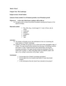
The Landscape of Poland
Young scholars recognize and re-create the political boundaries and physical features of the nation of Poland. They create three dimensional topographic maps of Poland. In addition, they compose two journal entries written in two...
Curated OER
The Landscape
Students recognize and recreate the political boundaries and physical features of the nation of Slovakia. They create topographic maps of Slovakia. The maps should include labeled line drawings of bordering countries. Slovakia should be...
Curated OER
Common Denominators between Primitive Art, Fine Art, Folk Art, Children's Art
Middle schoolers view and create art in several styles. They view African Masks, Picasso's portraits and self-portraits. They compare the two, then create a self portrait. In the second lesson, they view landscape paintings by folk...
Curated OER
Natural Features as a Resource
Students identify resources provided by nature for basic human needs. In this natural features lesson, students discuss the various regions of the United States. They explore one region in depth and complete activities that identify...
Curated OER
Book: Spain
Students, after reading Chapter One in the book, "Spain," design and re-create the political boundaries as well as the physical features of nation of Spain. They utilize play-doh or salt dough to illustrate and create their three...
Curated OER
Common Themes
Tenth graders test usefulness of a model Earth by comparing its predictions to observations in the real world. In this landforms lesson students construct an island from a contour map using model clay then analyze the landscape features...
Curated OER
Describing a Landscape
Students identify the geographical features and find them on a map. They describe the continuities and changes in a landscape between 1846 and the present.
Curated OER
Hungary: The Landscape
Students work in small groups to create a topographic map of Hungary. The map will include labeled line drawing of the bordering countries. Hungary should be three dimensional, made of salt and flour clay. The mountains, plains and...
Curated OER
Italy: The Landscape
Students work in small groups to create a topographic map of Italy. They must include labeled line drawings of bordering countries and bodies of water. Students use salt and flour clay to make Italy three dimensional, showing the many...
Curated OER
Malta: The Landscape
Students work in small groups to create a topographic map of Malta. They must include labeled line drawings of bordering countries and bodies of water. Students use salt and flour clay to make Malta three dimensional, showing the nearest...
Curated OER
Streetfilms' Moving Beyond the Automobile
This is an exceptional series that you can use in an environmental or engineering unit. There are four lessons: "Sustainable Transportation," "Designing for Safety," "Changing the Landscape," and "Engaging in Policy." Each lesson plan...
National Park Service
Fire Ecology on the Rim
An engaging unit on wildfires includes three sections, including a background section with eight lessons and five activities, a field experience section with 13 lessons and five activities, and a conclusion section featuring an analysis...
Curated OER
Around Avonlea's Green Gables
Students create an Avonlea landscape that takes their breath away. They read Anne of Green Gables, students look at pictures of Prince Edward Island, Canada. Students use their Crayola Erasable Colored Pencils to list and sketch the...
University of Wisconsin
Designing a Rain Garden
Now it's time for all of the data collected in previous lessons to be applied to the design of a rain garden. This resource can only be used as part of the greater whole, since learners will need to rely on gathered knowledge in order to...
Weather Bug
WeatherBug
Exploring the weather has never been more intriguing! Whether you are looking for a quick glance at the 10-day forecast, trying to figure out if lightning is heading your way, or wondering what the pollen count is, you will find out...
Curated OER
These Maps are for the Birds
Students identify and study New York State Breeding Bird Atlas maps to learn where different bird species nest and how their distributions have changed over time. They also identify how maps serve as representations of a geographic...
Curated OER
Ping!
Using "mystery bathymetry" shoeboxes, young explorers simulate sonar action to map out the topography of an un-viewable landscape. This classic activity helps physical oceanography learners understand how sonar works. It would be...
National Geographic
Mapping the Shape of Everest
With Mount Everest as the motivator, your earth science class learns about topographic maps. Begin by showing a film clip from The Wildest Dream: Conquest of Everest, featuring fearsome virtual imagery of a path up world's tallest peak....
Curated OER
Describing Paintings: Calm or Stormy
Young writers use nouns, verbs, and adjectives to describe details in two paintings. One depicts a sunny landscape, and the other shows a cloudier view. They write a narrative inspired by the paintings, paying attention to transitional...
Curated OER
The Mekong River
Junior geographers explore the region through which the Mekong flows, its pathway, the landscape, how people depend on the Mekong, and future uncertainties. They apply the five themes of geography to examine the region. They create a...
Scholastic
Perfect Postcards: California
It's time to hear about some adventures in travel! The Transcontinental Railroad changed life and travel in the United States during the 1800s. Practicing online research skills, pupils discover the features they would like to visit on...
Geography 360°
Introducing Europe
Provide your learners with a comprehensive introduction to Europe with this great set of worksheets. Map activities include matching European countries to their capitals and places on a political map, as well as exploring different...
Curated OER
Crowley's Ridge: An Upland in the Lowlands
This clever lesson combines elements of geography, art, literature, and storytelling. Pupils take a close look at the six geographical regions of Arkansas, and pay close attention to Crowley's Ridge - which is one of the six. In groups,...


