Curated OER
Introduction to Maps
Students investigate different types of maps and their purposes. In this mapping lesson students complete a worksheet, participate in a class discussion and do a hands on activity.
Curated OER
Pearl Harbor
Students identify the location of Pearl Harbor and Hawaiian Islands on a map. In this map skills lesson, students use latitude and longitude coordinates to locate various places of importance of the Pearl Harbor attack.
Curated OER
Asia Crossword
In this geography worksheet, students complete a crossword puzzle on the continent of Asia. They answer 21 questions related to the type of government systems found, capital cities, deepest lake, and lowest population density.
Curated OER
Two Reasons for the Four Seasons
Young scholars explore the reasons for the seasons. In this season instructional activity,students use flashlights to demonstrate the movement of the Earth and how it influences the seasons. Young scholars label pictures and discuss what...
US Mint
Absolutely and Relatively: The Puerto Rico Quarter Reverse
How much does your class know about Puerto RIco? How much can they learn from the back of a 2009 quarter? Use the coin, part of a series of quarters that depict US territories, to teach learners about the geography, culture, and history...
Curated OER
The Grand Excursion GPS Map
Eighth graders investigate the uses of a global positioning system. They create waypoints and have to find them using the system. Students must review the geographical concepts of latitude and longitude. The media requirements of the...
Curated OER
Earth Viewer Welcomes You- Web View of the Earth
For this science and Internet technology worksheet, students access the given web site to look at a current view of the Earth's surface. They enter longitude and latitude co-ordinates before answering 8 questions. They change the...
Mr. E. Science
Climate and Climate Change
What factors make up climate? How does longitude and latitude affect climate? What is causing Earth's climate to change? These questions are the topic of a presentation that explains characteristics of climate and climate change.
PBS
Rain Shadows
Satellite images from NASA help scholars focus on the similarities on the planet rather than the differences. The photos from the installment of a larger PBS series exploring weather and climate compare geological formations in the...
Curated OER
Snow Cover By Latitude
Students examine computerized data maps in order to create graphs of the amount of snowfall found at certain latitudes by date. Then they compare the graphs and the data they represent. Students present an analysis of the graphs.
Curated OER
Map of Arctic Region
For this Arctic region geography worksheet, students examine a map of the Arctic and color it. The latitude and longitude lines are shown as well as the labeled countries and oceans. The map shows an overhead view looking down on the...
Curated OER
Exploring Marine Ecosystems in the Caribbean and Maine
Students compare the marine habitats of Maine and the Caribbean using temperature, tides, ocean currents, latitude and longitude. In this marine ecosystems lesson, students analyze maps to complete graphic organizers that evaluate the...
Curated OER
Map Coordinate Bingo
Students play a bingo-type game to locate cities by coordinates. They explain the use of orientation on a map and identify cities in the western hemisphere. They compare road maps, shutttle images, and a CIR image and obtain an...
Curated OER
What A Tombstone Can Tell Us
In this coordinates worksheet, students determine the coordinates to visit a cemetery. Students determine 18 coordinates on this worksheet.
Curated OER
Coral Bleaching in the Caribbean
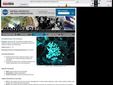
Young scholars use authentic satellite data on the NASA website to determine when the sea surface temperature meets the criteria to induce coral bleaching.
Curated OER
Social Studies: African Folklore and Geography
Students discover the connection between geography and folklore in several African nations. In groups, they record information from maps of their assigned countries. Students observe the pictures in books and match the geographic...
Curated OER
Some Things You Need to Know to Read a Map
Students study things the you need to know to read a map and explain location.
Curated OER
Orienteering - Lesson 3 - Topographical Maps and Contour Lines
Learn how to read a topographical map and understand what the contour lines mean. Explore longitude and latitude. Find a cliff, a valley, a mountain peak, and more. This is just one of the ten lessons in this unit on oreinteering....
Curated OER
Students Become Mapmakers
Students practice making a map of a continent and correctly plotting five cities on that map. They place latitude and longitude lines on a map, determine the need for various map projections and explain why map scales are necessary.
Curated OER
Sunrise and Sunset - Graph of Daily Solar Radiation
Young scholars use a graph of daily solar radiation to determine the times of sunrise and sunset. They also compare how sunrise, sunset, and the length of the day changes with latitude and longitude.
Curated OER
Plotting Plates
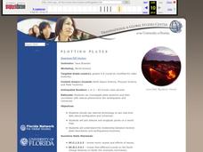
Students investigate plate tectonics and their correlation with natural phenomena like earthquakes and volcanoes. They use the internet to see real-time data about earthquakes and volcanoes. Students plot latitude and longitude points on...
Curated OER
Cargo Shipping
Young scholars work effectively in groups to achieve a common goal: Create the most efficient cargo shipping route. They successfully identify and locate port cities using latitude and longitude. To use the formula r=d/t (rate equals...
Curated OER
Beach Sands of the World
Students examine a variety of sand samples from throughout the world. On an index card, they write the characteristics of the sand and draw what the grains look like to use during the activity. Using a map, they practice plotting...
Curated OER
What Causes Irregular Temperature Patterns?
Students examine common trends in climate across the U.S. They identify the anomalies in hot-cold temperature differences in the U.S and locate them on the map using latitude and longitude coordinates.
Other popular searches
- Longitude and Latitude
- Longitude Latitude
- Latitude and Longitude Games
- Latitude and Longitude Maps
- Longitude & Latitude
- Longitude and Latitude Game
- Longitude and Latitude Math
- Geography Latitude Longitude
- Whaling Latitude Longitude
- Longitude Latitude Minutes
- Longitude and Latitude Lines
- Volcano Latitude Longitude


