Ocean Explorer
Living with the Heat
Young oceanographers study the Submarine Ring of Fire, which is a series of deep-water volcanic vents that come up from the ocean floor. Learners take a close look at the unique ecosystems that are associated with these areas, how these...
National Wildlife Federation
Why All The Wiggling on the Way Up?
Some of the CO2 emitted by burning fossil fuels is removed from the atmosphere by natural sinks, such as the ocean. The fifth engaging lesson in the series of 21 examines the CO2 data from three very different locations. It then makes a...
Curated OER
Creating a Rock Sequence
In this rock sequence worksheet, students will sequence a list of 10 historical events according to the principle of superposition. Students will label these events on a cross-section diagram.
Curated OER
Plate Tectonics: Fourth Grade Lesson Plans and Activities
The pre-lab portion of the lesson introduces emerging geologists to the various layers that make up Earth. After completing a sheet on the identification of the layers, class members simulate plate boundaries and their...
Curated OER
Ozone Hole - Changes in the Stratosphere
Halting the depletion of the hole in the ozone layer has been one of humanity's happy recoveries from previous damage done to the environment. Meteorology masters muse the Montreal Protocol and examine data on changes in the ozone....
Polar Trec
Sea Ice Impact
The arctic seas contain currents that are both warm (with high salinity) and cold (relatively fresh water) that circulate throughout the year. Through discussion, a lab, and a web quest, participants explore the impacts of melting and...
Biology Class
Plate Tectonics
A great reference to include in the classroom and on your class website, the presentation covers the following topics: Alfred Wegener's theory of continental drift, Pangea, layers of the earth and their properties, convection, plate...
National Park Service
It Was a Very Good Year
Waterton-Glacier International Peace Park includes whitebark pines that are over 1,200 years old, meaning they have been there since before medieval times. The second lesson of five details how to read tree rings for climate change and...
Curated OER
Hydrothermal Vent Challenge
Give our ocean voyagers the "Hydrothermal Vent Challenge!" It is a worksheet that guides them through an exploration of hydrothermal vents and the chemical reactions that occur when lava meets seawater. Using a collection of websites,...
Curated OER
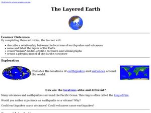
The Layered Earth
Students role play plate tectonics by creating a "plate statue" made up of students. In this earth science lesson, students describe how Earth's movement cause earthquakes and volcanoes. They draw and name the different layers of the Earth.
Curated OER
Tic-Tac-Toe for Layers of the Earth
Eighth graders identify the different layers of the earth. In this earth science lesson, 8th graders choose a project to do from a given list according to their learning style. They present their finished project in class.
Curated OER
Hot, Cold, Fresh and Salty
Students observe the effects of layering water and what is more or less saline than normal. In this geoscience lesson students create saline solutions, layer them and observe how the water becomes different temperatures in different layers.
Curated OER
Layering of Water
Students examine what happens when different types of water meet. In groups, they participate in an activity in which they combine different percentages of salt, fresh and brackish water and record their observations. They let the...
Wilderness Classroom
Ocean Life
Our oceans are composed of many complex relationships. Young oceanographers explore relationships between organisms, understand the world ocean's currents, and discover the effects of water pollution and how it behaves. There are...
Curated OER
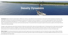
Density Dynamics
Students set up working models demonstrating lake turnover and the formation of deep water masses in the oceans.
Curated OER
It's Going to Blow Up!
Get your ocean explorers online, reading articles about submarine volcanoes. They answer a series of questions and take a geometery challenge in which they calculate how much of a volcano has been blown away. Make sure to explore several...
Curated OER
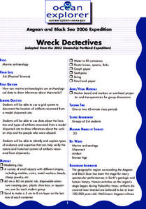
Wreck Detectives
Junior archaeologists examine types of artifacts from the Bronze Age on the internet. In collaborative groups, they create a story about a ship from this period and then construct a model of the ocean floor after their ship has sunk....
Curated OER
Plankton / Phytoplankton
Students discuss the importance of plankton in the ocean ecosystem. For this biology lesson, students identify the different types plankton by observing them under the microscope. They explain how plankton population affect global climate.
Curated OER
Introduction to Coral Reefs
Young scholars identify locations of coral reefs, both in the water and around the globe, identify relative depth of corals in the ocean by observing behavior of cold and warm saltwater, and create models of coral reefs.
Curated OER
Edible Rock Layers
Students use edible food items to conduct an experiment that simulates the movement, folding, and faulting of rock strata like sandstone, siltstone, limestone, and shale. Students then get to eat the experiment when completed.
American Museum of Natural History
Journey to the Bottom of the Sea
Follow the path to the sea floor. Pupils play an online interactive board game to reach the bottom of the sea. Participants must match descriptions of creatures to a property of water dealing with oxygen, food, light, or density to move...
Curated OER
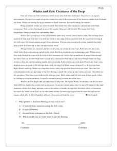
Whales and Fish: Creatures of the Deep
Practice comparing and contrasting details in informational text with a reading passage about whales. It explains the ways that fish and whales are similar, as well as the ways they are different, and specific characteristics of various...
Oregon State
World Map of Plate Boundaries
Young geologists piece together the puzzle of plate tectonics in an earth science lesson. Given a physical map of the world, they search for land formations that indicate the location of different types of plate boundaries.
Curated OER
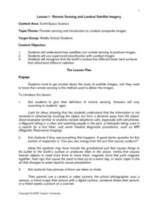
Remote Sensing and Landsat Satellite Imagery
Middle schoolers comprehend how satellites use remote sensing to produce images. They use supervised classification with Landsat images. Students recognize that the earth's surface has different basic land surfaces that reflect/emit...
Other popular searches
- Ocean Layers
- Ocean Layers Sunlight Zone
- Layers of Ocean Water
- 3 Layers of Ocean
- Ocean Layers Salinity


