Curated OER
Ozone Layer
Seventh graders develop an understanding of the ozone layer, it's affect on Earth, and the effect of human activity on the ozone layer. They then interpret data from satellite pictures and develop an understanding of longitude/latitude...
Curated OER
Sunrise and Sunset - Graph of Daily Solar Radiation
Students use a graph of daily solar radiation to determine the times of sunrise and sunset. They also compare how sunrise, sunset, and the length of the day changes with latitude and longitude.
Curated OER
Plotting Plates
Learners investigate plate tectonics and their correlation with natural phenomena like earthquakes and volcanoes. They use the internet to see real-time data about earthquakes and volcanoes. Students plot latitude and longitude points on...
Curated OER
Cargo Shipping
Students work effectively in groups to achieve a common goal: Create the most efficient cargo shipping route. They successfully identify and locate port cities using latitude and longitude. To use the formula r=d/t (rate equals distance...
Curated OER
Beach Sands of the World
Middle schoolers examine a variety of sand samples from throughout the world. On an index card, they write the characteristics of the sand and draw what the grains look like to use during the activity. Using a map, they practice...
Curated OER
Destination Investigation!
Students interpret a map or Atlas. They determine latitude, longitude, and absolute location and create and evaluate a travel itinerary. They identify the benefits and drawbacks of an itinerary and conduct online research as a means to...
Curated OER
What Causes Irregular Temperature Patterns?
Young scholars examine common trends in climate across the U.S. They identify the anomalies in hot-cold temperature differences in the U.S and locate them on the map using latitude and longitude coordinates.
Curated OER
A Bird's Eye View of our 50 States
Third graders focus on state birds as they learned absolute location (latitude/longitude) of each state, as well as their relative location (bordering states).
Curated OER
Our State Road Trip
Students take a virtual tour of the country of China instead of a state. Using the Internet, they examine the differences between a political and physical map and use latitude and longitude to locate specific places. They also research...
Curated OER
Using My Nasa Data To Determine Volcanic Activity
Young scholars use NASA satellite data of optical depth as a tool to determine volcanic activity on Reunion Island during 2000-2001. They access the data and utilize Excel to create a graph that has optical depth as a function of time...
Curated OER
Five Themes of Geography
High schoolers conduct research to determine why geography is important and how it provides information regarding many aspects of the world. They investigate the hemispheres, longitude, latitude and absolute location.
Curated OER
GEOGRAPHY OF FOOD & FIBER
Students will explain the ways geography determines the crops grown in the United States and other countries, and the resulting trade relationships.1. Discuss trade routes, both ancient and current. Discuss why the most direct route from...
Curated OER
Geography Search: The New World
Students explore the "New World". They collect geographic information related to the ocean, latitude and stars, longitude and time, wind patterns, and the weather. They analyze the geographic data and make decisions to plot their...
Curated OER
Vocabulary for Dimensions of the Earth
In this Earth dimensions learning exercise, students define 24 terms associated with contour maps, latitude, longitude, and time zones.
Curated OER
Japan: Land of the Rising Sun
Students locate Japan on a globe, name the major physical features, and describe the physical environment. They survey the differences and similarities between the life and culture of Japanese young people and American young people.
Montana State University
What's the Weather?
How many jackets do you need to stay warm and climb Mount Everest? An informatie resource covers the topic of Mount Everest, the resource helps young scientists discover the difference between climate and weather. Activities include...
Curated OER
Is Portland, Oregon Experiencing Global Warming?
Students use data to determine if the climate in Portland has changed over the years. In this weather lesson plan students complete line graphs and study long wave radiation.
Stillwater Central School District
The Adventures… Of Alice in Wonderland
Go down the rabbit hole with a thorough novel unit for Lewis Carroll's Alice in Wonderland. With a cause and effect chart, K-W-L organizer, and reading comprehension questions, the resource is a great addition to your summer...
Curated OER
Broken-Heart Matching Game
Learners use this fun game to practice, reinforce, or apply a wide variety of skills around Valentine's Day. Each students receives half a heart with zig-zag cuts made of pink construction paper with a piece of information. Their job is...
Curated OER
Basic Mapping Skills
Establish and study the parts of a map with your class and, then they will work in small groups to create their own detailed map, including a legend. There are specific instructions to follow on what needs to be included.
Curated OER
The Solstices
Compare surface temperatures when the solstice occurs in the different hemispheres. Young scientists draw conclusions from their investigation of data collected using spreadsheets and a globe.
Cloud Front
Weathering, Erosion, and Landforms—Student Activities
Tired of your students taking you for granite? Use a unit that offers multiple hands-on weathering and erosion labs and interactive activities. Some of the exciting lessons include planning a tour of Australia, using ice...
Curated OER
Westward Expansion
Students locate California and New York on a map and explore available means of travel in the 19th century. Students explore the role of trade in pioneer America and simulate various barter transactions.
Curated OER
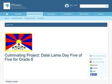
Dalai Lama
Sixth graders use skills and knowledge that they gained from their Tibet unit to formulate a final product of their Tibet journey. This study covers topics such as Tibet's geographical location, religious beliefs, customs, dress, and way...
Other popular searches
- Latitude and Longitude
- Latitude Longitude
- Latitude and Longitude Games
- Latitude & Longitude
- Latitude and Longitude Maps
- Longitude and Latitude Game
- Longitude and Latitude Math
- Geography Latitude Longitude
- Whaling Latitude Longitude
- Longitude Latitude Minutes
- Longitude and Latitude Lines
- Volcano Latitude Longitude


