Curated OER
Finding the Way
Learners identify and research navigational tools used in deep sea explorations. They are introduced to a compass, the Global Positioning System and sonar technology and then describe their uses in underwater exploration.
Curated OER
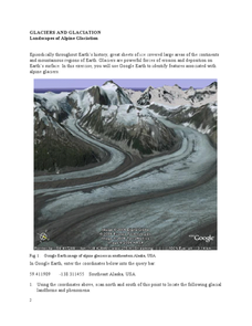
Landscapes of Alpine Glaciation
In this glaciers worksheet, high schoolers use Google Earth to look for examples of different glacial landforms and phenomena. Students complete 2 short answer questions.
Curated OER
Country facts
In this science facts worksheet, students pick a country and research science facts to put into this graphic organizer. Students complete 10 facts.
Curated OER
Exploring Alaska's Seamounts - Volcanoes, Plates, and Chains
Students examine the formation of seamounts in the Gulf of Alaska. In this seamount lesson plan, student focus on how the Axial-Cobb-Eikelberg-Patton chain was formed. They learn the associated vocabulary, and watch a teacher...
Curated OER
Creating and Analyzing Graphs of Tropospheric Ozone
Students create and analyze graphs using archived atmospheric data to compare the ozone levels of selected regions around the world.
Curated OER
Three D Constellations
Students are introduced to both celestial coordinates and to the first rung on the distance determination ladder. They convert spherical coordinates to Cartesian coordinates to construct a three dimensional model of a constellation...
Curated OER
The Librarian Who Measured the Circumference of the Earth
Sixth graders explore angles, triangles, and investigate the circumference of the earth. They participate in a Webquest, access data bases, and communicate with other students through an on-line project site involving the circumference...
Curated OER
Geographics in Arkansas
Third graders discuss where Arkansas is located on the United States map. They use geographic tools to participate in activities.
Curated OER
Make Your Own "Weather" Map
Learners create their own "weather" map using data from x-ray sources. They analyze and discuss why it is important to organize data in a fashion in which is easy to read. They compare and contrast different x-ray sources using a stellar...
Curated OER
Underwater Picture of the Hudson River Estuary
Young scholars identify important aspects of water quality such as slainity and turbidity. They test two of the water quality parameters and determine the quality of the water. In addition, they construct two sets of graphs based on data...
Curated OER
Adventures With Maps And Globes
First graders examine the differences between a map and a globe. They discuss and identify the symbols on maps and globes, then in small groups complete a worksheet. Students then complete a Venn Diagram comparing maps and globes.
Curated OER
Projects For USA Units
Students study different regions of the United states through interdisciplinary activities. This lesson presents very creative, artistic ways for students to explore the variety of regions found in the United States.
Curated OER
Map Making
Students use a tennis ball and paper to construct a student-made globe. They sketch in continents and major map features and then compare a flat map to a globe.
Curated OER
Common Themes
Tenth graders test usefulness of a model Earth by comparing its predictions to observations in the real world. In this landforms lesson students construct an island from a contour map using model clay then analyze the landscape...
Curated OER
Learning About the Shape of the Earth
Seventh graders investigate ways of telling the shape of the Earth and its position in the Universe both historically and today.
Curated OER
In The Shadow of Angkor
Students are introduced to basic historic and geographic facts about Cambodia. They understand the spiritual component of Cambodia's art. They identify Cambodia on a map of the world. They construct a graphic representation of a film...
Curated OER
Measuring Angles
Third graders describe an amount of turn from a particular position to another using the 'circular' benchmarks of 0, ++, ++, ++, and full turn. Estimation language such as 'just about', 'between', 'not quite', 'just over', and similar...
Curated OER
The Legend of the Indian Paintbrush: Native American Life
Students read," The Legend of the Indian Paintbrush" by Tomie dePaola and discuss the way legends are passed down orally. They then create their own legend and illustrate it on a simulated "Buffalo Skin" made from brown paper.
Curated OER
Planet Earth
Students explore and analyze data from different maps in order to explain geographic diversity among the continents. Student groups research continents' physical features and examine how they contribute to quality of life for inhabitants.
Curated OER
May We Present Planet Earth?
Students draw a map to scale. They illustrate knowledge of how to use DOGS TAILS on a map. Students identify the main parts of a map. They identify and illustrate the major features necessary for sustaining a quality of life for a society.
Curated OER
The Life of Dona Felisa Rincon De Gautier
Pupils identify Puerto Rico and discuss its relationship and proximity to the United States. Next, students identify significant events that occurred during Dona Felisa's term in office and how if may have affected her popularity. ...
Curated OER
Locating Places
In this locating places worksheet, students locate locations by referring to the absolute locations and finding out the coordinates for each location. Students complete 16 problems.
Curated OER
Globe Lesson 8 - Locating Places - Grade 6+
In this absolute location activity, students read a 2-paragraph review of locating places and respond to 16 short answer questions.
Curated OER
Plot Current Earthquake Data
Learners review earthquakes larger than 2.5 that have occurred over a span of several days using a given website reference. In this geology lesson, students plot epicenters on a world map and depth of the quake. All necessary...
Other popular searches
- Latitude and Longitude
- Latitude Longitude
- Latitude and Longitude Games
- Latitude & Longitude
- Latitude and Longitude Maps
- Longitude and Latitude Game
- Longitude and Latitude Math
- Geography Latitude Longitude
- Whaling Latitude Longitude
- Longitude Latitude Minutes
- Longitude and Latitude Lines
- Volcano Latitude Longitude

