Curated OER
Linkages Between Surface Temperature And Tropospheric Ozone
Students collect and interpret data to make predictions about the levels of ozone in the atmosphere. Using the internet to collect data students use their collected data to create a line graph for analysis. Students make mathematical...
Curated OER
Charles Lindberghs's Flight to Paris
Students practice map skills. In this map skills lesson, students locate the cities of New York and Paris on a map. Students read about the flight made by Charles Lindbergh in May 1927 from New York to Paris. Students answer 8 questions...
Curated OER
Students Become Mapmakers
Young scholars practice making a map of a continent and correctly plotting five cities on that map. They place latitude and longitude lines on a map, determine the need for various map projections and explain why map scales are necessary.
Curated OER
The Librarian Who Measured the Circumference of the Earth
Sixth graders explore angles, triangles, and investigate the circumference of the earth. They participate in a Webquest, access data bases, and communicate with other students through an on-line project site involving the circumference...
Curated OER
Sunrise and Sunset - Graph of Daily Solar Radiation
Students use a graph of daily solar radiation to determine the times of sunrise and sunset. They also compare how sunrise, sunset, and the length of the day changes with latitude and longitude.
Curated OER
A Bird's Eye View of our 50 States
Third graders focus on state birds as they learned absolute location (latitude/longitude) of each state, as well as their relative location (bordering states).
Curated OER
Westward Expansion
Students locate California and New York on a map and explore available means of travel in the 19th century. Students explore the role of trade in pioneer America and simulate various barter transactions.
Curated OER
Are We Falling Apart? Exploding Volcanoes
Students research and demonstrate volcanic activity. In this volcanism lesson plan, students research the types of volcanoes and define related terms using the Internet. They demonstrate volcanic activity with water, corn syrup, and flour.
Curated OER
Broken-Heart Matching Game
Learners use this fun game to practice, reinforce, or apply a wide variety of skills around Valentine's Day. Each students receives half a heart with zig-zag cuts made of pink construction paper with a piece of information. Their job is...
Curated OER
The Solstices
Compare surface temperatures when the solstice occurs in the different hemispheres. Young scientists draw conclusions from their investigation of data collected using spreadsheets and a globe.
Curated OER
Water Monitoring Vocabulary
As the title implies, this is a list of vocabulary terms relating to water monitoring. If your ecology class is learning about how to test water quality, this will be an appropriate reference sheet for them. As a bonus, if you live in...
Curated OER
Human Effect
Students investigate changes in air quality. In this science lesson, students compare data to determine the air quality. Students explore how humans affect the air quality.
Curated OER
Make Your Own "Weather" Map
Students develop and apply a variety of strategies to solve problems, with an emphasis on multi-step and non-routine problems. They acquire confidence in using mathematics meaningfully.
Curated OER
Design an Island
Students explore islands. They create a two- or three-dimensional map of an island. They explain how the topography of an area influences the location of water sources, ecosystems, and human settlements. Lesson includes adaptations for...
Curated OER
Natural Disasters and the Five Themes of Geography
Have your class do research on natural disasters and create a presentation using this resource. In completing this activity, learners apply the five geography themes to their research. They write a paper describing their results. It's a...
National Wildlife Federation
I Speak for the Polar Bears!
Climate change and weather extremes impact every species, but this instructional activity focuses on how these changes effect polar bears. After learning about the animal, scholars create maps of snow-ice coverage and examine the yearly...
Curated OER
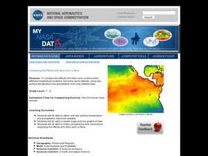
Comparing the Effects of El Nino and La Nina
Students examine the differences between an El Nino and La Nina year. For this investigative lesson students create maps and graphs of the data they obtained.
Curated OER
Solar Cell Energy Availability From Around the Country
Students determine areas that are the most likely to produce solar energy by using NASA data. In this solar energy lesson students analyze plots and determine solar panel use.
Curated OER
Is Grandpa Right, Were Winters Colder When He Was a Boy?
Students compare current weather data to historic data to see if there is a temperature change. In this weather lesson students complete a lab activity and determine average changes in temperature, precipitation and cloud cover.
Curated OER
Give Me a B: North Dakota Quarter Reverse
Students examine the North Dakota quarter reverse and note the bison. and Badlands displayed on it. After practicing as a group making the B sound, they explore the classrom for more words beginning with that letter. Working in pairs,...
Curated OER
Make Your Own "Weather" Map
Pupils create their own "weather" map using data from x-ray sources. They analyze and discuss why it is important to organize data in a fashion in which is easy to read. They compare and contrast different x-ray sources using a stellar map.
Curated OER
Adventures With Maps And Globes
First graders examine the differences between a map and a globe. They discuss and identify the symbols on maps and globes, then in small groups complete a worksheet. Students then complete a Venn Diagram comparing maps and globes.
Curated OER
May We Present Planet Earth?
Students draw a map to scale. They illustrate knowledge of how to use DOGS TAILS on a map. Students identify the main parts of a map. They identify and illustrate the major features necessary for sustaining a quality of life for a society.
Curated OER
Graphing on a Coordinate Plane
Eighth graders explore the coordinate system. They identify the x and y-axis, parts of the coordinate plane, and discuss the process of plotting points. To emphasize the process of plotting points, 8th graders play an ordered pair...


