Curated OER
The Unification of Italy
Students process variety of information on how Italy became a nation, and answer series of short-answer questions on the topics discussed in class.
Curated OER
Scavenger Hunt for Ancient Egypt
Seventh graders do a scavenger hunt in order to investigate Ancient Egypt.
Curated OER
Traveling Through North America
Students identify places and landmarks in North America, specifically Canada and the United States, by using and constructing maps. Six lessons on one page; includes test.
Curated OER
Everglades
In this wetlands instructional activity, students will research and answer 11 questions about the Florida Everglades. Students will create a report.
Curated OER
A Study of Panama
In this worksheet on Panama, students read an introduction about Panama, then read about its history, The Panama Canal, the Kuna Indians and the Endangered Species of Panama. After each selection, students answer a set of related questions.
Curated OER
Surrender at Yorktown
Eighth graders examine the start of the American Revolution. In this American History instructional activity, 8th graders analyze primary sources. Students prepare a narration of events leading up to the revolution.
Curated OER
China: Dim Sum: 3 Mapping Lessons
Fourth graders, after studying maps, draw a very large outline map of Asia and then a large map of China on it in the appropriate place. They label the appropriate information.
Curated OER
Lesson Plan on Map Skills for South Asia
Seventh graders observe and discuss an overhead transparency map of South Asia. In small groups, they label a blank map of South Asia, and listen to a lecture on the realm.
Curated OER
My Water's Place in Space
Students discover their absolute and relative place in space relative to water and create a book sequencing that space from most specific to most general.
Curated OER
Idaho State Trivia
In this Idaho learning exercise, learners complete 20 questions about Idaho trivia. Students may click on an answer button for immediate feedback.
Curated OER
Immigration and Settlement of Ethnic Groups in the Pacific Northwest
Students examine ethnic history of the Pacific Northwest in the period 1850-1950. They research documents and images in digital archives to explore immigration of various ethnic groups that settled in the region during this period.
Curated OER
Come One, Come All
Students analyze information from core map and other sources and construct routes from New York and Boston to Cincinnati as they might have existed in 1835.
Curated OER
Mississippi Delta Blues Moves: Second in a Series of Three with Barb Hoffman and Steve Hoskins, MGM
Students complete a graphic organizer reviewing Barb Hoffman's prior lesson plan," Slave Songs (1840-1876)" as well as listen to and discuss Delta Blues music samples. Students research one Delta Blues singer and write a "color coded"...
Curated OER
How History Changed the Way We Eat
Students participate in a instructional activity that is concerned with the history of the food pyramid and how it evolved and changed into its modern state. After being presented with the information they conduct classroom discussions...
Curated OER
Yaks, Yurts, and Yogurt: A Look at China's Autonomous Regions
Students are introduced to five Chinese geographical areas. They, in groups, research these areas and develop presentations including information on the physical characteristics, climate, elevation, agriculture and language.
Curated OER
Regions of South America
Students explore facts about South America in the four lessons of this unit. Booklets are created from the materials produced as the class delves into the topic.
Curated OER
Water Cycle
Students answer short answer questions about the water cycle and other cycles. For this water cycle lesson plan, students explore clouds, rain, evaporation, and more.
Curated OER
Breaking News English: Loss of Nature Will Damage Economies
In this English worksheet, students read "Loss of Nature Will Damage Economies," and then respond to 1 essay, 47 fill in the blank, 7 short answer, 20 matching, and 8 true or false questions about the selection.
National Geographic
National Geographic: Mapping the World's Watersheds
In this lesson, students use a world map to locate and label major rivers and their watersheds. They then compare watershed shapes and look at typographical features that determine their shapes. A vocabulary list with definitions is...
World Geography Games
World Geography Games: Rivers
Explore the major rivers of the world through this interactive quiz.
University of California
Ucmp: The World's Biomes
This is an introduction to the major biomes on Earth. This page groups biomes into five major types: aquatic, deserts, forests, grasslands, and tundra. Information on climate, animal/plant life, and much more is given for each of type...
Other
New World Encyclopedia: Missouri River
The history of the Missouri River is discussed in detail. Its location, physical characteristics, and major tributaries are covered.
Houghton Mifflin Harcourt
Holt, Rinehart and Winston: World Atlas: Myanmar (Burma)
Check out this map of Burma showing the major cities and the Irrawaddy River running the length of the country. There are also some quick facts listed about the country.
Other
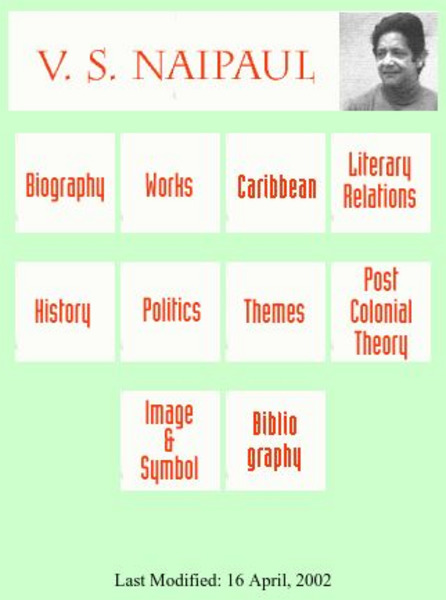
Postcolonial and Postimperial Authors: v.s. Naipaul
An excellent resource on V.S. Naipaul, a Carribean writer, this website provides articles on his status as a "rootless wanderer," his major works, and the key themes and ideas conveyed in Naipaul's writing.


