Curated OER
Rational and Irrational Numbers 2
Is the circumference of a circle always, sometimes, or never rational? Learners answer questions individually and also work in groups to look at sums and products of rational and irrational numbers. They must also be able to use the...
Curated OER
Modeling Conditional Probabilities 1: Lucky Dip
Check out this detailed lesson plan on conditional probability! Learners work individually and also collaboratively to analyze the fairness of a game and justify their reasoning. it includes detailed notes and many helpful...
Curated OER
Investigating Brass Instruments and Pitch
Students observe the sounds of different brass instruments in order to understand how to create different pitches. In this musical instructional activity, students create a "brass" instrument from everyday household objects. The students...
Curated OER
Community Map
Second graders engage in a lesson about their own community. They map the community and are assessed by the creativity of the document. The maps are produced using an example made with the teacher. Students make the cognitive connection...
Curated OER
Climate and Topography, What Is the Connection?
Fourth graders study Neumann's world continent map and explore topography and climate.
Curated OER
Hazard Alert
Students examine data regarding the occurrence of natural hazards as they occur in the United States. They record data on a classroom chart, map the areas affected by the hazards, and analyze and discuss conclusions drawn from the...
Curated OER
Global Perceptions: How Your Students View the World
Students examine their own perceptions and attitudes about places around the world. Using their mental maps, they compare and contrast it with a world map from different periods in history. They review the various types of map...
Curated OER
A Geographic Study of Florida's Diverse Community
Eighth graders identify major population centers and their demographic features using an outline map of Florida and the Internet to.
Curated OER
Boundaries
Students are introduced to the term of mental mapping. Individually, they develop their own mental map of Washington state and discuss as a class what makes a boundary. They draw their mental map on paper and compare it with their...
Curated OER
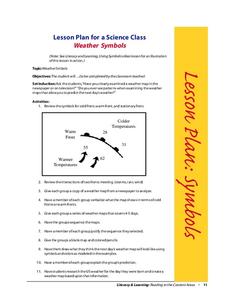
Weather Symbols
Young scholars study weather symbols. In this weather symbols lesson, students review the symbols for cold, warm, and stationary fronts. Young scholars use a weather map to study the weather symbols, complete a weather illustration and...
Curated OER
Geography of the English Settlements
Third graders locate several important American colonial cities on a map and research how their proximity to water and nearby arable land affected the rate and success of settlement.
Curated OER
Where Is Hoku?
Students are introduced to map making and reading. Using maps, they identify the cardinal directions and discuss the importance of a legend. They analyze the human characteristics of the classroom and create overhead view maps of the...
Curated OER
Following a Monster
Students follow tracks of a monster who has walked through their classroom to see what he has done. They discuss sequencing vocabulary before using computer software students sequence the monster's visit using a concept map. In a word...
Curated OER
United States Climates
Pupils identify regional climates by using weather maps. They, in groups, locate and mark their city on the small map, then go to the larger map to locate and mark their city when they are called upon by teacher.
Curated OER
Tools of the Explorers
Fifth graders examine the history of the European exploration of the New World. They research and create replicas of many of the tools used by the explorers including a compass, quadrant, hourglass, log and map.
Curated OER
Where in the World Am I?
Students are introduced to geography skills. They answer questions on a worksheet using the internet and maps. They examine the area of Japan as well.
Curated OER
My Country, Your Country
Fifth graders read a story about a girl living in Tokyo. Using the Internet, they research Japan while noting its unique characteristics. They virtually connect with a classroom in Japan and share information about their school with them.
Curated OER
Displaying The Data
Students engage in a research project to find information about one's personal family heritage. They collect information by conducting family interviews. Students use the data to create a graph, map, and timeline. Then students take part...
Curated OER
Digital Picture Books
Second graders create digital picture books reflecting their experiences during the school year on field trips and various classroom activities. Using digital pictures taken during the year, they write captions for each picture and...
Curated OER
Patchwork of the Planet
Students are taught how satellite images can be joined to make a picture mosaic. They use actual satellite images to make satellite mosaics regions of the United States. Students use a camera to photograph portions of a globe in the...
Curated OER
Vectors
Students use both magnitude and direction to locate a place. They use locating techniques to make a temperature field of their classroom.
Curated OER
Geography Review
Third graders name the continent, country, state, and community in which they live. They locate Maryland and Baltimore on a map of the United States.
Curated OER
U.S. State Web Search
Second graders engage in an integrated lesson which combines classroom curriculum with Internet use of online reference resources. They, in pairs, are assigned a state to research on the internet. They utilize a worksheet imbedded in...
Curated OER
The Cities We Live In
Students research a major city. They create a diagram of the city, labeling major monuments and points of interest. Next, students draw a map of their own town and label its major interest areas. Students compare and contrast their...
