Curated OER
Fairy Tale Maps
Students study direction as they listen to the stories of Little Red Riding Hood and The Jolly Postman. In this cardinal direction lesson, learners create a map to show the path Little Red Riding Hood took in the story and label the path...
Curated OER
Map It With Pixie
Fourth graders use the computer program 'Pixie' to create a topographic, detailed map for the state they live in. In this mapping skills lesson, 4th graders use Pixie to make a map of their state that includes topographic features, state...
Columbus City Schools
Constructive and Destructive Geologic Processes
Show the class the world as they've never seen it before—from way above! Learners try to unravel the mysteries presented by rich satellite imagery, learn to interpret topographic maps, and study erosion by constructing their very...
Curated OER
Project Whistlestop:Missouri Vacation Learning Unit
Fourth graders reserach the state of Missouri. For this Missouri History lesson, 4th graders plan a vacation to a region of Missouri. Students work in collaborative groups to determine all aspects of the trip. Students use math...
Curated OER
Maps Reinforcement
In this map worksheet, middle schoolers complete 6 multiple choice questions and 5 short answer questions about 3 different map figures.
Curated OER
North Carolina Salt Dough Map Social Studies Project
In this lesson, North Carolina Salt Dough Map, 4th graders create a salt dough map of North Carolina, Students use dough to form the shape of the state of North Carolina. Students label the three regions of North Carolina and all of...
Curated OER
Map It!
Fourth graders demonstrate map making skills by using the computer to create maps of the geographic features, regions, and economy for their state.
Curated OER
Electronic Mapping
Students identify countries, oceans, and capitals by building an electronic map.
Curated OER
Mapping My Spot in History
Students create their own town's history. They place themselves on the map in a literal as well as figurative sense. Students produce portions of an updated version of an early twentieth century panoramic map. Students gather information...
Rocklin Unified School District
Spanish Speaking Countries Project
Ask your class members to provide a tour of a Spanish speaking country with a brochure and flag project. Learners research their assigned country, making sure to check off each of the required pieces of information listed on the first...
Curated OER
Introduction of the Lunar Relief Map Project
Pupils investigate the geographic features of the surface of the moon. In this lunar relief map instructional activity, students watch and discuss the Apollo II Moon landing and make preliminary plans for their lunar maps.
Curated OER
"Me" Resource
Learners elucidate themselves by writing up to six entries in different formats. Some formatting choices include a dictionary, encyclopedia, or atlas entry, a magazine article, a newspaper article, and a table of contents. Some...
Curated OER
Finding Your Way Around the World
Students plan a trip around the world and create a PowerPoint presentation of the journey. In this map, atlas, and technology instructional activity, students plan a trip around the world in which they avoid using an airplane. Students...
Curated OER
E-mailing the Chamber of Commerce
Encourage effective internet research and e-mail correspondence as scholars investigate a US capital city they've never visited to find pertinent and relevant information. They begin by picking a city, then visit that city's chamber of...
Bowland
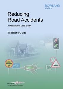
Reducing Road Accidents
By making the following changes to the roads, we can prevent several accidents. A multiple-day lesson prompts pupils to investigate accidents in a small town. Pairs develop a proposal on what to do to help reduce the number of...
Curated OER
Navigation
Students explain that globes are the best way to show positions of places, but flat maps are portable and can show great detail. They make a mercator projection of the route Lewis and Clark took on their journey.
Curated OER
Map Your Community
Learners study their community's assets and needs to create a service project that would meet the needs. In this community project lesson, students research their community and look for the strengths and weaknesses of the community. As a...
Curated OER
Mapmaker, Mapmaker, Make Me a Map!
Students evaluate the different types of historical and geographical information that one can gather through close study of historical maps from the 16th through the 19th centuries. They create their own maps.
Curated OER
Story Quilt Project
Students investigate how quilt making was a family and community activity. They read and discuss books, complete various handouts, and create a paper quilt celebrating philanthropic activities.
Curated OER
Waldseemuller's Map: World 1507
Students investigate the 1507 word map. In this world geography lesson, students examine the details of each section of the map and then draw conclusions about how the people of 1507 understood the world. Students are evalated on...
Curated OER
Local History: Mapping My Spot
Learners explore maps to discover historical information about their local area. For this mapping and history lesson, students use panoramic maps of their own town/city to interpret historical information. Learners also place...
Curated OER
Map Reading in the 21st Century
Students interact with MapPoint tools to view maps of the past and the present in multiple ways. They participate in mini-lessons aimed at locating certain points of interest or famous routes taken in history.
Curated OER
Mapping Your Schoolyard Habitat
Learners explore the terrain, structures, plants and signs of habitats around their schoolyard. They draw a sketch map showing the different areas around the schoolyard. Students identify the location of weeds and native plants on their...
Curated OER
Character Development Project
Read Dangerous Minds with your language learning disabled pupils to identify characteristics and connect to literature. This is a specific activity intended for use with the suggested book. The class uses a character map as a way...


