Curated OER
Exploring Biomes Lesson 4: Mapping Arizona
Once junior ecologists are familiar with Earth's major biomes, they hone in on Arizona's biomes. Using a website about Arizona's natural resources, learners will identify biotic communities. Beautiful maps and worksheets are provided for...
Curated OER
Mapping the News
Students explore cartography. In this map skills and map making lesson, Students work in groups to create wall size world maps including legends, compass roses, latitude and longitude, and physical features. Students collect...
Curated OER
North Carolina Salt Dough Map Social Studies Project
In this lesson, North Carolina Salt Dough Map, 4th graders create a salt dough map of North Carolina, Students use dough to form the shape of the state of North Carolina. Students label the three regions of North Carolina and all of...
Curated OER
Draw To Scale The E-Z Way
Fourth graders draw a rough floor plan of a house to scale without using a ruler to determine measurements. They see how architects use scale to draw blueprints, and solve math problems using scale.
Curated OER
School Neighborhood Walking Tour
Students list specific boundaries in their school neighborhood and explain their possible purpose. They examine a neighborhood and see what connects us and what divides us. They, in groups, make maps of various neighborhoods and present...
Curated OER
Painting the Hallway with Pixels
Middle schoolers create science design to be painted on the wall in the hallway of the science area of the school building. They measure space available, make a scale model of the design, and paint different pixels.
Curated OER
3-D Model of Lake Benthos
Students create 3-D models of Lake Benthos. In this scale drawing lesson, students create a 3-D model of Lake Benthos. Students work in groups to create the models. Students use the models to to encourage people to conserve natural...
Curated OER
Understanding: Geography
Students explore their neighborhoods. In this geography lesson, students make a map of their neighborhood. They must include a key, natural terrain, buildings and streets. They also write a descriptive paragraph about their neighborhood.
Curated OER
Drake's West Indian Voyage 1588-1589
Middle schoolers investigate several maps detailing Sir Francis Drake's voyages. In this geography lesson, students practice reading maps and locating the precise locations of where Sir Francis Drake visited. Middle schoolers...
Curated OER
Make a Map
In this mapping activity worksheet, students finish the map by following the 5 directions and using the map key. Students the map key, scale, and an inch ruler for help.
Curated OER
Park Brochures
Sixth graders investigate natural environments by researching national parks. In this brochure making lesson, 6th graders explore a specific national park and research it's information by utilizing the web. Students create travel...
Curated OER
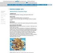
Emphasizing Scale When Creating a Site-Specific Work of Art
Students study art by Matthew Ritchie. Students view pictures of the artist and discuss art that is created specifically for a designated area. Students create pen and ink drawings on letter size paper. Using an overhead, students...
Teaching Tolerance
Identity Self-Portraits
What symbols represent you best? Individuals consider how they would draw peers using symbols about their identities with an interview and art activity. After conducting interviews and portraits, the art makes a great centerpiece for...
Teaching Tolerance
Identity Portraits
When you look at me, what do you see? Young learners answer this question by creating a portrait that reflects the identity of one of their peers. First, class members create interview questions. Then, they interview classmates to...
Curated OER
U.S. Geography: The Northeast
Students investigate U.S. Geography by creating a map in class. In this natural resource lesson, students create a map of the United States and research the Northeast based on their resources and recyclable materials. Students...
Curated OER
Cartography
Students follow directions to draw a map of an island. They complete the island map adding their own details using symbols and a legend.
Curated OER
THE TRAVELS OF BABAR: An Adventure in Scale : Integrating Visual Art and Social Studies
Students comprehend how the use of color impacts a work of art. They research how a theme can be rendered in a variety of ways (words, music, visuals). Students analyze how an artist's choices affect the aesthetic quality of artwork.
Curated OER
3D Textured Globe
The earth, our home planet, and the star of Earth Day celebrations everywhere! Celebrate Earth Day or examine Earth's place in the solar system, with a fun and easy craft, perfect for children nine and up. Paper mache ornaments, paint,...
Curated OER
Map-Making Basics
Students study maps. In this geography and art lesson, students create their own map of the classroom.
Curated OER
Treasure Hunters
Young scholars design an on campus treasure hunt to find various architectural vocabulary words which they then create definitions for on the blog page on the Environmental Design website.
PBS
Home, Sweet, Home!
Students investigate the local history and architecture of their community. They draw maps, conduct Internet research, discuss varied architectural designs, take a walking tour of their town and work in teams to record their community's...
Curated OER
GPS Art
Students design their own logo or picture and use a handheld GPS receiver to map it out. They write out a word or graphic on a field or playground, walk the path, and log GPS data. The results display their "art" on their GPS receiver...
Curated OER
Medieval Castles
Second graders design a scale model of a medieval castle and its surroundings including the following items: castle, moat, bailey, drawbridge, turrets, dungeon, grounds, and outer walls. A perfect lesson plan for those kids who are...
Curated OER
Field Trip - San Francisco Bay Model
Students investigate scale models while attending a field trip within the San Francisco Bay Area. In this oceanography lesson, students identify the currents of the Bay Area and discuss how they are created by different tides....


