Curated OER
The Big Circle
Students explore geography by participating in a mapping activity. In this concentric ring instructional activity, students utilize a poster board, string and markers to identify their current location within the entire world. Students...
Curated OER
How Much Water is in That River?
Students practice measurement using the Hudson River. They calculate the discharge measurement at a location on the Hudson River using ingenuity and a topographic map.
Curated OER
American Indians, European Settlers, and Colonial Arkansas
Students identify the interdependence among various ethnic groups in early Arkansas history. They illustrate timelines and visit historic sites. They make maps of the site and give class presentations.
Curated OER
What Makes a Map?
Learners, in groups, brainstorm to find what makes up a map, what kind of information can be "read" from a map, who might use a map, how their world is defined or helped by maps, etc. They make a map of their "world."
Curated OER
Making a Point
Students become familiar with maps as insights to new perspectives. They also evaluate maps that were designed to express a perspective. They explain the qualities of an equidistant azimuthal projection
Mathematics Assessment Project
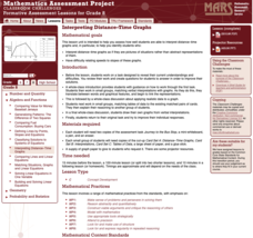
Interpreting Distance–Time Graphs
Pre-algebra protégés critique a graph depicting Tom's trip to the bus stop. They work together to match descriptive cards to distance-time graph cards and data table cards, all of which are provided for you so you can make copies for...
Curated OER
Mapping The Ocean Floor
Young scholars explore and analyze the bottom structure of underwater habitats. They describe and explain what can't see through the collection and correlation of accurate data. Learners assess that technology is utilized as a tool for...
Curated OER
U.S. Geography- The Northeast
Students investigate the geography of the Northeast states. In this map skills lesson, students are shown a map of the Northeast states and identify the state names and borders. Students construct individual maps of the Northeast using...
Curated OER
Cardinal Directions
Students explore cardinal directions. In this social studies instructional activity, students create maps of home and school using the cardinal directions.
Curated OER
Materials: Hidden Costs, Mapping the Source and Cost of Raw Materials.
Students map connections among raw materials. In this environmental stewardship lesson, students design strategies to minimize the use of raw materials and discuss how to use more sustainable materials.
Curated OER
She's All Over the Map
Students consider female authors and their literature. Working in partnerships, they research and map the life and work of a Nobel Prize-winning female author of their choice. Students write individual letters expressing their thoughts...
Curated OER
VA Statute for Religious Freedom, I. Semantic Map
Students analyze the Virginia Statute for Religious Freedoms and consider its implications. In this document analysis lesson, students explore primary and secondary sources regarding the document and create a semantic map that...
Curated OER
Snack Search
Students make maps to show where the agricultural products used to produce various packaged snacks are grown. They bring in snacks from home and utlize a worksheet imbedded in this plan.
Curated OER
Where in the World is Hawaii?
Learners compare a globe and a two-dimensional world map and explore how they both represent the planet Earth. They locate the Hawaiian Islands on the globe or the world map and describe how the geographical position is unique.
Curated OER
Making Sense of Homographs
What is a homograph? Develop your students' vocabulary with a word association tool. Language arts classes discover what a homograph is and how it can be used as a visual thesaurus. They discover the other uses for homographs...
Curated OER
Cities and Countries Around the World
Briefly introduce your young Spanish speakers to different cities around the world. Identify the country they are located in, what the people are called from those countries, and the country's location on a class map. Make sure to use...
Asian Art Museum
Make Your Own Samurai Sword
When you click on this resource, it will seem to be lacking; however, you'll soon realize it is an idea with potential. Included are visual instructions for creating a Samurai sword. Why? Because, the Samurai sword could be used in...
Curated OER
Storyboards: The Director's Map to a Video Project
Class groups collaborate to produce the storyboard for their video project. After determining the sequence of scenes, the camera angles, and characters in each scene, each group member is assigned a number of scenes to illustrate. When...
Curated OER
Making a Cartogram
Students interpret statistical geographic information by creating a cartogram.
Curated OER
Map It Out
Explore how illustrations add to a story. Young learners will look at picture books to see how the pictures tell the story. They create illustrations to go with a chosen story, and then flip the activity so they have to write a story to...
Science Matters
Energy and Winds
In the study of wind energy, scholars build a small windmill and observe how it transfers wind into mechanical energy. Learners will make connections to the previous instructional activity with concepts such as the...
Curated OER
How to Make a Lake
Delve in the creation of the Great Lakes in Michigan. After listening to stories about the formation of the lakes in this area, pupils perform experiments to investigate how this occurred. This provides a great way for learners to...
National Wildlife Federation
Massive Migrations: Grades K-8
Migratory animals follow the same path every year. Learners research the path of an assigned species and create a map highlighting key landmarks along the way. As a group, they come up with a presentation to share with their class.
US Environmental Protection Agency
Mapping Greenhouse Gas Emissions Where You Live
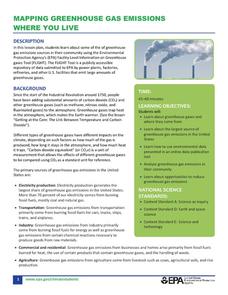
After investigating the US Environmental Protection Agency's climate change website, your environmental studies students discuss greenhouse gas emissions. They use an online interactive tool to look at data from power production...
Other popular searches
- Making Maps Geography
- Making Maps and Research
- Making Maps Using Technology
- Making Maps of History
- China, Making Maps
- Making Maps of Community
- Reading Making Maps
- Neigborhoods and Making Maps
- Making Maps Lesson Plans
- Making Maps Usign Technology
- China Making Maps
- Neighborhoods and Making Maps


