Curated OER
MAP MAGNETIC FIELD OF A ROOM
Students map the magnetic field of a room (classroom or room at home -- recommend kitchen) at two or more heights. They create a coordinate grid within the room and make a relatively accurate map of the room to super impose the...
Curated OER
Mapping Africa
Young scholars identify the location of parallel and meridian coordinates. They illustrate their understanding of the physical shape of the continent of Africa through a mapping activity, then explain the processes that have influenced...
Curated OER
Neighborhood Map Machine
Second graders study building placements in a neighborhood. They discuss businesses, roads, houses, rivers, police/fire stations, and use Neighborhood Map Machine to create a new map. They complete an exploratory map and community of...
Curated OER
INTERPRETING MAGNETIC FIELD MAPS
High schoolers interpret magnetic field maps, rotate the coordinates to obtain different views, change the coordinate representation, and produce alternate graphical representations.
Curated OER
Early European Explorers Map
Fifth graders create an explorer's map. In this explorers lesson students use a map of the world as reference to draw their own map of Europe, North America, Central America, and the Caribbean Islands. The students use their maps to show...
Curated OER
Weather Predictions
Students record weather data and create a five day forecast. Students investigate the roles of meteorologists and identify symbols used on a weather map. After gathering weather data for a week, students will create a five day forecast...
Curated OER
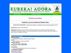
Reading a Local and National Weather Map
High schoolers practice reading a national and local weather map. Using this information, they work together to make predictions about the weather for the next few days. They discuss the use of symbols and maps as a class and discuss...
Curated OER
Summarizing and Mapping for Comprehension
Students practice summarization in order to increase their comprehension of non-fiction text. They read and summarize passages by finding the main ideas in passages from a Social Studies textbook. After silently reading the passage they...
Curated OER
Investigating Earthquakes: GIS Mapping and Analysis
Pupils describes the technique of preparing "GIS-ready" data and shows how to map that data and conduct basic analyses using a geographic information system (GIS).They use latitude and longitude fields to plot the data in a GIS and...
Curated OER
Mapping the War
Young scholars work in pairs to draw their own maps as specified of World War II areas. When all projects have been completed let one group at a time share their assignments with the rest of the class. Compile all the maps into a...
Curated OER
Mapping a Temperature Field
Students measure and graph temperatures. In this temperature field lesson students use a map to measure and plot field values and construct isolines and interpret the results.
Curated OER
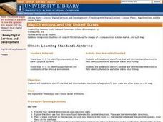
Map Directions and the United States
Third graders search TDC database for images of a compass rose, a miles marker, and a US map. They identify cardinal and intermediate directions to help identify their state and other states on a US map.
Curated OER
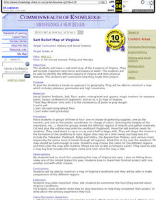
Salt Relief Map of Virginia
Fourth graders create a salt relief map of the four regions of Virginia. They indentify land forms and bodies of water, and summarize how they made their project.
Curated OER
Color Enhanced Maps
Students download or create maps with numerical weather data. They add isolines and color to create regions on their maps. They explore the visual properties of color palettes and create a visualization applying their knowledge.
Curated OER
Mufaro's Beautiful Daughters - Mapping the Story
Students listen to John Steptoe's story, "Mufaro's Beautiful Daughters" and create a story map.
Curated OER
Rockin' Map Summaries
Students summarize a piece of text. After reviewing the correct way to read and summarize, students work in groups to summarize a piece of text assigned by the instructor. They write a summary paragraph by creating a story map and the...
Curated OER
When a Map Isn't A Map...
In this maps activity, students read about the Earth, sky, rivers and lakes, and more, and then answer short answer questions about it. Students complete 3 questions.
Curated OER
First World War Maps
Tenth graders examine the First World War. In this Global History lesson, 10th graders analyze various maps of this time. Students construct maps of each front of the war by answering various questions.
Curated OER
Let's Sum It Up
Students read the book, 'Shiloh, and, as a group, complete a story map of the first chapter. They re-read the second chapter and individually make up a story map for it. In small groups, they complete story maps of the remaining chapters.
Curated OER
Mapping Potato Island
Students create their own topographical map using a potato. For this hands on lesson students construct a topographical map and explain what contour lines are using a potato.
Curated OER
Coordinate Grid: Mapping Archeological Sites
Fourth graders discover how to apply the Cartesian coordinate system by figuring out the length and width of their school playground. They determine that pacing is an important tool for the initial mapping of a site. Students conduct a...
Curated OER
Making Public Policy
Eighth graders examine a Legislative website to view the biography of a member and a map of the district that the member represents. They are then visited by the member who engages students in a discussion about how legislators make...
Curated OER
Technology Strategy Map
In this technology strategy mapping activity, students formulate a strategy for a technology leadership project for their organization.
Curated OER
Mapping Data Made Manageable
Students explore how to select unbiased random samples as they choose report data to include on maps. They propose methods for choosing random numbers and discuss their advantages and disadvantages. They consider bias in science.
Other popular searches
- Making Maps Geography
- Making Maps and Research
- Making Maps Using Technology
- Making Maps of History
- China, Making Maps
- Making Maps of Community
- Reading Making Maps
- Neigborhoods and Making Maps
- Making Maps Lesson Plans
- Making Maps Usign Technology
- China Making Maps
- Neighborhoods and Making Maps


