Curated OER
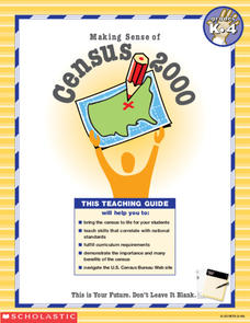
Making Sense of the Census
In this unit of lessons, young scholars make sense of the census. They examine why a census is taken and participate in activities.
Curated OER
Geography: Islands and Alcatraz
Learners, in groups, create maps of islands including map keys and compass roses. They compare and contrast their island communities with that of the island prison, Alcatraz. Students select from a series of projects, including writing...
Curated OER
Connections Between World Events, Geography and the Human Quest for Knowledge
Students examine the relationship between innovations in geography and world events. Using maps, they report different information from a spatial perspective. They develop hypothesis about how man's quest for knowledge has impacted the...
Curated OER
Geography Grid
Fourth graders search a database to find images and scan and affix them on an 8-foot long map of the state of Illinois. They then use it as a basis for discussion.
Curated OER
Making Sense of the Census
In this unit of lessons, students make sense of the Census. They examine why a census is taken and participate in activities.
Curated OER
Geography Review
Third graders name the continent, country, state, and community in which they live. They locate Maryland and Baltimore on a map of the United States.
Curated OER
Geography of the English Settlements
Third graders locate several important American colonial cities on a map and research how their proximity to water and nearby arable land affected the rate and success of settlement.
Curated OER
Past v. Present: Using Geography & Anthropology
Students examine artifacts and documents from their Canadian community. They analyze early Canadian history and make predictions about the future of the country.
Curated OER
Boilermaker Geography
Fifth graders investigate the geography of central Indiana with an emphasis upon finding the location of Purdue. They make a connection to literature with the reading of a newspaper article to create the context for the lesson while...
Curated OER
Making A New Nation
Eighth graders read standard road maps and topographical maps, and examine the lives of pathfinders who opened the trails to the West. They develop Living History presentations, role-playing a character from the past.
Curated OER
Influence of Geography on the Migration of Virginians
Sixth graders study how geography influenced the westward migration of Virginians. They review the settlement patterns of early Virginians before discussing reasons why people move away from an area. Looking at maps, they determine how...
Curated OER
World Geography: Who am I?
High schoolers are able to provide a basic description of one country that has arsenic in its water supply. They are able to locate these countries on a map. Students explore the majors countries that have been affected by arsenic...
Curated OER
Mapping With MapPoint
The class is engaged through a discussion of mapping. They determine what they believe makes a good map and what the essential elements of a map are. Students work independently to complete a worksheet on mapping. They follow clear...
Curated OER
Geography and Archeology of the River People
Seventh graders work together in groups to read a handout and answer questions about the geography and archeology of a group of native peoples. As a class, they discuss their opinions and answers and the importance of using artifacts to...
Curated OER
Making a Globe
Students examine the mercator projection or nautical chart and observe how global maps do not have the same distance as flat maps. They design handmade globes using the meridians and equator as guides to draw in the land. They paint and...
Curated OER
Creative Expressions: Making Puppets
Students are introduced to the very basic geography of Indonesia. In groups, they examine the different types of puppets and decide on which one to make. They travel between various stations to complete their puppet in which they use...
Curated OER
Geography: Mapping Neighborhoods
Learners examine their neighborhoods and draw maps reflecting land use. In addition, they make predictions about their community's future. Students also consider the impact of business and industry on their communities and predict ...
Curated OER
Sand Island Story Mapping
After reading Under the Blood-Red Sun, by Graham Salisbury, students use story mapping to create a visual representation of Hawaii. They include Pearl Harbor, Sand Island, and the Japanese relocation camp, where Tomikazu swims to visit...
Curated OER
Mental Map Postcard
Learners visit an outdoor setting and make a mental map of what they observe. They return to the classroom and create a postcard with specified elements such as a description of the land and the ecosystem. Students illustrate the...
Curated OER
Geography: Snow Cover on the Continents
Students create maps of snow cover for each continent by conducting Internet research. After estimating the percentage of continental snow cover, they present their findings in letters, brochures or Powerpoint presentations.
Curated OER
If You Mess With A Wetland, At Least Try to Make Amends!
Eighth graders examine the role of wetlands in an ecosystem. In groups, they use the internet to research how humans have disturbed and ruined the effectiveness of wetlands throughout the country. They pretend they are in charge of...
Curated OER
Where Is Japan? What Direction Is It?
First graders locate countries on maps and globes and learn about the hemispheres and the cardinal directions. They listen to books read out loud and dicuss geography.
Curated OER
U.S. History: What Happened Here?
Students apply the global positioning system to create maps of local historical sites. By collaborating with local historical groups, they research events and relate them to broader, national history. In addition to writing essays...
Curated OER
What in the World?
Eighth graders plot points of longitude and latitude on a world map. In groups, they create a model of the earth's interior and label the parts,


