Chicago Botanic Garden
Historical Climate Cycles
What better way to make predictions about future weather and climate patterns than with actual climate data from the past? Young climatologists analyze data from 400,000 to 10,000 years ago to determine if climate has changed over...
Curated OER
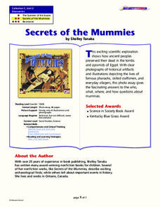
Secrets of the Mummies
How did the ancient people of Egypt preserve their dead so well that their bodies are still recognizable today? Learn the painstakingly complex process they used for preservation. Young scholars read and summarize a narrative detailing...
Core Knowledge Foundation
Columbus Sailed the Ocean Blue
Young adventurers embark on a journey, setting sail along the blue ocean with Christopher Columbus. Teachers will find that this unit makes their lesson planning smooth sailing!
Curated OER
Making a Life Map
Students create a life map of their life. They start the activity with a question from the teacher and expand on it. They can share their life maps with the class if they so choose.
Curated OER
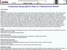
Comparing Topographical Maps to 3-Dimensional Models
High schoolers apply knowledge of topographical maps and how computer programs are used to make 3-D models of areas that humans have never visited. They view a Mars Canyon movie, then map the canyon.
Curated OER
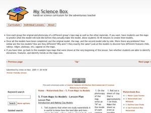
From Maps to Models
Fourth graders study topography maps and learn the importance of their contour lines. In this map lesson plan students create their own topography map.
Curated OER
Mapping Districts
Students become literate in their use of maps. For this 2010 Census lesson plan, students visualize census data on maps, use map keys to read population maps, and explore the concept of population density.
Curated OER
Lesson 2: Mapping Sub-districts
Students learn more about the census. For this mapping sub-districts lesson plan, students visualize census data on a map, use a map key to read a population map, and better understand the concept of population density.
Curated OER
Mapping Your School Site
Students map a map of their school. In this school map lesson plan, students make a map of their school, record major features, and not wildlife on the school grounds.
Curated OER
Relief Maps
Students study geographical maps and their functions. In this geography lesson students work in groups to build a map to scale.
Curated OER
Mapping Districts
Young scholars use maps to learn about the U.S. Census. In this 2010 Census lesson plan, students visualize census data on maps, use map keys to read population maps, and explore the concept of population density.
Curated OER
Reading distance on maps
Eighth graders complete worksheets on reading the distance on maps in miles or kilometers. For this maps lesson plan, 8th graders use a calculator and ruler.
Curated OER
Mapping Crime
Students use data on break and enter crime incidents to make a map that prompt discussion about the spatial location of crime in the city, why it would occur in those places, and how residents may reduce crime.
Curated OER
Understanding a Geological Map
Students identify different types of maps and observe a geological map. In this geology instructional activity students create a replica map of a geological area that includes a key.
Curated OER
Geological Maps of the Western Regions
Students study the geological makeup of the West. In this geological maps lesson students creat a map that includes a key and present it to the class.
Curated OER
Toy Making and Resourcefulness
Students demonstrate their understanding of resourcefulness by making a toy and describing how they were resourceful. They find Malawi on a map and tell the interesting things about the book Galimoto.
Curated OER
Map Creation
Second graders identify a map, symbol, key, and compass rose. Students create and print a map for teacher evaluation using the computer. Students identify the symbols on their map and orally present them to the class.
Curated OER
Map your Schoolyard
Pupils practice their mapping skills by creating an accurate map of their schoolyard using an aerial photo from the National Map web site. Students include legends, a scale, and a north arrow on their maps.
Curated OER
The Importance of Site Maps in Archaeology
Students consider the importance of site maps in archeology. They interpret site maps, draw site maps of their classroom and home and then participate in simulated Paleolithic archeological camp activity.
Curated OER
Topographic Map Unit Plan
Learners examine topographic maps and discover how to decipher contour intervals, use contour lines and apply information to complete a topographic map lab. Working in groups, they identify the scale of the map, latitude and longitude,...
Curated OER
Making Topographic Maps and Mountain Profiles
Students study how to mark inclines and construct a mountain profile. In this topographic map lesson students mark contour intervals and draw mountain profiles.
Curated OER
Isolines on a Weather Map
Ninth graders explore weather by analyzing maps. In this temperature instructional activity, 9th graders view black and white weather maps of locations in which the weather changes often. Students identify the isolines used on the maps...
Curated OER
Maps In Our Everyday Lives
Students break into groups and complete a chart about information on maps of their hometown.
Curated OER
Mini - Lesson #5: Get To Know - Mapping
Students examine and draw landscape maps. In this mapping lesson, students investigate what a landscape map is. They draw a map showing objects on a small piece of natural landscape. Students fill in a grid sheet and a worksheet to make...
Other popular searches
- Making Maps Geography
- Making Maps and Research
- Making Maps Using Technology
- Making Maps of History
- China, Making Maps
- Making Maps of Community
- Reading Making Maps
- Neigborhoods and Making Maps
- Making Maps Lesson Plans
- Making Maps Usign Technology
- China Making Maps
- Neighborhoods and Making Maps

