Curated OER
Mi Perro Perdido (My Lost Dog)
Learners receive a map of the school and a set of directions in Spanish for each pair that lead them to a specific place on campus. They use the directions and maps to leads them to pieces of colored paper that have been hidden. Each...
Curated OER
Arsenic and Lead Scavenger Hunt
Health wizards read and discuss an article about lead contamination then come up with a plan to help solve the problem. They get into groups to develop a community solution within the parameters of a budget, feasibility, and the source...
Curated OER
When I Was Young In Appalachia
Young scholars comapre and contrast the lifestyles of the people of the Applachian region with their own community through in-class discussions, creative projects, hands-on activities, food preservation, homemade remedies, home...
Curated OER
Underground Rails: The New York City Subway System
Students explore the New York Subway system. They investigate its usefulness as mode of transportation for the people in the city and study its history compared to other city subway systems. They examine how the subway connects the...
Curated OER
Community Map
Second graders engage in a lesson about their own community. They map the community and are assessed by the creativity of the document. The maps are produced using an example made with the teacher. Students make the cognitive connection...
Curated OER
Making Decisions About Public Land
Students write a proposal. For this public land lesson, students discuss the difference between private and public property and brainstorm what problems might occur if a citizen changed public property. Students work in groups to write a...
Curated OER
Cultural Mapping
Students are introduced to the cultural diversity in Australia. Using new vocabulary, they define multiculturalism and explore their own cultural backgrounds. In groups, they complete a series of worksheets to develop a better sense of...
Curated OER
Making Democracy Work for Everyone, 1877-1904
Students investigate the culture of the post Reconstruction South. They participate in a jigsaw research activity, conduct Internet research on an assigned topic, and write a report to present to the class.
Curated OER
Using Star Charts and Maps
Students study star charts and describe locations of objects. In this scientific models lesson students use coordinates and identify characteristics.
Curated OER
Finding Your Spot in the World
Young scholars learn the concept of movement by locating their house and the houses of their ancestors.
Curated OER
Glad to Meet You, Newfane
Students brainstorm a list of important community locations or buildings. We take pictures of inside and outside and include the history of each. They describe the service or product it provides, the date originated, etc. They build a...
Curated OER
My Neighborhood: A Webquest
Students engage in a Webquest to discover their school and community. They interview staff members of the school, create maps and take digital photographs of the school. As they write about their school, they use Microsoft Word to...
Curated OER
Episode # 158A
Students research the life of Martin Luther King, Jr. and determine how they can contribute to community projects.
Curated OER
Spatial Understanding of the Cities and Towns
Students engage in a fun stand up, move around activity that teaches some basics of geography. They develop concepts of distance between community locations and practice giving and taking directions in an organized manner.
Curated OER
Mass Transit
Learners explore the world of mass transit and how it affects their community as well as how it attempts to reduce our pollution mass. Included as well are the environmental and social factors relating to mass transit. They read and...
Curated OER
What's Driving Us?
Middle schoolers determine what the people in their community are driving. Using traffic flow information, they develop recommendations on how to achieve sustainability. They calculate the carbon dioxide emission index for various sites...
Curated OER
Finding Your Spot in the World
Learners investigate a world map, a United States map, a state map, a county map and a city map. They locate each student's house on the city map and put a length of yarn from their house to a country of one of their ancestors.
Curated OER
River Study
Students study physical features of a local stream. They study how to identify water features on topographic maps.
Curated OER
Paws in Jobland: Lesson Plan 25 - People in our School
Learners brainstorm a list of jobs that exist in their own school and its surrounding environment. In this lesson on careers, students create a map of the school and locate on the map where each job takes place. Next, the class divides...
Curated OER
Communicate with a Truck Driver
Sixth graders complete activities to learn about the trucking industry. In this truck driving lesson, 6th graders explore websites for positive trucker images and learn about their contributions to society. Students communicate with...
Curated OER
Landforms
Students study how landforms affect all aspects of a community. Students work in groups to identify landforms from other works of art. In cooperative groups Students select a work of art depicting a particular land form and create a poem.
Curated OER
Then and Now
Students explore population and come to understand how it changes over time. In this census lesson, students discover what population is and how it changes as they participate in age-appropriate activities.
Curated OER
Finding Sources of Air Pollution
Students locate on a map the potential areas of air pollution in their community. They identify the possible sources and types of air pollution in the community based on observations and predict and locate on a map potential areas of...
Curated OER
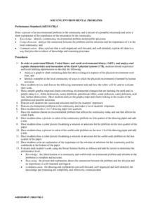
Solving Environmental Problems
Students identify a community environmental problem and possible solutions. They analyze the connection between the problem and the solutions and the importance of it to the local community. Students then draw a picture of an...


