Curated OER
City, County, Community
Students explore issues and situations that make for a city and its local environments. In this local government lesson, students design maps, define issues and create brochures that illustrate their understandings of these concepts and...
Curated OER
Local History: Mapping My Spot
Learners explore maps to discover historical information about their local area. For this mapping and history lesson, students use panoramic maps of their own town/city to interpret historical information. Learners also place...
Curated OER
Tasty Mapping
Students create an edible map. In this civics and geography lesson, students research their town's features and local government. Students work in groups to design and create a physical map of their town based on research.
Concord Consortium
School Bus Routes
Plan the way to school. Given a map of a school district, class members portray a transportation consultant hired to develop a bus transportation plan that will pick up the eligible riders and get them to school. The plan must contain...
Howard Hughes Medical Institute
Measuring Biodiversity in Gorongosa
Take your biology class' understanding of biodiversity to a whole new level! Ecology scholars use data to calculate three different diversity indices based on the organisms in the Gorongosa National Park. The four-part activity uses an...
Curated OER
How Far Did They Go?
Students create a map. In this direction and distance lesson, students come up with familiar places in the community and calculate the distances from these places to the school. Students create a map that displays these places and their...
Curated OER
Fair Haven Community and the Grand Avenue Bridge
Students use the internet to research the history of Fair Haven, Connecticut. In groups, they are introduced to the socio-economic developments and how the area has grown over time. They work together to create their own bridge design...
Curated OER
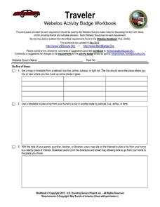
Traveler: Webelos Activity Workbook
This three-page worksheet is designed to be used by the Weblos of Boy Scouts of America. They are given 13 choices of academic activities that involve the use of maps, geography, math, and money. They must complete five of the activities...
Inside Mathematics
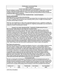
Scatter Diagram
It is positive that how one performs on the first test relates to their performance on the second test. The three-question assessment has class members read and analyze a scatter plot of test scores. They must determine whether...
Inside Mathematics
Swimming Pool
Swimming is more fun with quantities. The short assessment task encompasses finding the volume of a trapezoidal prism using an understanding of quantities. Individuals make a connection to the rate of which the pool is filled with a...
Curated OER
Flight Path
Young mathematicians investigate that things move in a directional path. They construct a paper airplane and measure an airplane's length of flight. Everyone constructs a map with a key showing their airplane's flight path
Curated OER
Locating Points Using Cartesian Coordinates
Students discover coordinates as they explore Chicago. In this math lesson plan, students give the coordinates of a point, plot a point, and use the coordinate system in locating places on a map.
Curated OER
Where Am I, and How Do I Get Where I am Going?
Students describe geographical places through art, music, writing, and math. They compile information in booklets which may be published.
Curated OER
Mass Transit
Learners explore the world of mass transit and how it affects their community as well as how it attempts to reduce our pollution mass. Included as well are the environmental and social factors relating to mass transit. They read and...
Curated OER
Biomimicry, Nature: Architecture of the Future
Students explore the relationship between nature and architecture. For this cross curriculum history, culture, and architecture lesson, students observe and discuss structures visible in nature. Students view websites in which Native...
Purdue University
The Represented World: Recreational STEM
How are forces and motion important to a swing set? Scholars explore the concepts of force and motion using swing sets. In preparation for their own STEM design project, individuals take surveys and data from peers, complete labs on...
Inside Mathematics
Marble Game
Pupils determine the theoretical probability of winning a game of marbles. Individuals compare the theoretical probability to experimental probability for the same game. They continue on to compare two different probability games.
California Education Partners
Animals of Rhomaar
Investigate the growth rates of alien animals. Pupils study fictional animals from another planet to determine how much they grow per year. The investigators plot the growth of their animals over a period of time and then compare...
Curated OER
School Yard Park/ Ecosystem
Fifth graders examine ecosystems in their schoolyard. For this nature and ecosystem lesson, 5th graders map their schoolyard into workable plots. They classify plants and animals found in the plot. They revisit their site every two weeks...
Curated OER
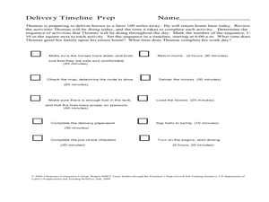
Delivery Timeline
Students study the transportation and delivery service and complete a timeline activity. In this delivery and transportation lesson, students identify activities that need to be completed to make deliveries. Students arrange activities...
Curated OER
Math and Native Americans
Students explore how math is relevant to Native Americans. Students investigate Indian culture through geometry. They describe and create geometric polygons and patterns. Students problem solve with tangram patterns to make Indian...
Curated OER
The Mathematics of Space and Place
Students investigate the measurements and geometry of the school grounds. They conduct inquiry while measuring the campus and some of the city blocks. Then students draw a map to scale and categorize property types using a pie graph.
Curated OER
Math: Checking Scale Drawings for Accuracy
Students critique their own drawings for accuracy and make constructive suggestions prior to reworking them. They discover how scale in maps and drawing relate to relative size and distance. In addition, students comprehend the...
Curated OER
Geometry: Classifying Angles
Students measure, construct, and classify angles as acute, right, straight, and obtuse. Once they have completed an angle worksheet, students use a map of South Carolina to locate cities by constructing the aforementioned angles.


