Curated OER
FUN WITH MAPS
Fifth graders learn map skills by showing the routes they travel from home to school and using that data to practice map reading and interpreting geographical information.
Curated OER
Mapping Los Angeles over Time
High schoolers read maps for chronological information in Los Angeles. They develop a multicultural chronology of Los Angeles.
Curated OER
Learning Lesson: Analyzing a Weather Map
Students use weather maps to locate warm and cold fronts. They discover the different types of weather associated with these fronts. They also observe the weather in their local area.
Curated OER
Map Skills: Explorers, Continents, and Oceans
Third graders use a software program to make and label a map of the world. On the map, they locate the seven continents, oceans and the countries of Europe. They also draw the routes of Christopher Columbus, Juan Ponce de Leon and...
Curated OER
Story Map Situations
Third graders explore a variety of ways to represent text. They represent text in story maps while on the playground. Students depict the elements of a story on a story map. They create a poster for character, setting, problem, and the...
Curated OER
Using Maps in the LCTL Classroom
Students review terms and prepositions of location and view a map to illustrate the meanings of the prepositions students are unfamiliar with. They play "Where am I?" game utilizing correct prepositions then they work with a partner to...
Curated OER
Archaeology- State Map
Students study state maps. In this map skills lesson, students identify the states' location and how to use a legend. Students complete photocopies of the state map.
Curated OER
Lesson Design Archaeology- USGS Maps
Learners research USGS maps and identify the major features. In this map skills lesson, students identify low and high elevations on a USGS map and practice finding latitude and longitude.
Curated OER
United States Map- State Capitals
Students explore the state capitals. In this geography lesson plan, students use a political map to identify the state capitals and place post-it notes on various capitals.
Curated OER
Kid Maps: Reading and Creating Maps with Human Characteristics
Young scholars look at maps. In this map lesson, students listen to the book My Map Book by Sara Fanelli and they see the difference between human characteristics (buildings, etc.) and natural characteristics (rivers, etc.)....
Curated OER
Tooling Around Arizona: Reading Arizona Maps
Students research Arizona maps. In this map activity, students discuss map titles, scales, directions, elevation, and symbols. The class will examine topography, landforms, and rivers found on an Arizona map.
Curated OER
Orienteering: Map Skills
Young scholars discover orienteering. In this orienteering instructional activity, students search for six specific landmarks. Young scholars brainstorm how maps and landmarks are helpful.
Curated OER
What Is A Map?
Students become familiar with a map and what it is used for and become familiar with school and home surroundings. With the familiarity of their surroundings they discover that maps can be created to help them with directions and how to...
Curated OER
The Global Grapefruit - Maps vs Globes
Students tell how maps differ from globes, state some characteristics of 3 different types of map projections, and realize that distortions are inherent in various systems of map projections.
Curated OER
Hide and Seek with Bones: A Mapping and Scaling Comparison
Students examine and simulate how paleontologists map objects. They hide and find objects using a grid to map the objects' placements.
Curated OER
Map Projections: The Grapefruit Activity
Students partcipate in activities in which they examine different map projections. They discover the positives and negatives of each type. They use grapefruits to help them with the different types of map projections.
Curated OER
Map Grids
Students study map grids and explore how they can be used to locate positions of objects or features on a map. They read a story and then participate in a grid activity using a large map of the setting of the story.
Curated OER
How to Interpret a Map
In this social studies learning exercise, students find all the important facts on a map. Students find any map and fill out the chart and answer 12 questions about what they find.
Curated OER
Map Skills
In this history worksheet, students use a map and legend to answer nine comprehension questions. Students check their answers when done.
Curated OER
United States Map - Lesson 2 Introduction to Symbols
Young scholars explore the United States using a map. In this map lesson, students discover how to use map symbols in order to read maps.
Curated OER
Geographical Skills-- Map Scale
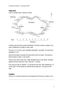
In this maps instructional activity, students study a simple map and the scale in kilometres. Students read the directions and answer one question. Students then look at a sketch map of a town and answer 2 questions. Students also read...
Curated OER
Story Maps and Boxes
Students use a story map template to review the parts of a story and information about a book that they have read. The elements of the story are identified and placed into story boxes and shared with classmates.
Curated OER
Learning to Read a Regional Map
Students locate the local community, surrounding communities and major geographic features of the SE Utah and the Four-Corners region on a map, after receiving direct instruction.
Curated OER
STORY MAPPING: THE HUNDRED DRESSES
Students illustrate and paraphrase each chapter of The Hundred Dresses, creating a graphic organizer through the use of story mapping. After students have completed their story maps, ask for a few volunteers to present theirs to the class.
Other popular searches
- Map Skills
- Map Skills Lesson Plans
- United States Maps
- Map Scale
- Weather Maps
- Topographic Maps
- Story Maps
- Map Skills Worksheets
- Map Reading
- Maps and Charts
- Types of Maps
- Maps and Globes


