Curated OER
Holocaust Map Studies
Middle schoolers analyze maps and answer discussion questions related to WWI. In this geography lesson, students analyze historic maps to determine causes and effects of WWI in Europe. Middle schoolers read testimonies of Holocaust...
Curated OER
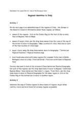
Regional identities in Italy
In this Italy map activity worksheet, students complete 2 map activities that require them to identify major cities and landforms in the country.
Curated OER
Where Is Rome?
Third graders discover Ancient Rome through maps and worksheets. In this world history lesson, 3rd graders locate Rome on a world map and identify the scope of the Roman Empire. Students label an entire map of Italy after printing one...
Curated OER
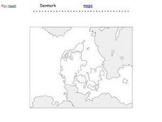
Denmark Outline Map
In this blank outline map activity, students explore the political boundaries of Denmark located in Europe. This map may be used in a variety of classroom activities.
Curated OER
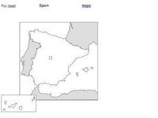
Spain Outline Map
For this blank outline map worksheet, students explore the political boundaries of Spain located in Europe. This map may be used in a variety of classroom activities.
Curriculum Corner
Earth Day Book
This Earth Day, celebrate our beautiful planet with an activity book that challenges scholars to show off their map skills, complete a crossword puzzle, write acrostic poems, alphabetize, and reflect on their personal Earth-friendly habits.
Curated OER
The Interconnectedness of Ancient Peoples Map Study
Seventh graders begin this lesson by viewing various maps of the Ancient World. As a class, they take notes on the changes of different areas in Europe and Asia as their teacher lectures to them. They answer questions about the...
Curated OER
Lesson Plan #3 ~ Ocean Currents
Sixth graders experiment to understand the ocean's currents. In this ocean current lesson, 6th graders complete an experiment with two bottles of water and an index card to discover information about the ocean current. Students...
Bowland
You Reckon?
Sometimes simple is just better. A set of activities teaches young mathematicians about using plausible estimation to solve problems. They break problems down to simpler problems, use rounding and estimation strategies, and consider...
Student Handouts
Christopher Columbus Workbook
Youngsters gain ample reading comprehension practice while studying the history of Christopher Columbus with this great workbook! It includes word puzzles and comprehension checks of multiple assessment styles, including multiple choice,...
Curated OER
Europe Outline Map
In this outline map activity, students examine the political boundaries of the continent of Europe. The map may be used in variety of activities that individual teachers create to accompany it.
Curated OER
The Legacy of the "Great War"
Students study how the map of Europe changed as a result of the Treaty of Versailles at the end of World War I. They examine the results of the end of the Cold War.
Curated OER
The Road Map & the Middle East
Will walls help? Read to learn how Prime Minister Ariel Sharon proposes to build walls around Isreal in hopes of isolation from Palestine. Complete an online Webquest, analyze maps, listen to audio clips, answer discussion questions, and...
Curated OER
Liverpool Lights Up
Students explore the culture of Liverpool. In this World History lesson, students research a variety of events and activities in Liverpool, then they work in groups to prepare a class presentation to share their findings.
Space Awareness
Where on Earth Am I?
Almost every phone has GPS installed, but a large number of teens don't know how the technology works. An initial activity illustrates how GPS determines a location on Earth. Scholars then apply trilateration procedures to a...
Delegation of the European Union to the United States
Cultural Identity
How does cultural diversity impact political identity? That is the question researchers face as they continue their examination of the European Union and the programs it has developed in its attempt to achieve unity in diversity. To gain...
Echoes & Reflections
Rescuers and Non-Jewish Resistance
What does it mean to be a rescuer during the time of the Holocaust? Learners consider the role of those who resisted the Nazi invasions, including hiding Jewish people, throughout Europe. Activities include listening to the testimony of...
Curated OER
Radio Program #2: Ethnic Mix
Young scholars examine patterns of migration into the area. They complete various map activities and interviews. Students partake in family histories as well. On a map of Europe, identify the countries of immigrant origin mentioned in...
Curated OER
Mapping Population Changes In The United States
Students create a choropleth map to illustrate the population growth rate of the United States. They explore how to construct a choropleth map, and discuss the impact of population changes for the future.
Curated OER
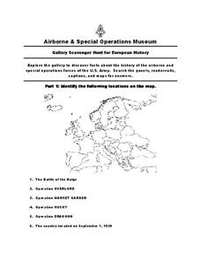
European History
In this world history instructional activity , 5th graders look for information related to the history of Europe. They view the facts from a map and apply them to different activities.
Curated OER
Exploring an Atlas
Students explore global geography by participating in an atlas activity. In this countries of the world lesson, students collaborate in small groups and analyze an atlas while researching continents, countries and demographics. Students...
Curated OER
World War I
Students justify how alliances lead to war. They compare the conflicts of war that arose because of imperialist interest. Students explain the cause of World War I. They compare and contrast European maps before and after World War I....
World Maps Online
Introduction to the World Map
Students identify the differences between maps and globes. In this map skills instructional activity, students are shown a globe and a map and recognize the differences. Students use post-it notes to locate several locations on the world...
Curated OER
European Elevation Sort
Given a prepared database of European countries, sixth graders sort the countries in ascending order by elevation and identify the five countries with the highest elevations. This cross-curricular lesson combines elements of computer...


