Curated OER
Exploring an Atlas
Learners explore global geography by participating in an atlas activity. In this countries of the world lesson, students collaborate in small groups and analyze an atlas while researching continents, countries and demographics. Learners...
Curated OER
Play Doh Map of Your State
Students create a state map using Playdoh. In this hands-on state geography lesson, students work in groups to form a three-dimensional map of their state using Playdoh made at home following a (given) recipe. Students use four colors...
Houghton Mifflin Harcourt
Journeys: Challenge Activities (Theme 1)
This nine-page packet, the first in the series of support materials for the Houghton Mifflin Harcourt thematic units on journeys, contains enrichment activities for learners who have mastered the basic concepts of the lessons. Kids...
Curated OER
Mapping the News
Students explore cartography. For this map skills and map making lesson, Students work in groups to create wall size world maps including legends, compass roses, latitude and longitude, and physical features. Students collect current...
Curated OER
"Me" Resource
Learners elucidate themselves by writing up to six entries in different formats. Some formatting choices include a dictionary, encyclopedia, or atlas entry, a magazine article, a newspaper article, and a table of contents. Some...
Curated OER
Where Is Rome?
Third graders discover Ancient Rome through maps and worksheets. In this world history lesson, 3rd graders locate Rome on a world map and identify the scope of the Roman Empire. Students label an entire map of Italy after printing one...
Curated OER
Bright Ideas #6
Students complete activities as extra time, learning stations, or homework activities. In this extra time lesson plan, students may complete the activities for visual arts, language skills, and social sciences. Students participate in...
Curated OER
Location, Location, Location!
Twelfth graders locate cities, states and countries on maps. They use the cardinal directions to locate places on maps. They describe where they were born by giving clues without naming the exact state. They trade papers and try to guess...
Ball State University
Dear Pen Pal
Keep your class in conversation with others across the country or across the sea by writing letters to pen pals. The activity calls for students to be pan pals with pupils in Africa; however, the listed steps could be used for any...
Curated OER
Map a World of Facts
Students mark ten places on a world map while they follow fun facts on the included printable sheet. They research using a variety of resources to determine the location of the ten places.
Curated OER
Knowing Where You Are
Students work together to research the names of places in their state. They divide up their state so that each group can research a different section and complete a chart of the different names. They create a key for the map to explain...
Curated OER
The Great Migration
Students research the Great Migration and answer questions to discover where it took place, when it took place, who were migrating, and why in a 2 page paper. They use a map or atlas to plot out the routes and destinations of those...
Curated OER
The Marvelous World of OZ
Students investigate the major themes in fantasy maps, expand basic map reading skills, write imaginative narrative essays based on the OZ map, and create their own fantasy map detail based on a core map.
Curated OER
Capitalization and Washington, D.C.
Second graders learn and practice capitalizing names of cities, states, countries, streets, buildings, bridges, and geographical places around the theme of Washington, D.C. through activities at learning centers in the classroom.
Curated OER
Cite Your Sites
What information would you find in an almanac that you would not find in an atlas? What is the difference between a dictionary and a thesaurus? Using a Cite Your Sites worksheet on which they record their observations, groups participate...
Curated OER
Worksheet 5/7 A Colony of Collective Nouns
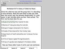
Practice identifying and using collective nouns with this resource. For this activity, pupils circle the collective noun and the group that it describes in each sentence. They then use the collective nouns to write their own sentences....
Curated OER
Worksheet 3/7 A Gaggle of Collective Nouns
Encourage your class to identify the correct usage of collective nouns in sentences with this activity. Given three choices, with the collective nouns circled in each possible choice, class members choose the sentence in which the...
Curated OER
Message in a Bottle
Sixth graders write a short story about being stranded on a deserted island. After a brief geography review of locations at various latitudes and longitudes, 6th graders draft their story about being stranded. They use sensory and...
Curated OER
Where in the World...?
Students use longitude and latitude to locate various cities, regions, landforms, and bodies of water around the globe. They use The New York Times Learning Network's crossword puzzle 'Longitude and Latitude' to sharpen their atlas skills.
Curated OER
Colonial Regions of America 1689 - 1754 Worksheet
In this Colonial America worksheet, students color and label a map of the 13 colonies. They complete three more maps on which they label the major cities and waterways in New England, the Middle, and the Southern colonies. They answer an...
Curated OER
My Own Private Idaho; Using Social Studies to Explore Idaho
Students engage in several activities to explore Idaho and Social Studies themes. Using an variety of media, students become familiar with Idaho's geography and geology.
Curated OER
Mending the Rift
Students determine what factors identify a country's political borders. After reading an article, they investigate questions surrounding the Great Rift Valley. On a map, they trace the valley from Asia through Africa and research the...
Defining US
Integration of Education and American Society
How did the struggle for Civil Rights during the 1950s transform American society and politics? Why are American schools integrated today? Class members explore these essential questions by examining a series of primary and secondary...
Curated OER
Exploring the Sky: Reading Maria's Comet
Discover the science behind astronomy. After reading the book Maria's Comet, which is about a young woman who breaks new ground by becoming a female astronomer, young learners practice reading comprehension with worksheet questions about...


