Curated OER
Fostering Geospatial Thinking: Space to Earth: Earth to Space (SEES)
Students locate and access data to help them with their science inquiry. In this geographical positioning lesson students evaluate and compare data sets.
Curated OER
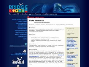
Plate Tectonics
Students complete a data sheet. In this Earth composition lesson, students learn what happens when the Earth's plates push against each other. They watch a teacher demonstration and complete a data sheet.
Science Matters
Finding the Epicenter
The epicenter is the point on the ground above the initial point of rupture. The 10th lesson in a series of 20 encourages scholars to learn to triangulate the epicenter of an earthquake based on the arrival times of p waves and s waves....
Curated OER
Mapping and Excavating a Jello Mold
Fifth graders, in groups, map the three layers of different colored jello layers in molds and note the placement of fruit in them. On the grid paper they draw each grape, raisin, or other object and carefully remove each layer. After...
Curated OER
Analyzing Hurricanes Using Web and Desktop GIS
Students analyze hurricanes. In hurricanes activity, students use the Internet and GIS to analyze hurricanes. Students view the National Atlas of Maps to discuss the direction hurricanes move. Students study the wind and pressure fields...
Curated OER
Roman Archy
Third graders use Google Earth to examine Roman architecture. In this ancient Rome lesson plan, 3rd graders visit the noted URLs to look at examples of Roman architecture. Students work in teams to examine data about the structures.
Curated OER
Stratigraphy -- Layers of Time in the Earth
Learners are introduced to the process of stratification. Using the internet, they read about the Richard Beene archeological site near San Antonio. Using a map, they color code the different layers present at this site and answer...
Curated OER
Fossil Fuels (III), The Geology of Coal: Interpreting Geologic History
Students hypothesize about why various samples of coal have different characteristics. Pupils use information that they found during Internet searches to ascertain the validity of their hypotheses and verify the "story" of coal. ...
Curated OER
The Breathtaking Nature of the Urban Explosion, Part 2
Learners explore ozone levels. They measure the concentrations of ground-level ozone in the atmosphere. Students observe changes in the concentrations of ozone over time. Learners complete a data sheet to record ozone readings over a...
Curated OER
Linkages Between Surface Temperature And Tropospheric Ozone
High schoolers organize and analyze data regarding changes in tropospheric ozone and then hypothesize about the consequences of these changes.
Curated OER
Liquid Layers
In this density worksheet, young scholars investigate what will happen when various liquids with different densities are put into the same container. They hypothesis and make observations. Students answer 4 questions about their...
Curated OER
Rocks in our Backyard
Students examine igneous and sedimentary rocks. They observe and identify geological formations in their community, analyze igneous and sedimentary geological layers using a geological map, and use GPS to locate geological formations.
Curated OER
Plate Tectonics: Recycling the Seafloor
Students classify earth's layers and plates using Ocean Seismicity data. For this plate tectonics lesson, students outline where the plate boundaries are on the world map. They then compare these predicted boundaries with USGS map of the...
Curated OER
Creating and Analyzing Graphs of Tropospheric Ozone
Students create and analyze graphs using archived atmospheric data to compare the ozone levels of selected regions around the world.
Curated OER
Plotting the Petroleum Plume
Eighth graders examine the difference between confining layers and aquifers in a basic water table aquifer scenario. They contour groundwater elevation and petroleum product thickness data.
Curated OER
Sea Surface Temperature Trends of the Gulf Stream
Learners use authentic satellite data to produce plots and graphs of sea surface temperature as they explore the seasonal changes of the Gulf Stream.
Curated OER
Sea Surface Temperature Trends of the Gulf Stream
Students explore the importance of the Gulf Stream. Using a NASA satellite images, they examine the sea surface temperature. Students collect the temperature at various locations and times. Using spreadsheet technology, they graph the...
Curated OER
What Does Your "Homunculus" Look Like?
Students determine the density of touch receptors in various parts of the body on the right hand side. They use collected data to draw a picture of the
"homunculus" of an experimental subject.
Curated OER
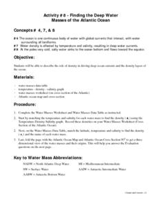
Finding the Deep Water Masses of the Atlantic Ocean
Students describe the role of density in driving deep ocean currents and the density layers of the ocean. They determine that the ocean is one continuous body of water with global currents that interact, with water surrounding all...
Curated OER
Aquifers and Groundwater
Students understand the purpose of an aquifer. In this aquifer and groundwater lesson, students build a model aquifer find its relationship to water usage. Students record observations as they build the layers of the aquifer.
Curated OER
What Does Your "Homunculus" Look Like?
Students investigate the density of touch receptors in various parts of the body. They discover how the body senses various stimuli, then maps a picture of the "homunculus" of the experimental subject.
Curated OER
Ozone: The Earth's Security Blanket
Students work in groups to define and research the terms: ozone, troposphere and stratosphere. Students watch videos, conduct Internet research, participate in discussion groups and complete worksheets.
Curated OER
Coal: More Than Meets the Eye!
Students participate in a hands-on simulation to help them explain that coal resources are deposited unevenly between the earth's surface and under the ground.
Curated OER
Rain Shadows and Sea Breezes
Students plot the average rainfall for a variety of cities in the United States. Using the map, they work together to determine patterns on which toxicants are transported through the air. They determine the impacts of various weather...


