Curated OER
Mapping Worksheet #1
Get out the compass and a pencil its time to use a coordinate grid to practice mapping skills. Young cartographers use the prompts and provided grid to plot locations, draw parallel lines, and determine distances between points.
Owl Teacher
Introduction to World of Geography Test
Assess your learners on the five themes of geography and the most important key terms and concepts from an introductory geography unit. Here you'll find an assessment with 15 fill-in-the-blank and 14 multiple-choice questions, sections...
Institute for Geophysics
Understanding Maps of Earth
Here is your go-to student resource on primary geography concepts, including facts about the surface of the earth and its hemispheres, latitude and longitude, globes, types of maps, and identifying continents and oceans.
Curated OER
South America Map
In this South America political map worksheet, students examine the country boundaries. The map also labels each of the countries and their capitals.
Curated OER
South America Map
In this South American political map learning exercise, students examine both national boundaries and national capitals.
Curated OER
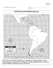
Global History & Geography: Latin America
The instructions say to use a text-book to label 11 different regions in modern Latin America. If a text-book is not available a map can be found on-line and printed for student reference.
Curated OER
Americas: Political Map
In this North America and South America outline map worksheet, students examine the political boundaries of the 2 continents.
Curated OER
Viewpoints
In this latitude and longitude worksheet, students complete 10 matching questions identifying key features or locations on a map. Students also use lines of latitude and longitude to identify the time in 4 different places.
Curated OER
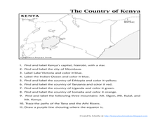
The Country of Kenya
For this map completion worksheet, students observe a map and map scale of Kenya to find and label bodies of water, cities, countries, and the equator. Students answer 11 questions.
Curated OER
5th grade social studies geography
In this geography worksheet, 5th graders complete multiple choice questions about hemispheres, maps, cities, ecology, and more. Students complete 25 questions.
Concord Consortium
The Six Faces of Amzora
Here's a task that is out of this world! Given a description of a fictional cube-shaped planet, scholars answer a set of questions about the planet. They create a two-dimensional map and consider the distances between locations on the map.
It's About Time
Where are the Volcanoes?
Middle school geologists map the volcanoes closest to themselves, learn about map distortion, and infer possible future volcano locations. A focus on latitude, longitude, and volcanoes beneath the ocean helps connect the lesson.
Curated OER
Americas: Physical Map
In this Americas physical map activity, students make note of the major landforms and bodies of water located on the North American and South American continents.
Curated OER
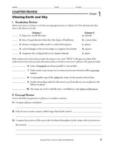
Viewing Earth and Sky
In this earth and sky worksheet, students review terms associated with map reading. Students also review topographic maps and how contour lines represent elevation. This worksheet has 5 matching, 5 true or false, 5 fill in the blank, and...
Curated OER
Latitude and Longitude- Online Interactive
In this maps worksheet, students learn about longitude and latitude by reading a two paragraph text and studying two maps. Students answer 9 fill in the blank questions. This is an online interactive worksheet.
Curated OER
Latitude Longitude Skills
In this latitude and longitude worksheet, students determine the number of degrees between the equator and specific latitude points. Students to the same for the longitude points from the Prime Meridian. This worksheet has 3 problems to...
National Center for Case Study Teaching in Science
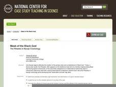
Mask of the Black God
Finally, an astronomy lesson for the high schooler! Explorers are able to read star maps for finding objects in the night sky by determining celestial coordinates. In particular, they locate the Pleiades and read about a Navajo legend...
Curated OER
Student Exploration: Summer and Winter
In this recognizing the seasons online/interactive worksheet, students explore the Earth's positions and determine the summer and winter season. Students answer 21 short answer questions
Geophysical Institute
Latitude and Longitude with Google Earth
Travel the world from the comfort of your classroom with a lesson that features Google Earth. High schoolers follow a series of steps to locate places all over the earth with sets of coordinates. Additionally, they measure the distance...
Curated OER
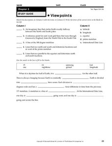
Viewpoints
In this map learning exercise, students review latitude, longitude, equator, and prime meridian. This learning exercise has 5 matching and 8 fill in the blank questions.
Curated OER
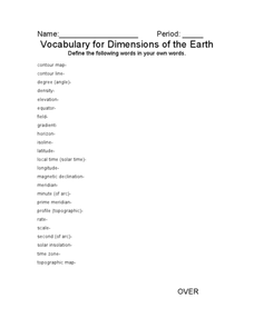
Vocabulary for Dimensions of the Earth
In this Earth dimensions learning exercise, students define 24 terms associated with contour maps, latitude, longitude, and time zones.
Curated OER
Give Me Some Latitude
In this latitude activity, students use an atlas or other reference to respond to 4 multiple choice questions about the equator and the poles.
Curated OER
Sub-Saharan Africa: Physical Geography
In this geography skills worksheet, learners respond to 22 short answer and map skills questions about the location and geographic features of sub-Saharan Africa.
Curated OER
Longitude
In this globe worksheet, students learn how longitude is measured on a globe. Students read the information before answering 5 questions. A globe will be required.


