Curated OER
Latitude
Your young geologists generate a graph given a table of values from the context of latitude and percent of the earth's surface north of that latitude. The questions in the activity then focus the learners to a deeper understanding of the...
Curated OER
Geographics in Arkansas
Third graders discuss where Arkansas is located on the United States map. They use geographic tools to participate in activities.
Curated OER
Dough Lake Topology
High schoolers practice coordinates and measurements, develop 2D, 3D topological map, construct grid with string on real surface, establish "level" fixed point for measurements, take and record data points of elevation, and enter data on...
Curated OER
Effigy Mound Activity
Learners research effigy mounds of Native people in Wisconsin. They create large models of effigy mounds in a given area based on factual information from their studies and research.
Curated OER
Geography Grid
Fourth graders search a database to find images and scan and affix them on an 8-foot long map of the state of Illinois. They then use it as a basis for discussion.
Curated OER
Gridding a 2 x 2 Meter Unit
Students use the internet to examine what happens at an archeological dig site. In groups, they practice measuring a 2x2 meter square unit and gridding it out as an archeologist would do. They review the possible solutions at the end of...
Curated OER
Exploration Activities
Students examine the stages in finding, removing, and processing mineral resources. They participate in the "Exploration Hunt" and "Leasing Mineral Rights" activities to better get a handle on their studying.
Curated OER
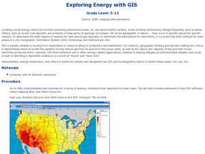
Exploring Energy with GIS
Students examine GIS technology as it is used to locate energy sources. In this GIS lesson, student access an assigned website to locate a series of lessons using the GIS software. They use the maps that are located on the primary lesson...
Mathematics Assessment Project
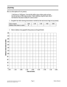
Journey
Drive home math concepts with an engaging task. Learners follow a verbal description to fill in a table and create a distance-time graph representing a car journey. They then answer questions by interpreting the graph.
Curated OER
Plotting A Hurricane Using latitude and Longitude
Students explore map and plotting skills by tracing the movement s of hurricanes through the Earth's systems. a hurricane map is developed from daily media reports.
Curated OER
Treasure Hunt: Coordinate Graphing
Two of the best words any one can hear– treasure hunt! Your class will be excited to practice graphing on a coordinate grraph as they identify and write coordinates for landmarks they see on a treasure map. They trace their route to the...
Curated OER
Paleo-Dig
Pupils will comprehend the use of simple grids and the basic principles and skills used on a paleontological dig, such as the Illampi Mound Colony. They incorporate a systematic investigation. Students analyze a variety of different...
Curated OER
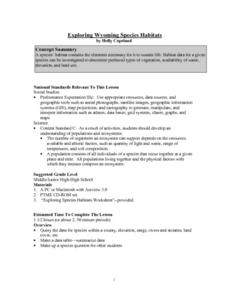
Exploring Wyoming Species Habitats
Students are introduced to the concept of species habitats and ranges. They introduced to ArcView GIS as a tool for mapping. Pupils use query data for species withina county, elevation, range, rivers and streams, land cover, and etc....
Curated OER
Dream House
Learners solve real world problems involving area and perimeter in this unit culminating activity.
Curated OER
Earth on the Earth
Fourth graders plot points on a graph and transfer those coordinates onto a large scale model resulting in an outline of the Western Hemisphere. They identify the major geographical landforms of the Western Hemisphere.
Curated OER
Blackout!
Learners read news reports and first-person accounts of a blackout in a large city and keep weblogs or journals. They take on different roles of people who live in the city or commute there to work and then use their journal accounts to...
Curated OER
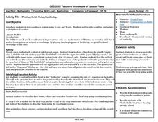
Plotting Grids Using Battleship
Learners coordinate grid points on X and Y axises to plot a physical location. The game of "Battleship is used to present first hand knowledge of this skill.
Curated OER
Sonar Mapping
Students use a shoe box to create a seafloor model and use cardboard for layering inside of the shoe box to simulate the ocean floor. They probe the ocean floor to simulate sonar echoes. Finally, students graph their data to get a...
Curated OER
Pacific Atolls and Island Groups
Learners construct, interpret and translate maps and geographic data. Given a worksheet, students identify an island, an atoll, a scale, and a compass rose. Learners grid systems, legends, and symbols. They use the map to find answers to...
Curated OER
Tracking the Storm
Students discuss the different types of storms that can hit land. They locate specific coordinates on a plane grid. They discuss lonsgitude and latitude to plot the coordinates of a tropical storm. They practice finding coordinates...
Curated OER
Measurement and the Illampi Mound Colony
Students comprehend the basic units of measurement, scale, plotting, and basic grids. Students practice their estimation
and measuring skills and will demonstrate their ability to work well in groups.
Curated OER
Exercise 23--the Regular Pentagon on a Given Side
Students examine and study how to recognize the characteristics of a regular pentagon and demonstrate how to construct one. They become aware of associating a regular pentagon to its term of a double map and practice the concept of line...
Curated OER
Lesson: Journey of a Tree
Third graders explore the operation of a Christmas farm and how trees are shipped. After taking a tour of a Christmas tree farm and researching transportation, location and cost issues, 3rd graders create a map to show the distribution...
Curated OER
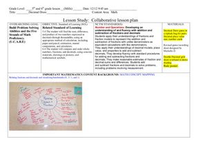
Decimals: Collaborative Lesson
Pupils explore mathematics by participating in a group activity. In this number value lesson, students identify the uses for decimals and how to best estimate whole numbers based on decimals and fractions. Pupils collaborate with...


