Curated OER
Texas Regions and Native Americans of Texas
Fourth graders research to find the regions of Texas. In this technology lesson, 4th graders create a Kid Pix project showing the location of various regions of Texas. Students show where in those regions Native American...
Curated OER
Cherishing the Water of Life
Learners work in small groups to brainstorm a list of all creatures, plants, natural, and artificial processes that use or depend on fresh water. The class views an aquarium filled with water representing all the water in the world. The...
Curated OER
Graphing Ordered Pairs
In this math worksheet, students learn to graph ordered pairs. Students examine a graph with 3 labeled points and tell the ordered pairs for each. Students also plot 8 ordered pairs on a graph they draw themselves.
Curated OER
"Now and Then" Comparing Present Day with Medieval Times
Eighth graders compare a present-day social issue with a medieval issue. They use technology tools to conduct their research and demonstrate their new knowledge. Students present their findings to the class in the form of a PowerPoint.
Curated OER
The Plains Indians
Students have a better understanding of another culture other than their own. This help them to see that there were other people living in this region before us.
Curated OER
Glacial Landscapes
Students examine the impact of glaciers on Great Britain. For this geological history lesson, students examine and measure a glacial valley and look at several types of glacial landscapes in Britain.
Curated OER
Real Life Challenge
Ninth graders read and examine narratives, review chronologies, consider ideas, and analyze trends in order to understand the past and present. In this American History lesson, 9th graders examine cause and effect, review...
Curated OER
Ancient China: Student Created Word Search Puzzles
Sixth graders classify and organize information about ancient China. In this Chinese history lesson, 6th graders create word search puzzles and record the processes they used to create them.
Curated OER
Translating Transformations in Geometry
Students create an image using given coordinates and evaluate how the coordinates change when a slide or rotation takes place.
Curated OER
The Plant Restoration Project
Students discuss Restoration Ecology. They see that restoration can mean removing invasive, non-native plants and replacing them with native plants grown by Students.
Curated OER
Perimeter and Area
Sixth graders explore the relationship between area and perimeter of rectangles. In this area and perimeter lesson, 6th graders measure and determine perimeter and area of various rectangles. Students create rectangles with given areas...
Curated OER
Fourths of Sets
Students create a set of cards that represent factors of four and use these cards to play a game in which they practice separating numbers into fourths. They first practice separating numbers into fourths with a projected computer...
Curated OER
Properties of Lines - Parallel and Perpendicular
Sixth graders identify parallel and perpendicular lines in the alphabet. In this line properties lesson, 6th graders use the letters of the alphabet to show parallel and perpendicular lines. Students open a Geogrid Mat on the computer...
Curated OER
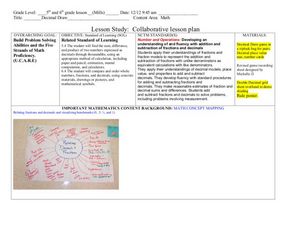
Decimals: Collaborative Lesson
Pupils explore mathematics by participating in a group activity. In this number value lesson, students identify the uses for decimals and how to best estimate whole numbers based on decimals and fractions. Pupils collaborate with...
Geographypods
Geographypods: Map Skills
A collection of highly engaging learning modules on various topics within mapping skills. Covers map symbols, how to use four- and six-figure grid references, cardinal directions, distance, contour mapping, and drawing cross-sections....
BBC
Bbc: Landscapes: Map Skills: Grid References
Young map readers will learn the idea of referring to the grid numbers to help find locations or to describe locations on a map.
BBC
Bbc: Bitesize Geography: Os Map Skills
A short tutorial on mapping tools and how to read maps. Covers features of maps, symbols, the compass, scale, distance, how height is represented, and grid references. Includes multiple-choice quiz at the end.
City University of New York
Earth and Environmental Sciences: Treasure Hunt
Looking for enrichment? Here's an online treasure hunt requiring skill with directions, distance, contour maps, latitude, and longitude. Also supplementing the activity are interactive quizzes on latitude, longitude, and other related...
University of Cambridge
University of Cambridge: Nrich: Treasure Island
See if you can find what the ordered pairs are for each of the items on the map. This one page website will help you practice plotting points on the grid. You can check the answers right on the website.
