Curated OER
Majority Rules
Students color code a map of the United States and label the amount of Electoral votes each state has. In this Electoral College lesson plan, students conduct a vote of their own.
Curated OER
Africa - Not Just One Big Safari
Students draw a picture of an African city that is similar to a U.S. city and discover how other parts of the world have the same types of buildings. In this global similarities lesson, students create a map of an ...
Curated OER
Wild Animals in the World
In this wild animals worksheet, students answer multiple choice map questions, choose the correct animal names for the pictures, and more. Students complete 4 activities.
Curated OER
Hurricane Tracking
Students access the Internet to find information on current hurricanes. They get locations, speeds, and air pressures and then plot the location of the hurricane on a hurricane-tracking map. They also access the FEMA website to solve...
Curated OER
Where Does Our Food Come From?
Fourth graders identify the state or country that a food product came from and locate it on a map. They identify products that are grown in Hawaii and the factors important in the location of economic activities.
Curated OER
Climatic Zones
Third graders recognize and locate Frigid, Temperate, and Torrid climatic zones on the word map or globe. They explain that plants, animals, and human societies display adaptations to the climates they live in .
Curated OER
Move Around the Map
Fourth graders, while working with a partner, label and identify on a tarp map six major cities and five major rivers in Indiana. They traverse along the rivers utilizing a different locomotor skill (hop, skip, walk, run, leap, gallop,...
Curated OER
Lesson #3: Internet Map Activity
Young scholars label assembly centers and relocation camps on a given map of the United States in order to create a better understanding of the relocation experience of Japanese-American citizens and the distance that families had to...
Curated OER
Mapping La Salle's Travels
Students use the internet to create a map showing the path of La Salle through North America and the Caribbean. They identify the main geographic features of the two areas and the main French forts. They also complete a timeline.
Curated OER
Exploring BC Through Mapping
For this mapping worksheet, students use an atlas or map to locate and label the rivers, mountains, lakes, and cities in British Columbia.
Curated OER
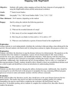
Mapping With MapPoint
The class is engaged through a discussion of mapping. They determine what they believe makes a good map and what the essential elements of a map are. Students work independently to complete a worksheet on mapping. They follow clear...
Curated OER
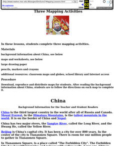
China: Dim Sum: 3 Mapping Lessons
Fourth graders, after studying maps, draw a very large outline map of Asia and then a large map of China on it in the appropriate place. They label the appropriate information.
Curated OER
Mapping Your Local Community
First graders take a walking tour of their community to discover the names of numbered locations on a premade map. They then, create their own map of the community on the computer using Kidspiration software.
Curated OER
GIS: Mapping Watersheds of the Edwards Aquifer in Travis County
High schoolers manipulate existing GIS data to create and map a new layer of information that shows that watersheds in Travis County that are on top of Edwards Aquifer. They create and map that shows the watersheds in Travis County that...
Curated OER
Landscape Picture Map: Natural Features
Students discover six landscapes. In this natural features instructional activity, students review the meaning and examples of natural features. Students use a landscape picture map to identify six natural features.
Curated OER
Rabbit Hill Garden Map Checklist
In this garden planning learning exercise, students draw a garden plot and label it in a legend. Students complete the checklist of necessary items for their garden map.
Curated OER
Global Lesson: Social Studies On-Line Global Lesson: Social Studies On-Line Continents
In this geography PowerPoint a simple world map on which each continent is represented by a solid green landform is the background for each of the nine slides. The continent names appear in a list on the first slide, followed by one...
Curated OER
Mapping of the Earth's Past
Young scholars create a scale model time linen of the Earth's 4.6 billion year history. They calculate a scale that can fit on a very long register tape then label each geologic era. They use text books to annotate each era with major...
Curated OER
Ancient Egypt: The Pyramids
In this labeling pyramids in ancient Egypt on a map worksheet, students observe a portion of ancient Egypt with dots designating important locations and label them. Students write 14 short answers.
Curated OER
Europe 1914
In this Europe 1914 map worksheet, students note the 9 regions of the Europe labeled on the map and their relevance to World War II.
Curated OER
British Isles
In this map worksheet of Britain, students study a detailed outline map of the British Isles. No labels are provided and there are no directions.
Curated OER
Australia
In this map of Australia worksheet, students research and study a map of Australia. Students label Australia's regions, major states and important landmarks.
Curated OER
Asia
In this map of Asia worksheet, students view and label on a map of Asia its regions, major cities, landmarks, compass rose and a legend.
Curated OER
What in the World?
Eighth graders plot points of longitude and latitude on a world map. In groups, they create a model of the earth's interior and label the parts,
Other popular searches
- Labeling a Map
- Africa Map Labeling
- Midwest Map Labeling
- Geography Map Labeling
- Labeling a Map Continents
- Labeling Map Parts
- Labeling Parts of Map
