Curated OER
Ohio Map
In this Ohio learning exercise, 4th graders explore the state of Ohio. Students look at the map of Ohio and fill in the state capital, major cities, and any other important landmark or site on the map.
Curated OER
South Dakota Map
In this South Dakota map learning exercise, students fill in the state capital, major cities and other state attractions in an outline map of South Dakota.
Curated OER
Utah Map
In this Utah worksheet, students analyze an outline map of the state of Utah. The capital city is marked. Students add other important cities, bodies of water or other important features. Students color the map.
Curated OER
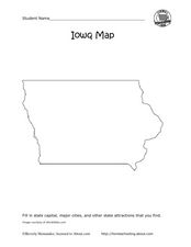
Iowa map
In this Iowa worksheet, students fill in cities and attractions in a map of Iowa. Students fill in as many cities and attractions they can find.
Curated OER
North Carolina Map
In this state maps worksheet, students identify the state map of North Carolina. Students fill in the state capital, the major cities, and other state attractions.
Curated OER
Maryland Map
In this Maryland worksheet, learners analyze an outline map of the state of Maryland. Students fill in the state capital, major cities and other state attractions.
Curated OER
Michigan Map
In this state maps activity, learners identify the map of Michigan. Students then fill in the capital city, major cities, and other state attractions.
Curated OER
Maine Map
In this state maps worksheet, students identify the map of Maine. Students fill in the capital city, major cities, and other state attractions.
Curated OER
Montana Map
In this state maps worksheet, students identify the state map of Montana. Students fill in the capital city, the major cities, and other state attractions.
Curated OER
Minnesota Map
In this Minnesota learning exercise, students fill in a map of Minnesota with its major cities and attractions. Students fill in as many cities and attractions as they can find.
Curated OER
Massachusetts Map
In this Massachusetts instructional activity, students fill in a map of Massachusetts with major cities and attractions. Students fill in as many cities and attractions as they can find.
Curated OER
Oregon Map
In this Oregon instructional activity, students fill in a map of Oregon with it's major cities and attractions. Students fill in as many cities and attractions as they can find.
Curated OER
Vermont Map
In this state maps worksheet, students identify the map of Vermont. Students fill in the state capital, the major cities, and other state attractions.
Curated OER
Science Concept Maps
A collection of concept maps has some terms filled in and others left blank for young scientists to fill in. This library can provide you with many pop quizzes for all of your middle to high school science curriculum.
Curated OER
Missouri Map
In this Missouri blank outline map worksheet, students examine the political boundaries of the state and then mark the state capital, other cities, and other state attractions on the map.
Curated OER
Eastern European Studies
One worksheet, three projects. Learners explore Eastern Europe and mark Eastern European countries on a map. They then collect and record census data on thirteen different countries, and write a 3-5 page expository essay on one of the...
Curated OER
Character Map
In this character analysis instructional activity, students explore two characters. Students fill in the graphic organizer, similar to a story map, for two characters and compare and contrast them.
Curated OER
South America Map
In this map of South America worksheet, students identify and label the countries in South America. Students improve their understanding of South America.
Library of Congress
Investigating the Building Blocks of Our Community’s Past, Present, and Future
As Ken Jennings said, "There's just something hypnotic about maps." Certainly, the longer you look at them the more you can learn. In this project-based learning lesson, individuals study both historic and present-day maps of...
Curated OER
Charting Neptune's Realm:
Learners explore how to construct and interpret maps and globes and find information about people, places, regions, and environments.
Curated OER
Mapping the Library
Learners compare their school library with another library such as: town library, for example, or a virtual library and identify the most important features. Students use their observations to create a map of the school library that can...
Curated OER
Nazi Concentration Camps -- Map and Chart-Reading Activities
Students use an informational chart about Nazi concentration and death camps to complete a mapping activity and a chart-reading activity.
Curated OER
Map It!
Fourth graders demonstrate map making skills by using the computer to create maps of the geographic features, regions, and economy for their state.
Curated OER
Mapping the Canyon
Students compare and contrast topographic maps and bathymetric maps. They investigate how bathymetric maps are made and how to interpret one.


