Curated OER
Using the Library for More than Research Papers
Use the repository of resources that modern libraries hold to your advantage during National Library Week.
Curated OER
Earth from Space Maps
Students use photo images from space to create a large map of the United States or the world, find where they live and label other places they know. They are exposed to a Web resource that allows them to view photo images of Earth taken...
Curated OER
West Virginia Map
For this map activities worksheet, students use an outline of the map of West Virginia to add the state capital, major cities, and other state attractions. Students complete 3 activities.
Curated OER
Map Coordinates: Monkey Map
Here's an engaging, meaningful, and clever lesson on map skills for elementary schoolers. Pupils combine story writing with mapping skills to create an original piece of work. They utilize a worksheet embedded in the plan to guide them...
Education World
Edible Resource Maps!
Young scholars discuss resource maps and examine examples from library resources. Working in groups, they create edible resource maps by drawing examples, such as popcorn on the border of Iowa and Nebraska. Then they use cookies in the...
Random House
Mapping Skills
Spark interest and enhance your pupils' map skills using Matteo Pericoli's book, See the City: the Journey of Manhattan Unfurled. Through Pericoli's illustrations and text, learners explore the East and West...
CK-12 Foundation
Topographic and Geologic Maps: Topographic Maps
Maps are great for helping you get where you're going, but what does that place actually look like? Geology scholars compare and contrast the features of topographical and geologic maps using an interactive lesson. The resource describes...
Curated OER
Customized Topographic Maps and Models
Students explore the information depicted on topographic maps. They construct a 3-D topographic map of a local area. They go on a field trip to the depicted area and compare the 'real world' with their models.
Curated OER
California Map
In this California blank outline map instructional activity, students examine the political boundaries of the state and then mark the state capital, other cities, and other state attractions on the map.
Curated OER
Wyoming Map
In this blank outline map worksheet, students fill in the state capital, major cities, landforms, and other places of interest on this map of Wyoming.
Curated OER
Tennessee Map
In this Tennessee outline map, students examine the political boundaries of the state. Students mark the state capital, major cities, and other state attractions.
Curated OER
Mapping the Past
Middle schoolers study historical maps to view how the world evolved from medieval times through the Renaissance. They work in groups to examine the maps and present a report on one of the listed maps.
Curated OER
Geo-Class Mapping My Neighborhood
Students create a map of the school and surrounding neighborhood. In this mapping lesson, students discover their school's location and learn about its past. Students use math skills and the steps in the design process to...
Curated OER
Texas Map
In this Texas activity, students explore the state of Texas. Students look at a blank map of Texas and add the state capital, major cities, and any other major attractions of the state of Texas on the blank map.
PBS
Concept Map
Make the thought process visible with a handy concept map organizer. As learners develop their main ideas in research, writing, or creative development, they can add details and like ideas to the worksheet as needed.
Curated OER
Finding Your Spot in The World; Geography, Maps, Multi-Culturalism
Students use a variety of maps to locate their home, their school and the origin of their ancestors.
Curated OER
Maps and the Pictures in Our Heads
Geographers of all ages examine different types of maps. They draw maps of their environment, utilizing both three-dimensional and picture maps. They interpret map information, noting how it can sometimes be misleading. Some good...
CK-12 Foundation
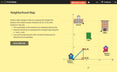
Pythagorean Theorem to Determine Distance: Neighborhood Map
Find the distance between various locations in a neighborhood. Scholars use the interactive to find distances between locations on a map. The map is overlaid onto a grid to provide coordinates for each location, and pupils apply...
Curated OER
Arkansas Map
In this Arkansas worksheet, students analyze an outline map of the state of Arkansas and label the capital city. Students label other important cities and important attractions and color the map.
Curated OER
Georgia Map
In this Georgia instructional activity, students fill in a Map of Georgia with cities and attractions. Students fill in the map with as many major cities and attractions they can find.
Curated OER
Idaho Map
In this outline state map of Idaho worksheet, students fill in the map with the state capital, major cities, and other state attractions or teacher created directions. Students draw at least 7 answers.
Curated OER
Illinois Map
In this Illinois worksheet, students fill in a map of Illinois with its cities and attractions. Students fill in the map with as many major cities and attractions as they can find.
Curated OER
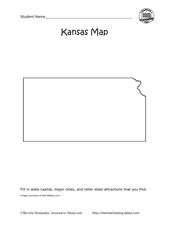
Kansas Map
In this Kansas worksheet, students fill in a map of Kansas with cities and attractions. Students fill in the map with as many major cities and attractions that they find.
Curated OER
North Dakota Map
In this North Dakota worksheet, students study an outline map of North Dakota with the capital city marked. Students color the map and add other important cities and landmarks.


