AGSSS
World Regions
Help your learners to visualize where historical events have taken place around the globe with a map that details the major regions of the seven continents.
Curated OER
Project Map: Latitude And Longitude Worksheet
In this latitude and longitude worksheet, students find the coordinates of 14 cities around the world and use this information to complete 14 short answer questions. This worksheet includes online atlas web links.
Curated OER
Floods
Students explore Earth science by answering study questions on-line. In this natural disasters lesson plan, students research Australia flood statistics over the past 40 years and identify patterns. Students utilize the web to view...
Curated OER
Continental Drift
Be sure to come prepared to discuss the theory of Pangaea and the two super-continents, Laurasia and Gondwanaland. Collaborative learners look for fossil evidence that supports the theory that one super-continent divided into two. They...
Curated OER
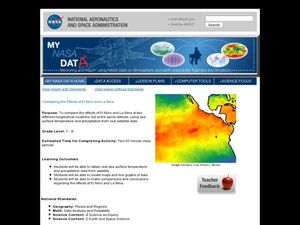
Comparing the Effects of El Nino and La Nina
Students examine the differences between an El Nino and La Nina year. In this investigative lesson students create maps and graphs of the data they obtained.
National Geographic
Genetic Markers: Connecting the Dots
Biology buffs simulate how genetic markers are passed among populations in order to understand how these markers can help anthropologists map human migration. A couple of volunteers leave the room while you walk the remaining learners...
Mr. Head's 6th Grade Classroom
Absolute Location
How do we know where we are in the world? A presentation for middle schoolers explains absolute location and other geography terms such as relative location. It also gives scholars the opportunity to practice finding absolute location on...
Curated OER
Australian Travel Adventure
Seventh graders are introduced to the states and territories within Australia. Using the internet, they bookmark sites and take notes on what they want to share with their classmates. They also complete a map study on the country to...
Curated OER
Global Lesson: Social Studies On-Line Global Lesson: Social Studies On-Line Continents
In this geography PowerPoint a simple world map on which each continent is represented by a solid green landform is the background for each of the nine slides. The continent names appear in a list on the first slide, followed by one...
Curated OER
Old World and New World - Why Contact Took So Long
Students use a globe to determine why contact between the old world and the new world took a long time. In this map skills lesson plan, students analyze routes between regions to determine why it took so long for the old world and the...
Curated OER
Wild Animals in the World
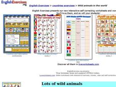
For this wild animals worksheet, students answer multiple choice map questions, choose the correct animal names for the pictures, and more. Students complete 4 activities.
Curated OER
World Map and Globe - Lesson 15 (K-3)
Students discover mountain ranges and their locations in the world. In this physical map lesson, students locate and identify major mountain ranges of the world on a large physical map.
Curated OER
Getting to Know My World
Students participate in hands-on activities using maps and globes to identify geographical features. Students use map legends to identify direction. Students locate oceans, continents, countries, states and cities. Handouts and...
Curated OER
Continents
Students investigate World Geography by researching the different continents. In this Asian Geography lesson, students discuss the continent of Pangaea and color a worksheet of the continents. Students locate China on the map worksheet...
Curated OER
Africa - Not Just One Big Safari
Students draw a picture of an African city that is similar to a U.S. city and discover how other parts of the world have the same types of buildings. In this global similarities instructional activity, students create a map of...
Curated OER
Breaking News English: Map Shows Chinese Discovered America
In this English worksheet, students read "Map Shows Chinese Discovered America," and then respond to 47 fill in the blank, 7 short answer, 20 matching, and 8 true or false questions about the selection.
Curated OER
Breaking News English: Map Shows the Chinese Discovered America
For this English worksheet, students read "Map Shows the Chinese Discovered America," and then respond to 47 fill in the blank, 7 short answer, 20 matching, and 8 true or false questions about the selection.
Curated OER
Oceania Map Quiz
In this online interactive geography quiz learning exercise, learners respond to 14 identification questions about Oceania. Students have 2 minutes to complete the quiz.
Curated OER
Sign a Map
For this geography worksheet, students think and identify the different features and landforms that an explorer would come across the continent of Antarctica. They use body gestures to communicate their list of items to a partner and...
National Museum of Australia
Telling Our Indigenous Stories
How far back is 40,000 years? Scholars research the first indigenous people in Aboriginal Australia. Using museum artifacts, maps, and background readings, they form conclusions on the life of the first Australians and their struggles to...
American Battle Monuments Commission
The Great War: U.S. Division Under Allied Command
The victory of Allied forces in World War I is due in large part to the continued collaboration and support of the Allied divisions themselves. Learn more about the ways Australia, Britain, France, and the United States worked together...
Curated OER
Continents of the World
Second graders participate in a lesson about how people are the same, how people are different and where the continents are located. They go on a trip around the woworld to visit a country in each continent.
Curated OER
Expanding Children's Geographic and Economic Worlds
Students learn their addresses and gain a sense of connection between their neighborhood and the rest of the world and the universe.
Curated OER
Racism No Way
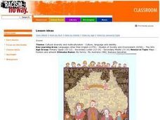
Students explore different cultural influences and their contribution to Australian identities. They reflect on their own backgrounds and making links with their peers, reflect on our heritage. Students view My family- My Australia,...
Other popular searches
- Australia Outline Map
- Australia Map
- Australian Map/regions
- Australia Map Skills
- Australian Map
- Australia Geography Map
- Social Studies Australia Map
- Australian Rainforest Map
- Label Map of Australia
- Australia Map Game
- Australian Rain Forest Map
- Australia Map Worksheet


