SeaWorld
Animal Migrations
Here is a fabulous set of activities for your young scientists. Each lesson contains map, hands-on, and game activities that will help the class understand why and how animals migrate from one place to another. First they'll examine the...
Curated OER
Exploring Mexico
Sixth graders describe images of a characteristic of a cultural group from 4 different time periods of Mexico's history analyzing how it has changed and why the student thinks it changed. They describe maps on 4 different time periods in...
Curated OER
North American Biomes
In this Science worksheet, students color a biome map of North America. Students color the map by solving the clues listed on a separate sheet of paper.
Curated OER
Where in the Latitude Are You? A Longitude Here.
Students distinguish between latitude and longitude on the map. In this mapping lesson, students participate in mapping skills to recognize spatial relationships, and where to find natural resources on the map. Students create...
Curated OER
Learning European Geography
Sixth graders discover locations and countries in Europe by identifying them on a map. For this European geography lesson, 6th graders read the book The Lost Little Elephant, with their class and discuss the geography referenced in...
Curated OER
Cacao Tree Geography
Students use a map to learn about where chocolate comes from. In this lesson on the cacao tree, students locate various regions where the cacao tree grows. They will discuss why the cacao tree grows more favorably in particular climates...
Curated OER
Where in the World Is ...
Students locate and place countries and continents on a large map using tag board and yarn. They locate a new geographic location on the map each morning.
Curated OER
Mapping Mexico
In this Mexico map activity, students label features and places on a blank map of Mexico. A reference web site is given for additional activities.
Curated OER
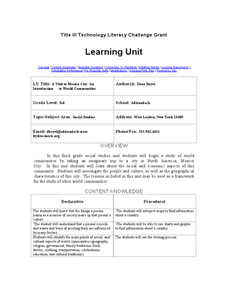
A Visit to Mexico City: An Introduction to World Communities
Third graders complete a variety of activities as they take an imaginary trip to Mexico City, complete with passports, maps, and Spanish dictionaries. They write postcards to send home and create items to sell at the market. The unit...
Curated OER
Temperature and Daily Life: Mexico City and Indianapolis
Students compare the effect of temperature on daily life of a citizen in Mexico City, Mexico with that of a citizen of Indianapolis, Indiana.
Curated OER
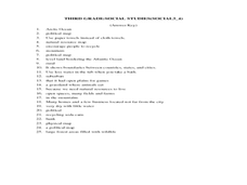
Third Grade Social Studies-Multiple Choice Activity
For this grade 3 social studies worksheet, 3rd graders complete a set of 25 questions about a variety of topics including geography, types of communities, map and questions about the environment.
Curated OER
Africans in Mexico
Students read case studies to examine the role of Africans in Mexico. Using maps, they research the areas that are discussed in the text and map out movement maps of Africans to and from Africa. They research the history of the Mexico...
Curated OER
Christmas in Mexico
Young scholars identify how Christmas holidays are celebrated in Mexico, compare Mexican holidays with U.S. holidays, and learn Mexican customs. Lesson includes many downloadable activities to try with students.
Curated OER
Moving West with the Forts: Using an Interactive Map
Seventh graders practice reading maps and locating the forts stationed in Texas. Using the internet, they analyze westward movements from statehood to the Civil War. In groups, they complete a worksheet about the forts and share their...
Curated OER
Reading a Map
Third graders become familiar with the vocabulary and skills related to mapping. In this guided reading instructional activity, 3rd graders find proper nouns on from the map. Students read Goldilocks. ...
Houghton Mifflin Harcourt
Voyagers: English Language Development Lessons (Theme 5)
This packet, the second in the series of support materials for the Houghton Mifflin Harcourt thematic units on voyagers, contains support and enrichment activities for ELD/ESL learners.
McGraw Hill
Study Guide for Island of the Blue Dolphins
Dive your class into a reading of Island of the Blue Dolphins with this in-depth study guide. Breaking the novel into three parts, the resource begins each section with a focus activity that identifies a specific theme or question...
The Alamo
The Alamo
Remember the Alamo! Scholars investigate the Battle of San Jacinto during the Texas Revolution. Using models, maps, quotes, biographies, and the Oath of Allegiance, the Alamo comes to life as the stories of those who fought and died in...
Port Jefferson School District
Hurricane Katrina
Young scientists track Hurricane Katrina across the Atlantic Ocean as they learn about these destructive forces of nature. Provided with a table of data tracking the location and conditions of Katrina over a one week span, students...
Curated OER
The Legend of the Poinsettia
Students explore the poinsettia and its symbolism as a Christmas flower. Students will listen to a story about the poinsettia and its origins in Mexico and discuss what they know about Mexico. They will discuss the poinsettia's...
National Geographic
Rescuing, Relocating, and Rehabilitating Wildlife
Bring up the Deepwater Horizon (BP) oil spill that occurred in the Gulf of Mexico in 2010. Display the colorful diagram of the coastal and marine organisms living in the area. Show a video about relocating the eggs of the Gulf's sea...
Curated OER
The Bread of the Sandwich
Students create relief maps of Canada and Mexico out of everyday objects like dried macaroni, dry rice, sand, etc. They create a clue card for a location game and try to stump their classmates. They host a travel fair to display their...
Curated OER
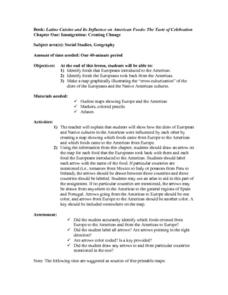
Immigration: Creating Change
Students explore how immigration has changed the culture of America. After identifying the foods and diets of Europeans and Native cultures, students create a map indicating where foods came from. Students design a restaurant menu,...
Curated OER
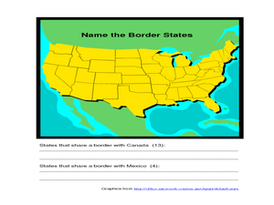
Identifying Border States of the U.S.
For this identifying border states of the U.S. worksheet, 3rd graders visually identify then write the names of the states that border Canada and Mexico; page 1 is a lesson, page 2 is the worksheet.


