Richmond Community Schools
Map Skills
Young geographers will need to use a variety of map skills to complete the tasks required on this worksheet. Examples of activities include using references to label a map of Mexico, identify Canadian territories and European...
Curated OER
Where in the World Is Mexico?
Learners practice map-reading skills as they locate Mexico and its cities on a world map. By creating a puzzle out of a map of Mexico, students engage in a meaningful hands-on activity to help them explore that country's geography.
Curated OER
Mexico: Culture, Language, and History
Study the culture, language, and history of Mexico in this collection of lessons. Create maps of Mexico's geography, study Spanish language phrases, and create a fiesta, along with a Mexican Marketplace scene.
Curated OER
Air Pollution in Mexico City
A fantastic lesson on urban air pollution problems throughout the world is here for you. Learners understand that there are many factors involved in creating pollution, that there are many health effects brought on by air pollution, and...
Curated OER
Volcanoes: Sixth Grade Lesson Plans and Activities
Bring a set of pre-lab, lab, and post-lab lesson plans on volcanoes to your earth science unit. Sixth graders explore the three types of volcanoes found on Earth, plot the specific locations of these volcanoes on a map, and...
Curated OER
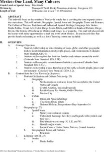
Mexico: One Land, Many Cultures
Students, through a variety of activities, discover the geography and culture of Mexico. They make maps, read folktales, write a journal, create pinatas and other artistic pieces, and review the history of Mexico.
Curated OER
Hazards: First Grade Lesson Plans and Activities
Examine the environmental hazards associated with volcanoes with a three-part science lesson. In the pre-lab, first graders learn that gas, landslides, ash, and lava are all hazards that come from volcanoes. They then explore...
Curated OER
Celebrate Hanukkah in Israel
Explore Hanukkah and its origins with a social studies lesson. Learners discover the history of Hanukkah and its traditions. They locate Israel on a map, hear the story of the menorah and create their own...
Curated OER
United States: Physical Features Fun
In this map worksheet, learners color and trace eleven listed features on a map of the United States. Students answer six additional questions about the map. A United States map is not provided. However, websites are provided to find...
Core Knowledge Foundation
Maya, Aztec, and Inca Civilizations
A 10-lesson unit explores the Maya, Aztec, and Inca civilizations. Over the course of two weeks, scholars read nonfiction excerpts, discuss their findings, and complete activities. An assessment equipped with multiple choice and matching...
Curated OER
Call to Arms: A Service Project
Sick of selling candy and washing cars? How about hosting a Digital Day or a Learning Lunch? The suggestions here make fund raising fun and rewarding. Raise money to preserve important maps and other primary source documents.
Curated OER
Mexico: One Land, Many Cultures
Students research and study the country of Mexico and complete a project about it. In this Mexico lesson plan, students research Mexico's geography, traditions, art, songs, stories, and legends that are native to Mexico.
Curated OER
Rivers, Maps, and Math
Students use maps to locate and label the major rivers of North and South America. Using the internet, they identify forests, grasslands, mountain ranges and other landforms on the continents as well. They compare and contrast the...
Curated OER
Geography and Artifacts of Mexico
Students review the structure of government in Mexico and discuss how it is different than the United States. Using artifacts, they must label and identify the city or state in which the artifact originated. They use the artifact clues...
Curated OER
Mexico Map
In this blank outline map worksheet, students study the political boundaries of the North American country of Mexico. This map may be used in a variety of classroom activities.
Curated OER
Mexico Outline Map 2
In this outline map worksheet, students discover and investigate the North American country of Mexico. This blank outline map may be used for a variety of classroom activities.
Curated OER
Nahuatl Culture
Students read stories, look at maps, and write journal entries to learn about the language and artwork of Nahuatl culture. In this Nahuatl culture lesson plan, students research the Nahuatl culture and present their findings.
Curated OER
Discovering New Mexico
Seventh graders discuss the elements of maps and using basic linear measurement. They calculate the distance between the cities and create a simulated journey around New Mexico using a road map. They write out the directions for their...
Curated OER
Along the El Camino Real
While studying each of the 21 missions in California, your class will learn about the founders and founding dates of each mission. Note: Some resource links may not be working, but can be supplemented with additional activities found on...
Curated OER
It's All in the Pattern
Here is a fantastic, nine-page, multi-session lesson plan on the Zia Sun Symbol (found on the New Mexico state flag), and the seasons of the Earth. Everything you need to implement the lesson is here, and the many engaging activities are...
National Endowment for the Humanities
The Mexican Revolution
The legacies of the Mexican Revolution are visible today—even if some history classes don't cover them. Using primary sources from leaders in Mexico at the time of the popular uprising and other evidence, such as railroad maps, young...
Curated OER
United States Map- Rivers
Students learn about rivers. In this maps lesson, students describe rivers and what human activities take place in a river. Students use a map to locate the rivers in the United States.
Curated OER
Maps and Models
Students study maps of New Mexico examining settlement patterns over time and the location of water sources. They research the history of their community and discover how cultural groups interacted, adapted to their physical...
Curated OER
Hopi Running
Students identify why the Hopi tribe practiced running as it relates to health, delivering messages, defeating other tribes, and for ceremonial events. In this social studies instructional activity, students use maps to identify latitude...


