Curated OER
The Geography of the United States
Full of bright maps and interesting information, this presentation details U.S. Geography. Slides include basic facts about size, regions, topography, and demographics, as well as fascinating trivia about the United States, including...
PBS
Arthur's World Neighborhood: Building Global and Cultural Awareness
Kids become global anthropologists as they explore commonalities and differences both in their classroom and expanding across the globe. Throughout several activities, learners conduct partner interviews that culminate in Venn diagrams,...
Bowland
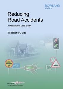
Reducing Road Accidents
By making the following changes to the roads, we can prevent several accidents. A multiple-day lesson prompts pupils to investigate accidents in a small town. Pairs develop a proposal on what to do to help reduce the number of...
Curated OER
Dalai Lama
Sixth graders use skills and knowledge that they gained from their Tibet unit to formulate a final product of their Tibet journey. This study covers topics such as Tibet's geographical location, religious beliefs, customs, dress, and way...
Curated OER
Title: Rivers as Borders
Students are introduced to the concept of borders. They read maps and identify rivers that separate different countries and states. They examine how or why a landform such as a river border might be the reason for different cultures.
Curated OER
Photo/Mat Weaving
Pupils explore the art of mat weaving. In this tapestry lesson, students create maps with paper or photographs. Pupils understand age appropriate skills and technique of map weaving. Students learn the cultural aspects of map weaving.
Curated OER
Volcano Contour Models Activity and Tracing the Highs and Lows in San Francisco
Students investigate how to draw topographic contours and read topographic maps.They examine the topography of San Francisco and contrast the elevation of different points within San Francisco.
Curated OER
Ring of Fire
Students locate some of the 1,500 active volcanoes on a world map. Then by comparing their maps with a map of the world's tectonic plates, they discover that volcanoes occur because of the dynamic nature of the Earth's lithosphere.
Curated OER
Bradford England
Students explore the locality and diversity of culture within the Bradford District of England. Through map activities and discussion, they identify the major forms of transport, people and places in the region. Students compare and...
Curated OER
Create a Migrant's Scrapbook from the First Great Migration
Help young historians personally engage in the stories of African Americans during the Great Migration! Assessing a migration route map, learners create a migrant character's experience, adding details while studying primary sources. A...
Curated OER
Hungary: The Landscape
Learners work in small groups to create a topographic map of Hungary. The map will include labeled line drawing of the bordering countries. Hungary should be three dimensional, made of salt and flour clay. The mountains, plains and...
Curated OER
Italy: The Landscape
Students work in small groups to create a topographic map of Italy. They must include labeled line drawings of bordering countries and bodies of water. Students use salt and flour clay to make Italy three dimensional, showing the many...
Indian Land Tenure Foundation
Indian Trust Lands
An important aspect of studying Native American history is understanding the nature of trust lands. Budding historians will learn that as Native Americans were removed from their home lands, trust lands were provided in the form of...
Curated OER
Interdependence in a Global Community
Students locate the geographic origin of a variety of products used in our society. They find countries in an atlas or on a wall map. They define the term imports and emphasize the theme of MOVEMENT and use it to explain interdependence.
Curated OER
The Sweet Connection
Students use maps to find what crops are dominant in areas where honey bees are raised and discuss possible correlations. They mark the top ten honey- producing states on a US map.
Curated OER
Rock River Watershed
Middle schoolers discover what a watershed is and which one they live in. Using the internet, they research why watersheds are important to an ecosystem and how to keep them from getting polluted. They use a map to locate various items...
Curated OER
There's a Volcano in my Backyard!
Learners utilizing a volcanic hazard map of Mount Rainier, reach conclusions about the potential hazards of future eruptions. They create educational materials about these hazards and what to do if one erupts again in the future.
Curated OER
Building Biographies: A Research Unit
Students explore the fundamental principles involved in completing a research project. Several handheld technical pieces of equipment are utilized to complete this lesson.
Curated OER
The Solar System
Looking for a cross-curricular project for language arts and science? Use this lesson to reinforce knowledge of the Solar System, as well as expository writing skills. Elementary and middle schoolers choose one aspect of the Solar System...
Curated OER
Identifying Issues facing Africa
Students identify 5 issues facing Africa as a class The work in teams to create a joint project, conduct independent research into Africa, and present these ideas in a persuasive argument. The work in their groups in class to plan their...
Curated OER
U.S. History: de Soto's Alternate Route
Eighth graders examine various maps associated with Hernando de Soto's expedition. By comparing their textbook maps with newer maps, they answer a battery of focus questions. Using Microsoft Word, 8th graders answer the questions...
Curated OER
My Home of North Dakota
Discuss the people, history and geography of North Dakota using this resource. Learners use a variety of sources to do research on North Dakota and present their findings in a PowerPoint presentation. They answer questions involving...
Curated OER
Sandscapes to Landscapes
Pupils explore landscapes and create their own in a creative project.
Curated OER
Going Greek
Third graders learn about the life of a young boy in Greece and all about his cultural heritage. Pupils gather information about the history, culture, and the many influences the ancient Greeks had on modern day society. Terrific video...
Other popular searches
- 3 Different Map Projections
- Map Projections Worksheets
- Different Map Projections
- Map Projections Cylinders
- Globe and Map Projections
- Types of Map Projections
- Map Projections Explanation
- Map Projections Cyclinders
- Map Projections Mercator


