Utah Education Network (UEN)
Order of Operations Treasure Hunt
For this algebra lesson, learners work in groups to design a treasure map in which algebraic equations must be solved using the correct order of operations. Students decide where treasure is hidden, then create and follow their group's...
Curated OER
Hurricane Impact: Storm Surges and Elevation Transitions
In this hurricane instructional activity, student answer 6 multiple choice questions and 8 short answer questions about hurricanes. They color the map to show flooded areas.
Curated OER
Donde en el mundo estas?
Students give & follow directions given in Spanish, using oral, written and graphics. They use maps, globes, atlases, and remote sensing, GIS, and GPS to acquire and process information about places.
Curated OER
Working on the Railroad
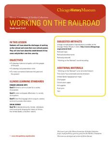
Students plan a trip on the railroad. In this railroad creation and implementation lesson, students listen to the song "Working on the Railroad", make a map of where the track was laid and discuss the geographical challenges. ...
Curated OER
Hooray For Heroes
Young scholars identify and interpret what heroes are by researching various American heroes of the past. Students select several school heroes and interview them, as well as their own personal hero and write a story about them. Young...
Curated OER
The Conquest of the Aztec Civilization
High schoolers use the classroom atlases, the Internet or textbooks to draw a freehand map. They work in groups using the maps in the book The Broken Spears (Portilla) and The Conquest of New Spain (Diaz) to draw a freehand map...
Curated OER
Students Slide to School on Air-Powered Sled
Students locate the Great Lakes on a US map, then read a news article about a sled being used as a wintertime school bus in Wisconsin. In this current events lesson, the teacher introduces the article with a map and vocabulary activity,...
Curated OER
Hero Within
Students interview a hero. In this heroes lesson plan, students read Number the Stars to begin a discussion about heroes and then create mind maps on each character. Students pick a local hero and interview them and then write a personal...
Curated OER
Operation Genesis
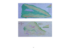
Learners, while working in groups under the Operation Genesis project involve fictional elements of role playing to grasp geographic concepts concerning human/environment interaction. They create the physical features of a fictional...
Curated OER
A Differentiated Way through Think Dots
Learners examine reasons that led people to explore, identify "West" as defined following Revolutionary War, explain importance of finding natural resources, develop time line of dates and events leading up to Lewis and Clark Expedition,...
Curated OER
Cloudy With A Chance of Meatballs
Second graders explore weather. In this weather lesson, 2nd graders read Cloudy With A Chance of Meatballs and participate in four supplemental science activities. Students participate in Internet research, create weather maps,...
Curated OER
Exploring the Natural World of the Balkan Peninsula
Young scholars explore the different habitats in the Balkan peninsula. For this ecology lesson, students research about a species and create a 3D diorama of its environment. They present project in class and share their research findings.
Curated OER
Mapwork: A Place In the News
Students determine how to find geographic information about places they read about in the news. In this geography activity, students look at political and physical maps to determine the difference. They access maps online to find the...
Curated OER
Meet One Picky Bird
Learners complete a research project In this endangered species lesson, students use the "Think, Puzzle, Explore" method to learn about endangered species. Learners research and write a report on the red-cockaded woodpecker.
Curated OER
Family Tree
Students create a family tree in this culminating activity to their family unit. In this family tree lesson, students extend their learning about the family unit by working in small groups to develop a three generation family tree. They...
Curated OER
The Iditarod Adventure
Students use the internet to follow the Alaskan Iditarod race as well as perform research. This project-based activity will result in students creating many desktop publishing documents.
Curated OER
What's the Matter? (Grade 3)
Third graders organize information about the three types of matter and to reinforce concepts learned in the matter unit of the science curriculum. They use Inspiration software to create a concept map of the three types of matter.
Curated OER
WHERE DOES OUR FOOD COME FROM?
Learners examine the sources, location and availability of local food, develop mapping skills, interact with Elders to gain pertinent information, and examine subsistence issues of the past and present.
Curated OER
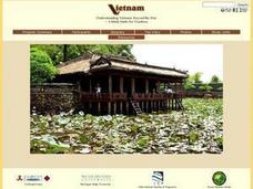
Understanding Modern Vietnam Through the Five Themes of Geography
Young scholars explore Vietnam and prepare a studenT book about Vietnam using the five themes of Geography. These books be used to teach a younger classroom about Vietnam, as part of a service-learning project in our school.
Curated OER
Topos, Compasses, and Triangles, Oh My!
Middle schoolers triangulate using a compass, topographical (topo) map and a view of outside landmarks. They take a field trip to another location away from school and mark discernible landmarks (like mountains or radio towers) and...
Curated OER
Contributions of Ancient Civilizations Applied to Multimedia
Sixth graders complete a long-term unit on ancient and early civilizations. They conduct Internet research, define key vocabulary terms, analyze maps, and create a PowerPoint presentation about a selected early civilization.
Curated OER
Getting to the Point
Students determine location by using the technique of triangulation. They imagine that they are out in the wilderness and have come to the top of a ridge. How can one identify the ridge on the topo map? How can one figure out where you...
Curated OER
Weather in Your City
Students observe weather conditions of a particular city. Multiple intelligences are explored within this lesson. They locate their particular city on a United States map. Each student writes about their discoveries in his/her journal...
Curated OER
How Texas is Planning To Manage Its Water
Learners research water management strategies in Texas. They analyze projected demand for water in the year 2050, interpret graphs and tables and then discuss the data as part of a written report. They research and map the locations of...
Other popular searches
- 3 Different Map Projections
- Map Projections Worksheets
- Different Map Projections
- Map Projections Cylinders
- Globe and Map Projections
- Types of Map Projections
- Map Projections Explanation
- Map Projections Cyclinders
- Map Projections Mercator


