Curated OER
Itaipu Dam and Power Plant (Brazil and Paraguay)
Learners study South America's Itaipu Dam and Power Plant in order to gain an understanding that hydroelectric power is a major means of generating electricity throughout the world. They also look into the environmental impacts that...
Curated OER
Simulated Air Trip to Seoul, Korea
Students become acquainted with the geography and culture of Korea. In this Korean trip activity, students view a video about Korea and read about the country. Students sample snacks and possibly learn a Korean phrase as they...
National Geographic
Measuring Elevation Past and Present
After viewing a short video about a climb up Mount Everest, high schoolers read about triangulation for measuring distant elevations. Have your class work in groups to construct an inclinometer and then use it to measure the height of...
Curated OER
Fish Communities in the Hudson
Learning to read data tables is an important skill. Use this resource for your third, fourth, or fifth graders. Learners will will study tables of fish collection data to draw conclusions. The data is based on fish environments in the...
Baylor College
People and Climate
Model how the sun's energy strikes the planet and help your class relate it to a climate map. Assign small groups an individual climate zone to discuss. They reflect on and research how humans survive in the assigned climate and write a...
Facing History and Ourselves
Social Media and Ferguson
How can social media help or hinder civil dialogue? How can information shared on social media be verified? As the investigation of media reports of the events surrounding the shooting of Michael Brown continues, class members read...
Curated OER
Easter Egg Orienteering Hunt
Students develop map reading and team building skills. After being divided into teams, students use a map of the school grounds to discover the location of Easter eggs. The first team to return with and eat their eggs wins the challenge.
Science Matters
Ring of Fire
Over a period of 35 years, earthquakes and volcanoes combined only accounted for 1.5 percent of the deaths from natural disasters in the United States. The 15th lesson in a 20-part series connects the locations of earthquakes and...
Curated OER
Locomotor Treasure Hunt
Students practice in refining their locomotor skills and developing their understanding of pathways and basic map reading skills.
Curated OER
Incorporating Reading Comprehension Using Cinderella Stories from Different Lands
First graders investigate Cinderella tales from different lands to discover their commonalities in this unit. They perform their favorite Cinderella story.
Curated OER
African-American Communities in the North Before the Civil War
Middle schoolers examine what life was like in free African-American communities before the Civil War. They analyze maps, identify elements of everyday life in these communities, explore various websites, and complete a chart.
Curated OER
George Washington Teaches Map Directions
Learners follow teacher given directions, either oral or written to plot points on a grid to create a profile of George Washington. They apply cardinal and ordinal directions to find the points on the grid.
Hastings Prince Edward Public Health
My Life—My Mental Health
Between peer pressure, an onslaught of hormones, and brand new responsibilities, the teenage years can be emotionally volatile. Equip young adults with coping mechanisms and a safe place to discuss their feelings with a guided...
EngageNY
Grade 10 ELA Module 1: Unit 3, Lesson 2
Sometimes, sensory details can bring you back to a familiar place. Study the setting descriptions from a critical chapter in Amy Tan's A Joy Luck Club, and discuss how they enhance the book's plot and contribute to a central theme.
K20 LEARN
Street Cred: Evaluating Sources
A lesson on evaluating sources of information teaches scholars to "think twice" before using a source. Researchers examine a resource's home page, author, and sponsor, as well as the date published and the documentation provided.
Pace University
Native Americans
Introduce middle schoolers to the First Nations that inhabited the Northeast during the Age of Exploration with a series of activities designed for differentiated groups.
Curated OER
Latitude & Longitude Bingo
Students practice map reading skills through a reinforcement game of bingo. They select any 24 of 30 listed cities to write on blank bingo cards. Then using atlases, locate a city based on the latitude and longitudinal coordinates...
Curated OER
Literature Circle Role Descriptions
In this literature circle role descriptions worksheet, students identify the role they play in the literature circle. The different roles include: summarizer, vocabulary finder, questions writer, story mapper. Each role has three to...
Curated OER
Vocabulary Development
By utilizing a graphic organizer called a bubble map, young readers work toward developing their vocabulary. After reading a story, a word that has something to do with the story is put in the middle circle. Then, other words that have...
Curated OER
Where is the Trail? The Journey of Lewis and Clark
Students explore the trail followed by Lewis and Clark on their journey across the United States. In this United States History lesson, students complete several activities to establish the Lewis and Clark Expedition, including a class...
Curated OER
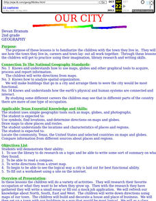
Our City
Second graders familiarize themselves with the town they live in by practicing their imagination, library research and writing skills.
Curated OER
Island Survival
Students participate in a simulation of life on a deserted island. They work with their group to develop an island survival plan and summarize it in a journal. Students use a worksheet and challenge cards to earn points. They will be...
Curated OER
Saudi Arabia -- Future city
Seventh graders summarize an article on Masdar. In this summarizing lesson students clearly explain three of the four points provided in an outline of the article. The students write an essay and identify six physical features of the...
Curated OER
Tracking Satellites Using Latitude and Longitude
Students, viewing an Internet site, plot the path of several satellites using latitude and longitude over the course of an hour. They learn the four basic types of satellites and their purpose.
Other popular searches
- Map Reading Skills
- Earth Science Map Reading
- Esl Map Reading
- Map Reading Activities
- Reading a Map
- Basic Map Reading
- Map Reading Powerpoint
- Topographic Map Reading
- Map Reading Grade 6
- Lessons on Map Reading
- Elements of Map Reading
- Geography Map Reading Skills


