Curated OER
Countries of the World
Students define the meaning of the word country. In this countries of the world map lesson, students identify boundaries, countries, and symbols within countries on the map. Students distinguish the words country and continent.
Curated OER
As the Kids Come and Go: Mapping a Classroom
Map the classroom with your kids to help them understand how maps work and how to read them. The lesson starts off with a story about animals living and moving around the globe, and then kids create maps of their classroom to show how...
Curated OER
A Walk Around the School: Mapping Places Near and Far
After reading Pat Hutchins’ Rosie’s Walk, have your young cartographers create a map of Rosie’s walk. Then lead them on a walk around the school. When you return class members sequence the walk by making a list of how the class got from...
Curated OER
Virtual Field Trip
This hands-on resource has future trip planners analyze graphs of mileage, gasoline costs, and travel time on different routes. While this was originally designed for a problem-solving exercise using a Michigan map, it could be used as a...
Curated OER
Virtual Field Trip
Are we there yet? Young trip planners learn about their state and plan a trip. They will select sites to see in three cities in their state, and record associated costs in a spreadsheet. While this was originally designed as a...
Curated OER
North Dakota Map
In this North Dakota worksheet, students study an outline map of North Dakota with the capital city marked. Students color the map and add other important cities and landmarks.
Curated OER
English Vocabulary Skills: AWL Sublist 1 - Exercise 3b
In this online interactive English vocabulary skills activity, high schoolers answer 10 matching questions which require them to fill in the blanks in 10 sentences. Students may submit their answers to be scored.
Curated OER
English Vocabulary Skills: AWL Sublist 8 - Exercise 4c
In this online interactive English vocabulary skills worksheet, high schoolers answer 10 matching questions which require them to fill in the blanks in 10 sentences. Students may submit their answers to be scored.
Curated OER
English Vocabulary Skills: AWL Sublist 10 - Exercise 1b
In this online interactive English vocabulary skills worksheet, students answer 10 matching questions which require them to fill in the blanks in 10 sentences. Students may submit their answers to be scored.
Curated OER
Mapping Our Home
Students explore how communities participate in census counting. In this census lesson, students recognize the absolute and relative location of a state and understand ideas about civic life and government.
Curated OER
I Can Find that Where? - A Study of Landforms
First graders make landform maps of the United States. In this landform lessons, 1st graders participate in a discussion of local landforms and make a landform map of the United States. They follow the teacher's directions to add plains,...
Curated OER
Map of Town
Third graders draw a map of the town given different sites to locate on the map by the teacher. They explain that latitude and longitude are used to locate places on maps and globes, identify the distinctive physical and cultural...
Curated OER
Story Map--Upper Elementary Worksheet
In this retelling of a story activity, students choose a story they've already read and fill out the story map. Students follow the sequence of the story map step-by-step.
Curated OER
Current Earthquake Activity
Fifth graders record any earthquake activity throughout the school year on various maps. In groups, they identify a map locating the points given to them by their teacher. To end the lesson, they add the date, strength and damage to each...
Goodwill Community Foundation, Inc.
Directions and Distances
Describe where you are—and find out where you are going—with a beginning Spanish resource on directions and maps. Spanish learners repeat and practice direction words such as norte, este, and oeste, as well as measurement terms such as...
National Endowment for the Humanities
Hopi Place Names
What's in a name? Historians consider the question as they examine places important to the Hopi people and the meanings of their place names. Included worksheets include maps and charts to help class members examine the geography of Hopi...
PBS
Arthur Compass Rose
Keep your class headed in the right direction with this printable compass rose. Large and easy to read with a smiling picture of Arthur in the middle, this resource would make a fun addition to the desk of any primary grade...
Penguin Books
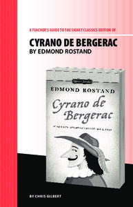
A Teacher's Guide to the Signet Classics Edition of Cyrano de Bergerac by Edmond Rostand
Edmond Rostand's Cyrano de Bergerac has enjoyed popularity since its debut in 1897 due in large part to the themes it addresses. Instructors planning on using the play with their classes will find much to like in this teaching guide. The...
Curated OER
Math with Maps and Globes
Young scholars round out their math skills with these ‘round the world' ideas. In this math and geography lesson, students try out time zone sticks, a polar race, and tic-tac-globe to engage them in learning more about globes and the...
Curated OER
Through the Forest and Home Again: Maps Help Us Find Our Ways
Students read Little Red Riding Hood, focusing on her path home to Grandma's house. In this language arts and geography lesson, students perform a reader's theater, re-creating the walk home and possible routes that could have been...
Curated OER
A School Map
In this school map instructional activity, students practice their map reading skills as they use the word box and the compass rose the help them answer 6 fill in the blank questions.
Curated OER
Map Key
In this map reading instructional activity, students read the map key and then cut our and paste the symbols where they belong on the provided map.
Curated OER
Map Skills
For this map skills worksheet, students research and label the states in Australia and add in the major cities, oceans and seas.
Curated OER
Map Reading
In this reading maps practice worksheet, students respond to 16 questions that require them to determine the directions north,, south, east, and, west.


