Curated OER
My Summer Vacation: Traveling
A classic lesson idea, kindergarteners share stories about their summer vacations on their first day of school! First, your young learners will listen to you talk about your summer vacation, making sure to use plenty of visual aids. Then...
Curated OER
Lesson Plan on Latitude and Longitude
Sixth graders identify at least ten places on the world map using given longitude and latitude points. They identify the longitude and latitude of ten places on the world map.
Curated OER
Indus Valley Geography and Civilization
High schoolers study the geographical features of the Indus Valley to determine how the location of this valley contributed to the growth of an ancient civilization. They work in groups to research the area before completing map work...
Curated OER
Teaching the Five Themes of Geography Through Picture Books
Read the story Make Way for Ducklings and introduce little ones to the five themes of geography. Reread the story, while displaying transparencies to reinforce the five themes. In groups, learners view pictures and identify the themes on...
Curated OER
The Geography of Tornadoes OR
Young scholars learn some basic facts about tornadoes and map two selected tornado statistics by state, and observe, analyze and speculate about the pattern(s) created by the completed map.
Curated OER
A Multicultural Study: Chinese New Year
Students study the customs and beliefs of the Chinese people as they experience Chinese New Year; students become aware that they live on one planet but their festivals and holidays vary.
Curated OER
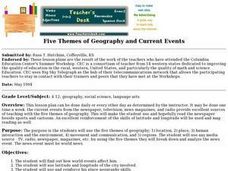
Five Themes of Geography and Current Events
Basically, pupils look for a current world event from a reputable source and identify the five themes of geography within it. Throughout the school year, they keep a notebook of these current events. A grading guideline is outlined, and...
Curated OER
Second Star To the Left and Straight On 'Till Morning" - Spreadsheet Driven Exploration of Pacific Asian Geography
Students explore the geography of Pacific Asia. The class is divided into two groups to participate in a role-play activity where they act as European explorers. Students utilize mathematics, spreadsheet and internet technology to make...
Curated OER
Controlling the Flow of the Colorado River: A Study of Dams
Students research and map the Colorado River and its dams and predict the effects of a dam on an area. They suggest reasons a dam would be built and compare the Colorado River system with other major river systems within the US and...
Curated OER
Where Is Japan? What Direction Is It?
First graders locate countries on maps and globes and learn about the hemispheres and the cardinal directions. They listen to books read out loud and dicuss geography.
Curated OER
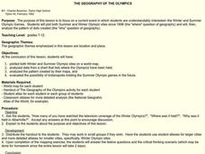
The Geography of the Olympics
Students plot the location of the Winter and Summer Olympics since 1896. Using the maps, they analyze data on where the Olympics have been held and discuss why that location was chosen. They discuss the possiblity of Indianapolis...
Curated OER
U.S. History: What Happened Here?
Young scholars apply the global positioning system to create maps of local historical sites. By collaborating with local historical groups, they research events and relate them to broader, national history. In addition to writing...
Curated OER
Study of New York City
Fourth graders read A Cricket in Times Square and examine the essence of living in New York City. They examine subway maps and other resources concerning NYC and then complete several writing activities about the city. They also create...
Curated OER
Geography Game
Second graders, in groups, selects a letter as a starting point and announces the direction in which he intends to move on a map. The team that closes a square takes possession of the square and marks it with their symbol.
Curated OER
Peru Geography and the Environment
Fourth graders draw maps of Peru and examine how Peru is a geographically diverse country.
Curated OER
On the Street Where You Live: Online Mapping
Students access the Internet and use Google Maps to pinpoint their home address and get directions to and from school. they write the directions in paragraph format.
Curated OER
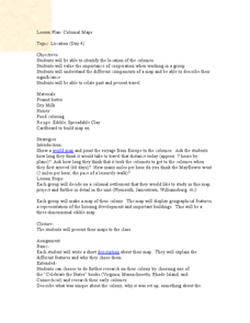
Colonial Maps
Students discover the history of America by identifying the traditional colonies. In this U.S. history lesson, students examine a world map and identify where the voyagers left from Europe to arrive at the United States. ...
Curated OER
Canada Geography PowerPoint
Learners create a PowerPoint about Canadian geography or history. In this Canada lesson, students spend two days researching their Canadian topic in the library and online. They create a PowerPoint presentation and add pictures taken...
Curated OER
Reading a Local and National Weather Map
Students practice reading a national and local weather map. Using this information, they work together to make predictions about the weather for the next few days. They discuss the use of symbols and maps as a class and discuss how...
Curated OER
Geography of Japan
Students complete a worksheet that guides them through an overview of Japanese geography. Students research the topography, climate, population and size of Japan and consider how these factors work together to produce Japanese culture.
Curated OER
What in the World?
Eighth graders plot points of longitude and latitude on a world map. In groups, they create a model of the earth's interior and label the parts,
Curated OER
Journey to Japan: An Elementary Geography Standards-Based Unit on Japan
Second graders compare and contrast Japanese customs and culture to those of Americans through research in this year long study. They determine the basic needs of all people in spite of cultural differences.
Curated OER
Turkey: Bridge Between East and West
Ninth graders study the geography of Turkey. In this Geography lesson, 9th graders examine the characteristics of Turkey. Students create an annotated map of Turkey.
Curated OER
Studying the States!!!
Students explore the fifty states of America. They also learn the capitals and locations of the states. They also study the population, mottos, flags, and interesting historical facts about each state.
Other popular searches
- Geography Map Skills
- Geography Map Reading Skills
- Geography Map Skills Scale
- Geography and Map Skills
- Geography Map Skills Europe
- Usa Geography Map Skills
- Geography Map Skills Us
- Canada Geography Map Skills
- Map Skills Geography Themes
- Geography Map Skills Ohio
- Geography Beginning Map Skills


