Curated OER
Map Coordinates: Monkey Map
Here's an engaging, meaningful, and clever lesson on map skills for elementary schoolers. Pupils combine story writing with mapping skills to create an original piece of work. They utilize a worksheet embedded in the plan to guide them...
Curated OER
The Global Grid System-World Map Activity
Young scholars demonstrate how to use the global grid system. In this map skills instructional activity, students use a world map to locate various locations. Young scholars identify locations based on the global grid system. Students...
Curated OER
Put Me in My Place: Using Alphanumeric Grids to Locate Places
Learners practice locating points on a large wall grid and create and label a neighborhood map. For this geography lesson, students spell and discuss places as the teacher places them on the map. They discuss the concept of an...
Curated OER
Grids
Take your study of coordinates online! Groups of students complete an online graphing introduction, plotting the points of virtual objects. A worksheet is included for extra practice.
Curated OER
Put the Mountains on the Map
Students discuss what they know about the regions where snow leopards live. They observe the worksheets to see if they can identify any of the mountain ranges and then use atlases to check and complete the country identification worksheet.
Curated OER
WORLD GEOGRAPHY
Students identify and analyze map symbols and map grids by completing various worksheets and creating their own map using these skills. Students identify and analyze what latitude and longitude are on a map to play a game of Bingo....
Curated OER
Giving Students a Little Latitude
Young scholars use a world outline map to locate places using coordinates of latitude and longitude. They answer questions about places based on their knowledge of the map and on their research and make up more questions of this sort...
Curated OER
Metrics And Measurements
Students engage in a study of measuring distances between geographical locations on a map. They are able to define and use the map scale in conjunction with the metric system. For this lesson they make their own maps and measure the...
Curated OER
More Than One Grain of Rice
Students explore mathematics, geography and agriculture by studying world rice production. In this production of rice lesson plan, students read One Grain of Rice and use a worksheet grid to calculate how much rice was received. Students...
Polar Trec
Global Snow Cover Changes
Snow is actually translucent, reflecting light off its surface which creates its white appearance. Pairs or individuals access the given website and answer questions about snow cover. They analyze graphs and charts, examine data, and...
Curated OER
Plotting A Hurricane Using latitude and Longitude
Students explore map and plotting skills by tracing the movement s of hurricanes through the Earth's systems. a hurricane map is developed from daily media reports.
Curated OER
Lines of Symmetry
First graders create symmetrical designs using a computer program. For this lines of symmetry lesson, 1st graders review their symmetrical designs and discuss other ways symmetrical designs can be made. Students work in pairs...
Curated OER
Where is it?
Students use a coordinate grid. They investigate and discuss what caused certain objects to be in specific places. They choose a room in their home to map and place objects in specific locations.
Curated OER
Filling in the Picture
Students study archaeological sites. They discover some of the problems inherent in choosing sites and what parts are chosen for excavation. They evaluate and explain their choices for study and articulate the process of archaeological...
Curated OER
Absolute and Relative Location
Second graders understand the difference between relative and absolute location using the grid map as an example of an absolute location. They observe a class map showing longitude and latitude lines and learn that they provide exact...
Curated OER
TE Activity: The Trouble with Topos
Pupils study the uses of topographical maps including the many forms that they take. They discover that the map features show its intended use such as city maps, wilderness maps, and state maps. They complete a worksheet in which they...
Curated OER
Causation-Exploration and World Trade
Students investigate spice trade. For this world history lesson, students identify various spices in jars and their places of origin. Students listen to a lecture on how spices came to countries in Europe. Students complete a source...
Curated OER
The Geography of Aboriginal Languages in Canada
Middle schoolers study the relationship between geography and the Aboriginal language communities.
Curated OER
Graphing Ordered Pairs
In this math worksheet, students learn to graph ordered pairs. Students examine a graph with 3 labeled points and tell the ordered pairs for each. Students also plot 8 ordered pairs on a graph they draw themselves.
Curated OER
Atlas Scavenger Hunt
Young scholars discover what type of information in an atlas by participating in a scavenger hunt. With a partner, they try to find the answers to many questions as possible. They exchange their papers with another partner group and...
Curated OER
Exploring Perimeter
Students explore perimeter. In this geometry and measurement lesson plan, students create squares and rectangles using given perimeters. Students construct four sided shapes with given perimeters using the computer program "Math Keys:...
Curated OER
Angles - Unlocking Geometry
Students investigate the concept of angles and how they are used in geometry. They construct polygons using various types of angles and then classify them according to their physical properties. Students use a computer program in order...
Curated OER
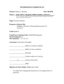
Perimeter Patterns
Sixth graders calculate perimeter of rectangles with different dimensions. In this perimeter lesson, 6th graders define length, width and perimeter. Students complete a perimeter activity using a web tool to change the...
Curated OER
Glacial Landscapes
Students examine the impact of glaciers on Great Britain. For this geological history lesson, students examine and measure a glacial valley and look at several types of glacial landscapes in Britain.


