Curated OER
US Policy In Somalia
Students investigate the US policy for the country of Somalia. They conduct research using a variety of resources. They locate the country and then discuss major geographical features of the areas. Students discuss the present US...
Curated OER
Central & Southwest Asia: Labeled Map
In this Central and Southwest Asia outline map activity, students examine boundaries of each of the countries in the region. This map is labeled.
Curated OER
The Country of Kenya
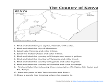
In this map completion worksheet, learners observe a map and map scale of Kenya to find and label bodies of water, cities, countries, and the equator. Students answer 11 questions.
Curated OER
Sub-Saharan Africa: Physical Geography
In this geography skills worksheet, students respond to 22 short answer and map skills questions about the location and geographic features of sub-Saharan Africa.
Curated OER
World Hunger - A Cultural Crisis
Students explore the problem of world hunger and starvation. After a class discussion, students use a map to identify specific areas where populations are starving. In groups, students research reasons for the lack of food. They prepare...
Curated OER
Arabia: Educator's Resource and Activity Guide
MacGillivray Freeman's film Arabia presents viewers with remarkable images and insights into this ancient and mysterious land. An educator's guide is designed to provided teachers with the materials they need to support a...
Curated OER
Drifting Continents
In this plate tectonics worksheet, learners study the continents map and complete 8 short answer questions related to them. They predict what the Earth will look like millions from now.
Curated OER
Ramadan (Islamic Holiday)
Students recognize that different groups of people have celebrations unique to them. They identify countries on a map where Islam is a dominant religion. They demonstrate their understanding of fasting and abstinence.
Curated OER
Korea Cultural Lesson Plan
Students engage in a study of geography and maps of Korea. They examine charts and graphs. Students are expected to interpret the information accurately and completely. The geography skills can be used on other countries as well.
iCivics
Drafting Board: Military Intervention
Should countries use their militaries to stop humanitarian crises in other countries? Learners make claims, organize their reasoning, and provide evidence for their arguments with this rich resource.
Curated OER
Verbs and Verb Phrases...With Pirates!
In this grammar worksheet, students underline the verbs and verb phrases in the 20 sentences. Students are also asked to circle the nouns and pronouns in each sentence.
Learning to Give
Africa - The Great Southland
Applying the five themes of geography, preteen explorers develop a visual aid for younger learners in celebration African American History Month. They investigate the political, geographic, economic, and social aspects of the continent...
Curated OER
World History/Current Events Activity
Students define the term terrorist, and examine how terrorist methods are used to promote fear and endanger the lives of innocent individuals. They analyze why President Bush has declared war on terrorism, and write essays on terrorism.
Curated OER
University of Texas: Somalia: Political Map
A map of Somalia showing its regions' boundaries, neighboring countries, and strategic location on the Horn of Africa. From the Perry Castatneda Collection.
Curated OER
University of Texas: Somalia: Relief Map
A relief map of Somalia showing its highlands and rivers, but also starkly shows the lack of roads in the country. From the Perry Castaneda Collection.
Curated OER
University of Texas: Ethiopia: Political Map
A political map of the landlocked country of Ethiopia showing its major cities and highways, provisional border with Somalia, and its neighboring countries. From the Perry Castaneda Collection.
Nations Online Project
Nations Online: Somalia
Presents a country profile and travel guide to the East African nation of Somalia, background overview, and numerous links to extensive information on the nation's culture, history, geography, economy, environment, population, news,...
Central Intelligence Agency
Cia: World Factbook: Somalia
This resource from the CIA World Factbook provides a detailed fact sheet of Somalia. The content covers the country's geography, people, government, economy, communications, transportation, military, and transnational issues. It includes...
United Nations
United Nations: Cartographic Section: Horn of Africa [Pdf]
This relief map from the United Nations shows the countries on the Horn of Africa. Roads, rivers, and other geographic features are marked on the map.
Encyclopedia of Earth
Encyclopedia of Earth: Somalia
The Encyclopedia of Earth provides an overview of Somalia, including its geography, natural resources, history, government, economy, and much more. Maps and images are also included, along with sources used to create the entry.
Curated OER
Science Kids: Science Images: Map of Somalia
A map featuring Somalia and its neighboring countries.
BBC
Bbc News: Q&a: Somali Piracy
Attacks on ships by Somali pirates has been on a steady rise. Who are the pirates? Why do they resort to hijacking ships? How do they manage to overtake and capture them? Why does it seem impossible to stop them? Does piracy affect...
Curated OER
Educational Technology Clearinghouse: Maps Etc: Egypt and the Nile Valley, 1920
A map of Egypt and the Nile Valley from the delta south to the confluence of the Sobat River and the Upper Nile. This map shows Egypt Proper, Nubia, Kordofan, Sudan, Eritrea, and portions of Abyssinia and British Somalia. The map also...


