Curated OER
Analyze This
Students gain practice in the analysis of various types of graphs common in daily life. These examples often use graphic images like charts, graphs, tables, and pictures to supplement learning.
Curated OER
Where Is Japan? How Far Is That?
First graders use literature and hands-on activities with maps and globes to explain distance and tools used to measure distance. They select tools to measure various objects in the classroom, then apply those concepts to their map...
Curated OER
Cross Section and Slope
Students draw cross sections of given contour maps. In this math lesson, students interpret the different symbols used in the map. They determine slope and steepness through direct measurement.
Curated OER
Countdown Challenge: Right Angles
In this right angle instructional activity, middle schoolers observe a map of the United States of America. They indicate all right angles on the map by using a right angle symbol. Students list the names of the states and identify the...
Curated OER
Cruisin' the Counties: Learning Counties and Major Roads in Arizona
Young scholars examine Arizona counties and use the themes of location and movement to develop an Arizona map.
Curated OER
Delightful Directions
First graders identify and demonstrate how symbols and models are used to represent features of the environment. They identify the directions on a map as east, west, north, and south. Finally, 1st graders play a direction game, move to...
Worksheet Web
Using Pictographs
If one ice cream cone represents three ice cream scoops, and Bob has four ice cream cones, then how many scoops does Bob have? Learners solve these kind of questions with their new understanding of pictographs.
Agriculture in the Classroom
A Holiday Tradition: Which Christmas Tree Will You Choose?
Different varieties of Christmas trees provide an interesting way to combine social studies, science, math, and technology. Class members not only research the history of the Christmas tree holiday tradition, they compare and contrast...
Curated OER
Popcorn Geography
Students use kernels to create a "Top Corn-Producing States" map or graph. They read and round off numbers. Students identify on a U.S. outline map the location of corn-growing states. They create a visual (map or graph) illustration...
Curated OER
2: Isle of Shapes - Based on the Puerto Rico Quarter Reverse
Students identify both two and three-dimensional shapes. In this geometric shapes lesson, students listen to a teacher led lesson about the island of Puerto Rico. They look at the symbols and shapes on "Puerto Rico Quarter Reverse" on a...
Curated OER
By Land, Sea or Air
Middle schoolers learn navigational techniques change when people travel to different places. They understand differences between navigation on land, water, air and in space. They explain the concept of dead reckoning as it applies to...
Curated OER
How Has Math Evolved?
Eighth graders pick a topic or person to research related to the history of mathematics. They brainstorm and create a concept map, using the multimedia software inspiration, about what they are researching and want to examine. They then...
Curated OER
The Shapes of Our World
Students utilize shapes and spatial relationships in a practical context by creating maps and writing a critical essay.
Curated OER
Quilts of the Underground Railroad
Fifth graders work as a class to create a quilt mapping a route on the underground railroad. Each student create one quilt block using quilt symbols to contribute to the quilt.
Curated OER
Nautical Navigation
Students work together to discover the importance of charts while navigating. They complete a worksheet and practice reading maps. They create their own nautical chart to complete the lesson.
Curated OER
Where In the World Are We?
Fifth graders read postcards and find their locations on maps. They use the pictures and text on the postcards to write about imaginary vacations. They compute the mileage and compare it to TripMaker data.
Curated OER
The Legend of the Poinsettia
Students explore the poinsettia and its symbolism as a Christmas flower. Students will listen to a story about the poinsettia and its origins in Mexico and discuss what they know about Mexico. They will discuss the poinsettia's...
Curated OER
Math and Native Americans
Students explore how math is relevant to Native Americans. Students investigate Indian culture through geometry. They describe and create geometric polygons and patterns. Students problem solve with tangram patterns to make Indian...
Curated OER
Where in the World is Tacky the Penguin?
First graders complete activities related to they story they are reading in class. Through art and measurement activities, 1st graders relate a story from the "Tacky the Penguin Series" to everyday objects and ideas they encounter.
Curated OER
Longitude
In this globe worksheet, students learn how longitude is measured on a globe. Students read the information before answering 5 questions. A globe will be required.
Curated OER
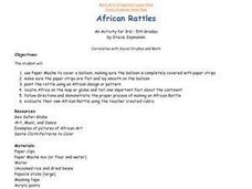
African Rattles
Students locate Africa on the map or globe and tell one important fact about the continent. They follow directions and demonstrate the proper process of making an African Rattle.
Curated OER
Geometry: Lesson 1: Points, Lines, Segments, Angles
Fourth graders examine the concepts of, draw, and label points, lines, segments, and angles, They draw, label, and identify horizontal, vertical, intersecting, parallel, and perpendicular lines. They complete an associated worksheet that...
Curated OER
Unlocking Whole Numbers
Fifth graders investigate three kinds of remainders, use computers and counters division mats to explore equal groups. In pairs, 5th graders solve problems at the computer. Notepad is used by the students to explain symbols, grouping,...
Curated OER
Graphing Integers On a Coordinate Plane
Seventh graders explore the concept of graphing integers on a coordinate plane. In this graphing integers on a coordinate plane lesson, 7th graders discuss scenarios where coordinate systems are used in real life. Students represent...
Other popular searches
- Weather Map Symbols
- Weather Map Weather Symbols
- Topographic Map Symbols
- Map Symbols First Grade
- Teaching Map Symbols
- Geography Map Symbols
- Os Map Symbols
- Map Symbols and Neighborhood
- Location/ Map Symbols
- Wetaher Map Symbols
- Reading Weather Map Symbols
- Weather Map Symbols Exercise


