Curated OER
United States Map- Rivers
Students identify major rivers on a map of the United States. In this geography lesson, students discuss what a river is and use a map marker to identify the symbol of a river on a map.
Curated OER
Where in the World Am I?
Students participate in mapping activities to explore an area from different spatial perspectives. In this mapping lesson, students define the terms needed to understand a map. Students use representations such as a balloon and a...
Curated OER
Ticky Plans His Trip to Antarctica to See Tacky
First graders participate in a creative problem solving activity to help Ticky get to the Atlantic Ocean. They identify Ticky's problem, brainstorm ways to solve the problem, and develop a plan. They write the steps Ticky needs to take...
British Council
Weather 1
Match weather words with pictures in a weather vocabulary worksheet. Beginning readers look at pictures of various weather patterns and choose/write the word that describes the weather. They create a map and write about the weather...
Curated OER
Other kinds of groups- part 4 of 5
Students compare and contrast characteristics of groups. Students create graphs using various symbols of different groups. Students make maps of their neighborhood 'groups'.
Curated OER
Where Is Japan? How Far Is That?
First graders use literature and hands-on activities with maps and globes to explain distance and tools used to measure distance. They select tools to measure various objects in the classroom, then apply those concepts to their map...
Curated OER
U.S. Geography: The Northeast
Students investigate U.S. Geography by creating a map in class. In this natural resource instructional activity, students create a map of the United States and research the Northeast based on their resources and recyclable...
Curated OER
Getting to Know My World
Students participate in hands-on activities using maps and globes to identify geographical features. Students use map legends to identify direction. Students locate oceans, continents, countries, states and cities. Handouts and...
Curated OER
Boats, Trains, and Wagons
Students read map symbols for transportation, specifically canals, railroads, and highways.
Curated OER
Weather Reporting
Students locate a weather map on the internet and explain or predict the weather for the following day. Students interpret the information on the weather map and pick the correct clothing to wear for that day. Students chart and graph...
Curated OER
Mapmaking: Colorado Quarter Reverse
Students examine the Colorado quarter reverse and draw symbols of the state's land and water features on maps. Using copies of the Colorado reverse, they color the coin design. They list reasons for the state's motto of "Colorful Colorado"
Curated OER
Mapping Your Local Community
First graders take a walking tour of their community to discover the names of numbered locations on a premade map. They then, create their own map of the community on the computer using Kidspiration software.
Curated OER
A First Encounter
Students identify symbols for ocean and land features, describe differences between Polynesians and Europeans of the 18th century, describe differences between people of the eighteenth century and today, and identify the four cardinal...
Curated OER
The Importance of Place
Is art connected to geography? It sure is! Your class will find out how even clay that comes from a certain location can have deep symbolic meaning. The class will analyze the piece, Mud Woman Rolls On and then research how geographic...
Curated OER
Essential Elements of Habitat
First graders compare their local area with the Belize landscape. They construct maps of the school area, adding descriptive information. They write haiku poems about their favorite outside places.
Curated OER
Delightful Directions
First graders identify and demonstrate how symbols and models are used to represent features of the environment. They identify the directions on a map as east, west, north, and south. Finally, 1st graders play a direction game, move to...
Curated OER
Relationships to Others
Students investigate aspects of a historical map drawn about 1721 by a Native American for presentation to the British governor of South Carolina, and draw maps of the classroom.
Curated OER
It's O-o-o-obvious That You're Sick
Learners experience the phonemes and map spellings of the short vowel /o/ sounds in spoken words. They practice matching letters to phonemes to identify the /o/ representations and letter symbols in words. Students work with the Dr....
Curated OER
Finding Important Community Sites
Students locate community sites on a city map using the map legend and grid system.
Curated OER
The Trail
Students identify major geographical features shown on the core map, explain map symbols used on the core map, create a picture of the condition of the trail in the 1840s, and construct a chart of average temperatures and rainfall.
Curated OER
Social Studies: Adinkra Printing
First graders demonstrate a sense of artistic composition by creating shapes and symbols in the pattern of African Adinkra printing. They use glue to create a raised design and then print it on colored paper. Students use symbols from...
Curated OER
Rulers For a Day
Students design and create foil coins with images that symbolize students' imaginary leadership in the ancient world. They model their coins on those made for Alexander the Great. They discuss what made him an important historical figure.
Curated OER
Where Is Japan? How Are We Alike And Different?
First graders use literature, maps, and globes to explain how physical environments in various parts of the world are similar to and different from one's own, and that certain areas have common characteristics and can be called regions.
Curated OER
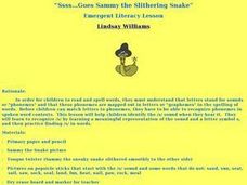
"Ssss...Goes Sammy the Slithering Snake"
Students practice recognizing the phonemes/grapheme's in /s/ sounds in words. They also practice viewing the representation of the letter symbol s and the picture of Sammy the Snake. The tongue twister "Sammy the sneaky snake slithered...
Other popular searches
- Weather Map Symbols
- Weather Map Weather Symbols
- Topographic Map Symbols
- Map Symbols First Grade
- Teaching Map Symbols
- Geography Map Symbols
- Os Map Symbols
- Map Symbols and Neighborhood
- Location/ Map Symbols
- Wetaher Map Symbols
- Reading Weather Map Symbols
- Weather Map Symbols Exercise


