Curated OER
Mexico Outline Map 2
In this outline map worksheet, students discover and investigate the North American country of Mexico. This blank outline map may be used for a variety of classroom activities.
Curated OER
Central American Map
In this Central American political map worksheet, students examine the boundaries of this region of the world. The map may be used in a variety of classroom activities.
Curated OER
South America Outline Map
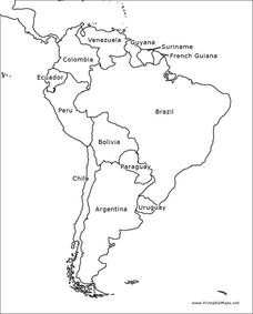
In this blank outline map learning exercise, learners explore the political boundaries of South America and the nations there. This map may be used in a variety of classroom activities. The map is labeled with the country names.
Curated OER
South America Outline Map
In this blank outline map worksheet, students explore the political boundaries of South America and the nations there. This map may be used in a variety of classroom activities. The location of the capital cities are denoted with...
Curated OER
Central America Map wtih Country Borders
In this blank outline map activity, students explore the political boundaries of Central America and the nations there. This map may be used in a variety of classroom activities.
Curated OER
Europe Map
In this blank outline map instructional activity, students explore the political boundaries of the continent of Europe. This map may be used in a variety of classroom activities.
Curated OER
Blank Europe Outline Map
In this blank outline map learning exercise, students explore the political boundaries of the continent of Europe and those of the countries located there. This map may be used in a variety of classroom activities.
Curated OER
Blank Europe Outline Map 2
In this blank outline map worksheet, students explore the political boundaries of the continent of Europe and those of the countries located there. This map may be used in a variety of classroom activities.
Curated OER
Africa Outline Map
In this outline map worksheet, students discover and investigate the continent of Africa and the political boundaries of its nations. This blank outline map may be used for a variety of classroom activities.
Curated OER
South America Outline Map
In this outline map worksheet, students discover and investigate the continent of South America. No country borders or physical features are depicted. This blank outline map may be used for a variety of classroom activities.
Curated OER
Australia Map
In this blank outline map worksheet, students explore the political boundaries of Australia. This map is labeled and may be used in a variety of classroom activities.
Curated OER
Australia Map: Labeled
In this blank outline map worksheet, students explore the political boundaries of Australia and its provinces and territories. This map is labeled and may be used in a variety of classroom activities.
Curated OER
A School Map
In this school map worksheet, students practice their map reading skills as they use the word box and the compass rose the help them answer 6 fill in the blank questions.
Curated OER
Mapping the Human Movement
Students practice their skills in reading content to locate the data on African-American emigration. After placing the data in a chart, they create a human movement map. They create another map using research on current immigration...
Curated OER
Making and Mapping a Volcano
Students build a baking soda volcano model. In this earth science lesson, students identify the sequence of lava flows. They make a volcano map using their models.
Curated OER
Orienteering - Lesson 4 - Distance and Height
Pretend that you've been dropped onto a mountain, in the middle of nowhere, and all you have to find your way is a topographical map and a compass. Could you find your way to the nearest town? Orienteering teaches the skills of map...
Curated OER
Examining Character Traits through Character Mapping
Some of what we know about a character is directly stated. Some of what we know is inferred by events in the story. Character maps help primary learners recognize the difference. After modeling with a story your class has read, pupils...
Curated OER
Mapping Meteorites
After reading an article, "Cameras Capture a 5-Second Fireball and Its Meteorite's Secrets," space science superstars use the triangulation method to determine the location of a distant object. In-class activities and homework are...
Curated OER
Exploring Hawaiian Mountain Zones
Fourth graders watch a video that describes the climate and vegetation zones of Hawaii. They describe the different physical conditions that create vegetation zones from the sea to the mountains. In groups, they create an illustrated...
Curated OER
The Crimean War
Use the list of cities, countries, and water ways to correctly label a map of the regions associated with the Crimean War. There are approximately 20 locations to locate and identify.
Space Awareness
Valleys Deep and Mountains High
Sometimes the best view is from the farthest distance. Satellite imaging makes it possible to create altitude maps from far above the earth. A three-part activity has your young scientists play the role of the satellite and then use...
Curated OER
Understanding Protagonists and Antagonists
How can you tell if a character is a villain? What about a hero? Work on literary analysis with an engaging language arts learning exercise. After completing an activity about the four types of conflict, learners fill out a character map...
Teach Engineering
What is GIS?
Is GIS the real manifestation of Harry Potter's Marauders Map? Introduce your class to the history of geographic information systems (GIS), the technology that allows for easy use of spatial information, with a resource that teaches...
Rainforest Alliance
Knowing the Essential Elements of a Habitat
To gain insight into the many different types of habitats, individuals must first get to know their own. Here, scholars explore their school environment, draw a map, compare and contrast their surroundings to larger ones. They then...


