Curated OER
Current Earthquake Activity
Fifth graders record any earthquake activity throughout the school year on various maps. In groups, they identify a map locating the points given to them by their teacher. To end the lesson, they add the date, strength and damage to each...
National Geographic
Mapping the Americas
Celebrate the geography of the Americas and develop map skills through a series of activities focused on the Western Hemisphere. Learners study everything from earthquakes and volcanoes of the Americas and the relationship between...
Curated OER
Earthquakes: Learn From the Past, Prepare for the Future
High schoolers examine the destruction caused by earthquakes. In this community safety lesson, students examine the risk involved in living in an earthquake zone and how to prepare for future earthquakes.
Curated OER
Earthquakes
Learners take a closer look at earthquakes. In this earthquake lesson, students investigate the causes of Kashmir earthquake and the impact of the earthquake. Learners also consider aid efforts in the aftermath of earthquakes.
Curated OER
Tectonic Plates, Earthquakes, and Volcanoes
Challenge geography classes to locate the major volcanoes and earthquake faults on a world map. In groups, they identify the pattern made and examine the relationship between the locations of the faults and volcanoes and tectonic plates....
Curated OER
Earthquakes
Sixth graders explore reasons for earthquakes. They discuss and describe the types of faults. Using the internet, 6th graders research a specific location of a former earthquake. They describe the damage, magnitude, the epicenter,...
Curated OER
Let Me Tell You About...
Students comprehend the differences between flat maps and relief or topographical maps. They recognize how forces such as earthquakes, volcanoes, water, and wind-as well as human actions--have altered the Earth's surface. Students work...
Curated OER
Amidst the Rubble of Ruined Cities
Students, in committees, develop and propose solutions to rebuild various elements of Colombia's infrastructure in the wake of the January 25, 1999 earthquake, as well as compare and contrast the earthquake's affects on Colombia to an...
Curated OER
Earth Forces
High schoolers use geological techniques such as plate tectonics, mountain building, earthquakes, and volcanoes, in order to explain the earth.
Curated OER
The Biggest Plates on Earth
The best part about teaching guides is all the great information you can use to inform your class. They infer what type of boundary exists between two tectonic plates. Then, using given information on earthquakes and volcanism they'll...
Curated OER
Maps with a "Spin"
Students, in groups, research and map the effects of a proposed airport three miles outside of town. They prepare a presentation based on a set of maps they make and explains its different points of view from the viewpoints of the town...
Curated OER
Earthquake Plotting
Students become familiar with map coordinates. They establish the frequency of earthquake occurrences and study the location and magnitude of earthquakes. To establish the location of plate boundaries.
Curated OER
Did You Feel That? Earthquake Data Chart
Students plot earthquakes on the world map using coordinates of longitude and latitude. They designate the earthquakes magnitude with a symbol which they include in the map key.
Curated OER
Basin & Range Faulting
Students identify that the crust of the earth is constantly moving and that with the exception of faults accompanied by earthquakes, this rate of movement is far too slow to notice. Then they print a copy of cross-section map A and...
Curated OER
Plate Tectonics
Students identify that most of mountain ranges found on all major land masses and in the oceans are external reflections of tectonic movements within the earth. They identify that earthquakes and related phenomena are caused by the...
Curated OER
Preparing for Disaster
Students examine the effects of earthquakes. In this earthquake instructional activity, students investigate survival strategies and disaster preparedness in the wake of an earthquake.
Curated OER
Natural History of Costa Rica
Students use outline maps to become acquainted with Costa Rica. They see how it was formed and how its origin has created very diverse environments. Students then use atlases and compare their physical maps with maps of climate and the...
Curated OER
Japan's Geography Worksheet
In this geography skills worksheet, students label a map of Japan and then respond to 8 short answer questions about the country.
Curated OER
Earth Science: In Depth Look at Earthquakes
Students engage in an interactive Internet instructional activity covering the reasons and results of earthquakes. After reading eyewitness accounts and viewing animations, they use seismograms to measure and locate the epicenters. In an...
Curated OER
Volcanoes, Earthquakes, and Tsunamis
Learners work in groups to research a tsunami, earthquake, or volcano. They use the internet to find information, and create a presentation. Each presentation should include a definition of their phenomenon, an illustration, three or...
Curated OER
Exploring Earthquakes in Space and Time Through the Internet and a Geographic Information System
Learners examine the frequency and distribution of earthquake epicenters and compare these epicenters to the distribution of plate boundaries and cities.
Curated OER
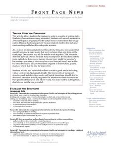
Front Page News
Students write original earthquake articles typically found on the front page of a newspaper. Each student has the freedom to write in a variety of writing styles (lead story, human interest story, editorials, etc.). They research...
Curated OER
Lesson on GPS
Students investigate global positioning systems. In this technology and mapping lesson, students view a PowerPoint presentation in which they identify the features of a GPS, state its uses, and follow steps to find a waypoint.
Curated OER
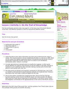
Lesson 3 Activity 1: On the Trail of Knowledge
High schoolers plot the earthquake epicenter data on the base map of the North Atlantic ocean floor using different symbols or colors to characterize different values.


