Curated OER
The Solar Neighborhood within 17 Light Years!
In this distance between stars worksheet, students plot the distance between the sun and 11 other stars on a 2 dimensional grid using a protractor and a ruler. They determine the distances between various stars and they find the shortest...
Curated OER
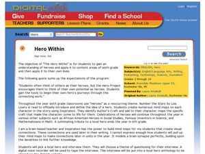
Hero Within
Young scholars interview a hero. In this heroes lesson plan, students read Number the Stars to begin a discussion about heroes and then create mind maps on each character. Young scholars pick a local hero and interview them and then...
Curated OER
Stellar Navigation
Middle schoolers are introduced to the concept of stellar navigation. Inside a portable digital planetarium they identify various stars that were used as a navigational tool. They go through several activities in which they attempt to...
Curated OER
United States: Physical Features Fun
In this map worksheet, students color and trace eleven listed features on a map of the United States. Students answer six additional questions about the map. A United States map is not provided. However, websites are provided to find...
Curated OER
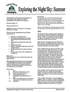
Exploring the Night Sky: Summer
Young scholars explain how moon phases occur. They describe and explain at least two common misconceptions that people have about the moon. Students explain what a star is. They explain 3 ways that the night sky has been used throughout...
Curated OER
Our World With MapsQ
Students examine and compare different types of maps. In this map skill lesson, students look at neighborhood and national maps on the overhead projector while making comparisons of the symbols and locations. They use a T-chart to record...
Curated OER
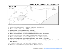
The Country of Kenya
In this map completion activity, students observe a map and map scale of Kenya to find and label bodies of water, cities, countries, and the equator. Students answer 11 questions.
Curated OER
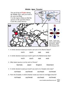
Middle Ages Traveler
In these Middle Ages worksheets, students use the maps to help them find the answers to the questions that help them understand the directions of north, south, east and west. Students also color another map of France according the...
Curated OER
Star Maps and iPads: Explore The World Above
Use these helpful stargazing tips and tools to enjoy the night sky this summer.
Curated OER
Let the North Star Tell You Where You Are
Students participate in activities in which they find the Big Dipper and locate the North Star in the night sky, examine the relationship between the angle to Polaris and latitude, and determine latitude by using an astrolabe.
American Museum of Natural History
A Kid's Guide to Stargazing
Get kids interested in stargazing with a step-by-step guide. The guide begins with the do's and don'ts, what the defines a star, and introduces a journal. The page is linked to see stars if light pollution keeps stars away in your area.
Curated OER
The Country of Chile - Map Work
In this map worksheet, students label a map of Chile by following 11 directions given at the bottom of the page. They label landforms and water bodies associated with the country.
Virginia Repertory Theatre
The Town Mouse and the Country Mouse
Accompany the story, Town Mouse Country Mouse by Jan Brett with an assortment of activities designed to reinforce concepts covering story structure, comprehension, grammar, and social studies. Here, scholars identify the difference...
Curated OER
Lone Star Round-Up
Students take a virtual tour of the Capitol Visitors Center in Austin, Texas. In groups, they receive a list of the artifacts and symbols they are to look for during their exploration of the building. To end the lesson, they make a...
Curated OER
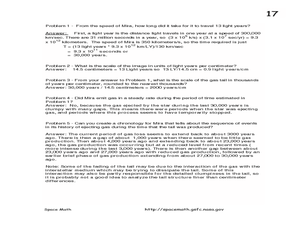
A Star Sheds a Comet Tail!
For this comet tails and stars worksheet, high schoolers read about the star Mira and the vast clouds of gases it emits. They use a photograph from the Galaxy Evolution Explorer satellite to solve 5 problems about the scale of the image,...
Curated OER
The Earth, Sun, Moon, And Stars
Fifth graders explore the solar system. In this solar system unit, 5th graders investigate numerous projects while rotating through learning centers. Students write about space and construct a space shuttle model. Students practice map...
Curated OER
Habitable Zones
Students focus on stellar luminosities to estimate size of habitable zones, map out habitable zone around hot light bulbs that serve as models of stars, investigate how size of model "habitable zone" around light bulbs depends on...
Curated OER
Mapping Spain
For this map labeling worksheet, students follow directions to label 10 items on a map of Spain. They label the capital city of Madrid, the Pyrenees Mountains, surrounding water bodies and countries. They trace the flow of the Duero River.
Curated OER
Following the North Star
Students give examples of the impacts of science and technology on the migration and settlement patterns of various groups. They draw stars
explaining how the North Star was used to give directions on the Underground Railroad.
Curated OER
Star Patterns
Third graders create constellation maps and record their own legends of how constellations came into existence. After observing the sky at night, 3rd graders discuss star maps, read previously recorded legends on the origin of stars. ...
Curated OER
Star Quest
Students engage in a lesson of using maps in order to find constellations in the night sky. They also conduct research using three constellations. The research is used to create a project to inform others. The teacher also leads the...
Curated OER
Outline Map of Japan
In this geography worksheet, students examine a black line outline map of Japan. There is a compass rose on the page. There are no labeled cities.
TRAIN Educational & Community Services
Multicultural Activities
From catching stars developed by African pygmy tribes to chop stix pick-up or the Hanukkah dreidel, use this list of diverse multicultural activities to help your learners draw connections to unique cultures of the world.
Curated OER
Reach for the Stars
Students investigate the Underground Railroad. In this slavery lesson, students read books about slavery, the Undeground Railroad, and how slaves escaped the south. Students develop knowledge about coded songs and constellations that...


