Syracuse University
Erie Canal
While canals are not the way to travel today, in the first half of the nineteenth century, they were sometimes the best way to move goods and people. Scholars examine primary sources, including maps and pictures, to investigate the role...
Curated OER
Dos mapas de Florida, el Caribe y parte de Sur America
What can maps tell us about the past? Find out with a Spanish lesson that incorporates geography. After examining maps individually, comparing two old maps of Spanish Florida and writing notes in the provided Venn diagram, pupils pair up...
Curated OER
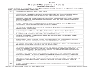
The Civil War Comes to Kansas: The Battle of Mine Creek
Seventh graders explore the impact of Price's Raid and the Battle of Mine Creek. In this American Civil War lesson, 7th graders examine a list of events based on the war in Kansas and then put them in chronological order. Students also...
Curated OER
Map on the Wall
Students examine the Ogallala aquifer water storage facility, identify rivers that refill the aquifer, and locate major cities near by. Students make maps of the area.
Curated OER
Reading a Map
Third graders become familiar with the vocabulary and skills related to mapping. In this guided reading instructional activity, 3rd graders find proper nouns on from the map. Students read Goldilocks. ...
Curated OER
State Poster Fair: US Geography, Social Science, Art
Pupils research a US state, design and construct a state 'poster' to display important facts about that particular state. They present their work to the class.
Curated OER
States with Attitude, Latitude and Longitude Dude
Sixth graders identify states whose boundaries are formed by lines of latitude and longitude or natural borders such as rivers. They trace a map of the U.S., and fill in borders, rivers and lines of latitude and longitude.
McGraw Hill
Study Guide for Island of the Blue Dolphins
Dive your class into a reading of Island of the Blue Dolphins with this in-depth study guide. Breaking the novel into three parts, the resource begins each section with a focus activity that identifies a specific theme or question...
PBS
Think Like a Historian: A Viewing Guide
Calling all junior detectives! Scholars use the tools of investigation to determine the causes and impacts of the American Civil War. Using viewing guides, videos, group research, and written resources, they discover what it takes to...
Curated OER
Adventure to Alaska
Students use their imagination and research skills to create a virtual tour of the "Land of the Midnight Sun." They are told that Alaska is the largest state in the United States. Students gather information about Alaska to help them...
Curated OER
The Kanaka Village at Fort Vancouver: Crossroads of the Columbia River
Students study the interaction between Native American and European cultures in the Pacific Northwest in the 1800s. They focus their study on the Hudson's Bay Company and Fort Vancouver.
Curated OER
Coasts
Learners explain the different types of marine coasts and where they are located in the United States and its territories. They explain and identify some of the life forms that inhabit different marine coastal regions.
Curated OER
Summertime Travel
Third graders write about a summer event they participated in. For this paragraph writing lesson, the teacher models how to write about a place they have visited. Students then write their own paragraphs. Students will point out on...
Curated OER
Louisiana Purchase
Learners use maps to locate and describe the area purchased by the Louisiana Purchase. In groups, they write a letter to Thomas Jefferson in which they evaluate the topography, climate and geography of the land. They determine the land's...
Curated OER
Grades 6-8 Lesson Plan - Cities as Transportation Centers
Middle schoolers examine maps of the 1800's and 1900's. In this geography skills lesson, students collaborate to read core maps and identify transportation centers and travel networks.
Curated OER
Sailin' Through Time...Rhode Island, The Ocean State
Fourth graders explore the history of Rhode Island. They research famous people who brought change to the state. They explore the state song, natural resources, and colonies of the state. In groups, 4th graders create a travel brochure...
Curated OER
Indianapolis Government
Learners read about a girl who takes a trip during the time of the State Capital moving to Indianapolis and then write their own essay about a trip that they took. In this Indianapolis Government lesson plan, students use maps and...
Curated OER
Finding Their New World
First graders place stickers on maps indicating their understanding of the cardinal directions. They locate Jamestown, England, the Atlantic, and Virginia.
Curated OER
Traveling with Flat Stanley
pupils use the internet to gather geographical data about a state of their choice. Using new vocabulary, they describe the features present in the state, its climate and attractions. They develop a PowerPoint presentation to share...
Curated OER
Survey This!
Students examine biological information about George Washington focusing on his love of surveying. They explore cartography and field of surveying. They write a letter and make a map of Virginia.
Curated OER
Identifying Your Watershed
Learners identify the watershed where they live and how it is related to their own water consumption. In this watershed instructional activity students locate their watershed on their town map. The learners find the source of their water...
Curated OER
Indiana Travel Guide
Fourth graders, after exploring and researching the state of Indiana, create a travel guide about the state of Indiana including its capital, major rivers, governors and two famous people from the state. They utilize a variety of art...
Curated OER
Territory and Statehood of Iowa
Fifth graders recognize the steps to create a territory, a district and a state. In this Iowa lesson, 5th graders discuss the three capitals and their importance. Students recognize the key people in the development of Iowa....
Curated OER
Places in My World
Second graders explore where they are located on the globe. In this maps and globes lesson, 2nd graders use a map to show where they live and show the cardinal directions. Students identify characteristics of mountains, flat land,...


