Curated OER
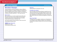
Real World Investigation- Math and Geography- Elevation Changes
For this math and geography real world investigation, 6th graders plan a driving trip to a city that is located several states away from their home while recording the elevations of three cities that are included in the trip. They use...
Curated OER
Alaska the Elephant
Students explore an Internet website, locating and matching the shape of an elephant's head to a state in the U.S. They complete an Alaska worksheet, identifying other geographical locations surrounding Alaska.
Curated OER
A Study of Genocide and Project for Rememberance
Tenth graders examine the mass execution of Ukranian Jews by the Nazis at Babi Yar through a variety of sources, including: music, poetry, primary sources and photographs. They also design a memorial for the victims.
Curated OER
ExplorA-Pond: 6th Grade Area and Random Number Tables
Sixth graders estimate surface area of a pond using a random number table.
Curated OER
Activities for a Day at the Zoo
A trip to the zoo can result in a multimedia presentation and a variety of interesting research topics.
Curated OER
Why is a salt marsh important?
Middle schoolers discuss the salt marsh. They define the following terms: habitat, water, land and air. Students work in small groups. They are asked why are they going to a salt marsh? Middle schoolers discuss whose habitat is it at...
Curated OER
How do we measure global earthquakes?
Students examine three seismograms of a recent South American earthquake recorded by USGS stations. They measure the S-P distance and use a P and S wave travel-time graph to find the epicenter distance for each seismogram. In addition,...
Curated OER
Motion of the Sun and Earth: Using a Playground Model to Explore Rotation and Revolution
Young scholars experience the rotation of the Earth and the Sun and the Earth's revolution around the Sun, using a playground mode.
Curated OER
The Greatest Survival Story of All Time
Students use the Internet to read about an explorer's survival in the Antarctic. They try to find a better route for him to have taken.
Curated OER
Give Me Back My School: A Back to Basics Approach to Ecological Restoration
Ninth graders research local geography to create successful, ecological school landscaping. They determine soil type, average weather patterns and temperature graphs and use the information to select ideal plants and plant maintenance...
Curated OER
Driving Currents
Students conduct a variety of investigations to see how water, heat, and salinity affect the flow of the world's ocean currents,as well as, explore many factors that affect the flow of the world's ocean currents. They also describe in...
Curated OER
Clean Water vs. Dirty Water
Students study the importance of clean water to the survival of organisms and what activiities and material pollute water. They measure the temperature of water samples and create a class graph.
Curated OER
Give Me The C and D Canal!!!
Students estimate the distance from Baltimore to Philadelphia via the water route before the Chesapeake and Delaware Canal was built. Students study canals and how transportation and economic necessities dictate the building of a canal.
Curated OER
Song Allouette - Oneida
Students practice singing the song Allouette. They discuss the meaning in both the English and Oneida languages and how the words to this song demonstrate important feelings for the Oneida people.
Better Lesson
Better Lesson: Scale Drawings
This lesson will provide students the opportunity to work with scale drawings as they create their own road trip to see how far they go using a map of the United States.
Illustrative Mathematics
Illustrative Mathematics: 7.g Map Distance
This lesson plan has students solve problems using scale drawings on a map.
CK-12 Foundation
Ck 12: Measurement: Scale Factor to Find Actual Dimensions
[Free Registration/Login may be required to access all resource tools.] Use scale factor to find actual dimensions from scale models, drawings or maps.
CK-12 Foundation
Ck 12: Measurement: Unit Scale to Find Actual Dimensions
[Free Registration/Login may be required to access all resource tools.] Use unit scale to find actual dimensions from scale models, drawings or maps.
