Curated OER
Finding Their New World
First graders place stickers on maps indicating their understanding of the cardinal directions. They locate Jamestown, England, the Atlantic, and Virginia.
Curated OER
Trailblazers - Now and Then
Students, working in pairs, use maps to determine the most efficient routes between two cities. They research which route would have been used by early trailblazers. They present a first person account of one of the trailblazers place in...
Curated OER
Discovering New Mexico
Seventh graders discuss the elements of maps and using basic linear measurement. They calculate the distance between the cities and create a simulated journey around New Mexico using a road map. They write out the directions for their...
Curated OER
The Amazing PE Race
Students utilize map reading skills, perform locomotor movements, and practice skills as they make their way through the Amazing PE Race. They use a map of school grounds to collect clues around the building.
Curated OER
Comprehension is Key!
Students observe and demonstrate how to use a story map to identify the main idea of text. They observe the teacher read an article about birds out loud, and create a story map for the article. Students then independently read another...
Curated OER
Math with Maps and Globes
Students round out their math skills with these ‘round the world' ideas. In this math and geography lesson, students try out time zone sticks, a polar race, and tic-tac-globe to engage them in learning more about globes and the...
Curated OER
Bunyans Lesson Plan
Students practice their map skills. In this early childhood lesson plan, students use a map of the United States and identify the location of several natural wonders included in the book The Bunyans by Audrey Wood.
Curated OER
Lesson Design Archaeology- World Map
Students practice locating positions on the world map. In this map skills lesson plan, students explore the world map and items such as the compass rose, Equator, mountains, cities, etc. The students practice locating positions on the...
Curated OER
Using Four Main Directions in the Classroom
Pupils identify the four cardinal directions. In this map skills geography lesson plan, students use a magnetic compass to label the four directions in the classroom. Pupils use the four directions to locate objects in the classroom.
Curated OER
Natural Features as a Resource
Students investigate how land and water can meet basic needs. In this natural resources lesson, students locate water features on a Landscape Picture Map and describe how water is used to meet their needs.
Curated OER
Where People Live- Neighborhoods
Students use a map. In this neighborhood lesson, students describe a neighborhood, emphasizing the common characteristics between all neighborhoods. Students locate a neighborhood on a landscape picture map and discuss.
Curated OER
Put Me in My Place: Using Alphanumeric Grids to Locate Places
Learners practice locating points on a large wall grid and create and label a neighborhood map. In this geography lesson, students spell and discuss places as the teacher places them on the map. They discuss the concept of an...
Curated OER
Country Capitals
Learners locate country capitals on a world map. In this map skills lesson, students review the definition of the word country and discuss what a capital is. Learners locate and label capital cities on a world map using a map marker.
Curated OER
Where Am I?
Pupils apply map reading skills by locating places through the use of latitude and longitude.
Curated OER
Finding Your Way
Students work in small groups to practice basic map skills. They take turns giving directions and tracing a path from one location to different destinations on the map.
Curated OER
Continents and Oceans
Students identify oceans and continents and their locations on a map. They color-code and label their own map of the world's continents and oceans. They play the game Continents and Oceans to identify specific areas.
Curated OER
Fun with Summarizing
Young scholars practice summarization by creating a story map. After reading Freckle Juice, students working in groups, create a story map of the main events of the story. Groups use their story maps to summarize a chapter of the story...
Curated OER
The Sands of Arabia
Sixth graders apply geographic information to the study of World History. In this Geography instructional activity, 6th graders create a political/physical map of the Middle East, develop questions and answers about the culture of...
Curated OER
Facts, Fictions and Perceptions of Regions
Students examine the different characteristics of the regions of the United States. They discuss places they have visited in the U.S., and in small groups conduct research on a selected region of the U.S. Each group labels a map of...
Curated OER
Natural Features
Young scholars identify natural features on a map. In this geography lesson, students identify six physical features and create pictorial definitions for each term. The terms which are listed in this lesson are mountain, hill, island,...
Curated OER
Where's the Sand?
Middle schoolers identify the characteristics of deserts. In this geography lesson plan, students discuss the characteristics of a desert and label a map with the names of deserts.
Curated OER
Theatre Lesson Plan: Finding Your Way
Second graders identify story elements in familiar stories from their lives. In this story elements lesson, 2nd graders act out familiar activities by following directions. Students read a story and discuss the story elements....
Curated OER
Indian Resistance
Students observe the pictures and maps of the Sequoyah Indians. In this Sequoyah lesson plan, students use the maps and pictures to discuss observations and write responses of the Indian point of view.
Curated OER
The Weather Page: Comparing Data
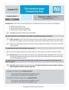
Learners analyze data from maps. In this comparing data lesson, students use comparative and superlative statements to draw comparisons among the weather in different American cities based on USA Today weather maps.
Other popular searches
- United States Maps
- Weather Maps
- Topographic Maps
- Story Maps
- Maps and Charts
- Types of Maps
- Maps and Globes
- Middle East Maps
- Maps and Flags
- Historical Maps
- Maps of Europe
- Create Character Maps


