Curated OER
Finding Your Spot in The World; Geography, Maps, Multi-Culturalism
Students use a variety of maps to locate their home, their school and the origin of their ancestors.
Curated OER
Magical Maps
Second graders discuss the importance of using maps and how they are used. After they listen to a folktale, they develop their own story line maps and write their own folktale to accompany a map. They also identify and locate the seven...
Curated OER
Orienteering: Map Skills
Students use a map to locate six specific landmarks on a course using a map. They identify how maps can help us and write a paragraph describing how to get from one landmark to another on the map.
Curated OER
Size It Up: Map Skills
Compare information from a US population cartogram and a standard US map. Learners draw conclusions about population density by analyzing census data a population distribution. They discover that census data is used to apportion seats in...
Curated OER
Map Skills
Do you need to practice map skills? Children with a range of abilities will complete a KWL chart about maps, practice important map vocabulary and then read a few pages from their textbook. They will use their vocabulary words and...
Curated OER
Mapping America
While learning about the Louisiana Purchase, pupils practice map skills. This motivating lesson has them answer questions about the Louisiana Territory and the United States. It provides a quick and easy way review of skills and the...
Curated OER
Direction and Angle: Positions and Directions
This is an interesting mix of concepts. Half of this presentation provides double-digit addition and subtraction practice and the other half has students discuss cardinal directions and right angles. Use these together, or use them on...
Curated OER
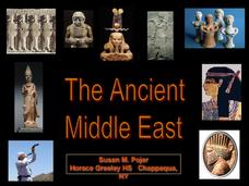
The Ancient Middle East
Math and history collide in this presentation, which displays ancient Babylonian numbers and math amidst a discussion about the earliest empires of the known world. Images of maps, ancient relics, and migration patterns establish the...
National Endowment for the Humanities
On This Day With Lewis and Clark
Walk in the footsteps of Lewis and Clark as they discover the wonders, beauty, and dangers of the American frontier. After gaining background knowledge about Thomas Jefferson and the Louisiana Purchase, young explorers use primary...
Curated OER
United States Map - Lesson 9
Students explore the concept of cardinal directions. In this geography lesson plan, students identify the compass rose on a large U. S. map and then discuss the cardinal directions.
Civil War Trust
Map the Civil War
Mapmaking was a very important element in successfully planning attacks on enemies during the Civil War. Guide pupils through the process of pacing to find the average length of their steps, measure the distance between one object...
Curated OER
Identifying, Mapping, and Personifying Countries Involved in WWII
Get artsy with this WWII group activity, starting with a whole-class assignment. Create a map of Europe, Northern Africa, and the Pacific using geometric shapes cut from construction paper and placed on the floor. Consider splitting the...
Curated OER
Topographic Maps
Your choice of hands-on topographic mapping tasks is provided in this resource. From actual map-making to viewing and interpreting stereographic photos, the activities are sure to succeed. To make the most of this lesson plan, you will...
Curated OER
Rhode Island Map
In this recognizing the shape of the state of Rhode Island worksheet, students fill in the state capital, major cities, and other attractions or follow their teacher made directions. Students write at least 7 answers.
Curated OER
War of 1812: Map and Label
Map test! Hand out this map of the East Coast of the United States and let learners mark each of the nine sites listed. They'll be making a map that shows the battle sites and areas involved in the War of 1812. Great as a test or as a...
Curated OER
The Ancient Middle East
The foundations of Christianity and Judaism are detailed in these slides, accompanied by bright, vivid pictures and maps. This presentation would successfully supplement a lesson on world religions or to contextualize the history of the...
Curated OER
The Ancient Middle East
Immerse your class in the ancient cultures of the world with this presentation, which travels through the Hittite Empire, the Assyrian Empire, Babylonia, and several more. Enjoy the pictures depicting the ancient worlds and the maps that...
Curated OER
The Ancient Middle East
Unlock the mysteries of the ancient Persian Empire with this presentation. Focusing on the militaristic and philosophical pursuits of the kingdom, the slides include photographs and maps to bring new life to Persepolis.
Curated OER
The Ancient Middle East
Good for a quick look at the Roman and Byzantine Empires, this presentation would serve as a strong supplement to a lesson on the politics and culture of ancient Middle Eastern territories. Enjoy the photographs of the Hagia Sophia, as...
Curated OER
Pirate Treasure Hunt
First graders name the directions North, South, East, and West on a map. They work collaboratively in small groups and create a treasure map using directions as clues.
Royal Geographical Society
An Introduction to Maps
First graders are introduced to a variety of maps such as globes, street maps, atlases, and different types of floor plans. The focus of the lesson requires individuals to create their own plan of the classroom using the PowerPoint...
Owl Teacher
Introduction to World of Geography Test
Assess your learners on the five themes of geography and the most important key terms and concepts from an introductory geography unit. Here you'll find an assessment with 15 fill-in-the-blank and 14 multiple-choice questions, sections...
Novelinks
Where the Red Fern Grows: Graphic Organizer, Story Map
How do you grow a goal from a dream to reality? You make a plan! After reading chapters two and three of Where the Red Fern Grows, learners map how Billy earns his dogs by completing an organizer in pairs and then discussing answers in...
Student Handouts
Compare and Contrast Chart with Bubble Map
Take your traditional Venn diagrams and mind maps to the next level with this unique bubble map! The graphic organizer allows students to compare and contrast several aspects of two concepts, encouraging a more in-depth analysis...
Other popular searches
- Middle East Maps
- Blank Middle East Maps
- Middle East Maps Trade
- Ancient Middle East Maps
- Medieval Middle East Maps
- East Asia Geography Maps
- Middle East Maps Puzzles
- Far East Maps
- Maps South East Asia
- East Africa Maps
- Asking Directions Maps
- Sou East Asia Maps


